

ARM in the Air
Published: 20 April 2023
For decades of complementary airborne data, ARM reaches for the skies
This is the ninth article in the yearlong “ARM30” series of stories on the evolution of ARM―its data, sites, science missions, field campaigns, and people.
Since collecting its first data in 1992, the Atmospheric Radiation Measurement (ARM) user facility has helped power the research of atmospheric scientists worldwide.
While ARM is known for its ground-based observations, many measurements, such as the complex chemical composition of aerosols aloft, cannot be made using remote-sensing techniques from the ground.
From ARM’s earliest field campaigns, aerial measurements by crewed aircraft, radiosondes, tethered balloon systems (TBS), and uncrewed aerial systems (UAS) have been essential elements of ARM activities.
Since 2000, at least 39 ARM campaigns have featured air observations. These observations, which are freely available from the ARM Data Center, provide spatial context for data—a perspective not always possible from a fixed location.
ARM Takes Off
Throughout the 1990s and into the 2000s, ARM focused on radiative processes. A pair of early campaigns drew the ARM community’s attention—the 1995 ARM Enhanced Shortwave Experiment (ARESE) and the 2000 ARESE II intensive operational period (IOP).
Both studied the absorption of solar radiation. Measurements were collected using three crewed aircraft: a high-altitude Egrett, a Twin Otter, and the NASA ER-2.
The ARESE flights provided critical information to help resolve discrepancies between modeled and observed estimates of solar radiation absorption in cloudy skies.
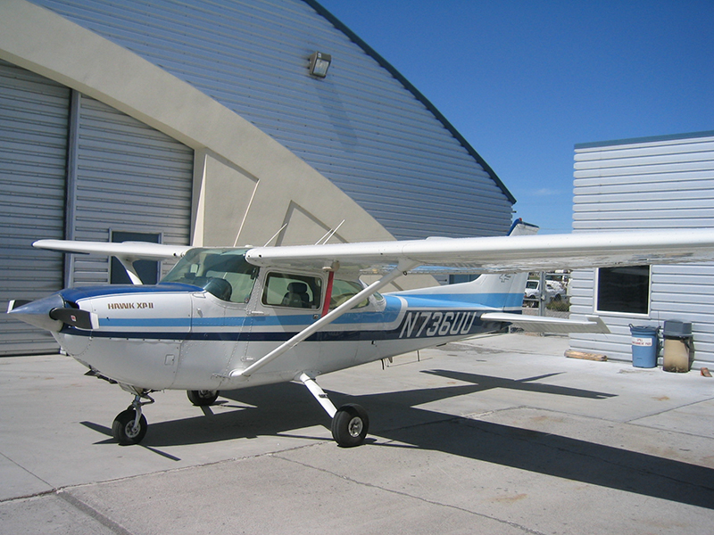
A small Cessna 172 took off from the Ponca City, Oklahoma, Regional Airport in March 2000, collecting atmospheric samples at different altitudes in the skies above ARM’s Southern Great Plains (SGP) atmospheric observatory. It was the start of the In Situ Aerosol Profiles (IAP) campaign (2000–2007), an investigation of aerosol vertical profiles led by principal investigator (PI) John Ogren of NOAA.
The science mission sought clarification on the variability in aerosol optical properties over hourly, daily, monthly, and seasonal timescales—and under what conditions surface-based measurements alone can calculate the direct aerosol radiative forcing. To find answers, the Cessna was outfitted with a modest instrument package to measure basic aerosol properties and some meteorological parameters.
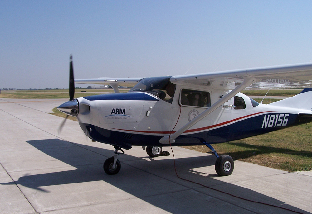
In 2003, atmospheric scientist Sébastien Biraud of Lawrence Berkeley National Laboratory in California joined the IAP effort and expanded the measurement focus beyond aerosols to trace gases, including carbon dioxide. By 2005, the Cessna 172 was replaced with a Cessna Turbo 206 on contract with ARM. The slightly larger and faster aircraft allowed more sophisticated instruments and data collection at higher altitudes.
After seven years and nearly 600 research flights, IAP went on to inform later ARM campaigns and journal articles.
IAP Leads to More Campaigns
IAP led to the first ARM Airborne Carbon Measurements (ARM-ACME) field campaign (2008–2011). The Biraud-led multi-institution, multi-agency airborne campaign added the study of atmospheric composition and carbon exchange processes to the IAP campaign.
Many studies drew from the first ARM-ACME campaign, including a pivotal 2013 paper in the Proceedings of the National Academy of Sciences. The authors concluded that greenhouse gas emissions from agriculture and fossil fuel extraction and processing have more significant greenhouse gas impacts than those indicated by existing trace-gas inventories.
“I’m not aware of a greater set of profiles for aerosols and carbon cycle gases,” Beat Schmid, ARM Aerial Facility (AAF) manager at Pacific Northwest National Laboratory (PNNL) in Washington state, says of the robust IAP and ARM-ACME data sets.
The long-running ARM-ACME set of campaigns later expanded to Alaska.
IAP also set the stage for two other campaigns at the SGP—the 2003 Aerosol IOP and the 2005 Aerosol Lidar Validation Experiment (ALIVE).
Led by NASA’s Richard Ferrare, the Aerosol IOP sought to improve understanding and model-based representation of aerosol radiative influences. Ultimately, the campaign provided a comprehensive data set for the vertical profile of ambient aerosol properties in the lower troposphere.
The 11-day ALIVE campaign, meanwhile, was led by Schmid, who was then a senior scientist with the Bay Area Environmental Research Institute, a NASA Ames Research Center partner.
ALIVE collected airborne remote-sensing data on aerosols for validation studies of the Raman lidar and micropulse lidars at the SGP. Lidars are radar-like instruments that use laser beams instead of electromagnetic waves to gather three-dimensional (3D) portraits of wind, snow, aerosols, and other dynamic phenomena.
More Campaigns and Creation of ARM Aerial Facility
In the mid-2000s, ARM entered what ARM Director Jim Mather describes as “an interesting period.” ARM was being designated as a scientific user facility, and the demand for aerial measurements continued to grow.
In fact, interest from the user community led to a series of significant cloud-aerosol campaigns at fixed-location sites. These included:
- North Slope of Alaska—Mixed-Phase Arctic Cloud Experiment (M-PACE), 2004; Indirect and Semi-Direct Aerosol Campaign (ISDAC), 2008
- Tropical Western Pacific—Tropical Warm Pool – International Cloud Experiment (TWP-ICE), 2006
- SGP—Cloud and Land Surface Interaction Campaign (CLASIC), 2007.
“There was also a lot of discussion about how aircraft should be used in ARM, and there was significant interest in conducting long-term sampling,” says Mather. “That had already been done with IAP and ACME, but they both used a very small aircraft. The ARM community was interested in something more.”
Responding to this interest, ARM launched two long-term SGP campaigns at the end of the decade: Routine AAF Clouds with Low Optical Water Depths (CLOWD) Optical Radiative Observations (RACORO) in 2009 and Small Particles in Cirrus (SPartICus) in 2010.
The AAF was officially established in 2006 when several ARM aerial efforts were consolidated. The directive was straightforward: Execute all aircraft campaigns for ARM.
Schmid joined ARM as AAF manager after the 2005 ALIVE campaign.
Like other ARM facilities, the use of the AAF is awarded to PIs at no cost through a competitive proposal process, and all data collected in AAF operations are curated for quality and made freely available to the research community.
The AAF also engages with investigators and private industry in the maturation, testing, and development of airborne sensors.
A Dedicated Aircraft and a Major California Campaign

Apart from small aircraft used for routine flights, the AAF did not have a dedicated aircraft until 2009, when it began managing operations for the Battelle Memorial Institute-owned Grumman Gulfstream-159 (G-1) research aircraft.
PNNL and Brookhaven National Laboratory in New York had previously used the well-traveled airplane, built in 1961, for atmospheric research campaigns funded by numerous U.S. Department of Energy (DOE) Biological and Environmental Research programs.
In 2010, DOE‘s Atmospheric Science Program and the science component of ARM merged into the current Atmospheric System Research (ASR) program. That’s when the G-1’s capabilities expanded from aerosol and trace gas measurements to include cloud microphysical properties and atmospheric radiative properties.
The AAF upgraded the G-1 with additional underwing pylons, probes, and a new power system. The refitted airplane expanded the AAF’s range of operations to remote campaigns and ARM sites around the globe.
In June 2010, the G-1 flew in support of the Carbonaceous Aerosol and Radiative Effects Study (CARES). Based in California’s Central Valley and led by PNNL’s Rahul Zaveri (watch video), CARES investigated the evolution of urban and natural (biogenic) aerosols, possible interactions between them, and the resulting radiative forcing. A focus was on the aging and evolution of the urban plume from Sacramento.
Two ground sites made surface observations, while the G-1 flew across the urban plume twice a day. NASA’s B-200 aircraft flew at a higher altitude in coordination with the G-1 crew. Other major partners included the California Air Resources Board; California Energy Commission; and NOAA, which operated a Twin Otter aircraft that measured trace gases, aerosols, and wind profiles.
The campaign data ultimately contributed to dozens of journal articles, including a 2016 summary of CARES published in Atmospheric Chemistry and Physics.
Where There’s Fire, There Are Aerosols
In the United States, aerosols from wildfires, agricultural burns, and other biomass burning comprise about one-third of the total atmospheric aerosols that affect regional climate. The aerosols and gases scatter and absorb solar radiation, change cloud properties, and affect rainfall.
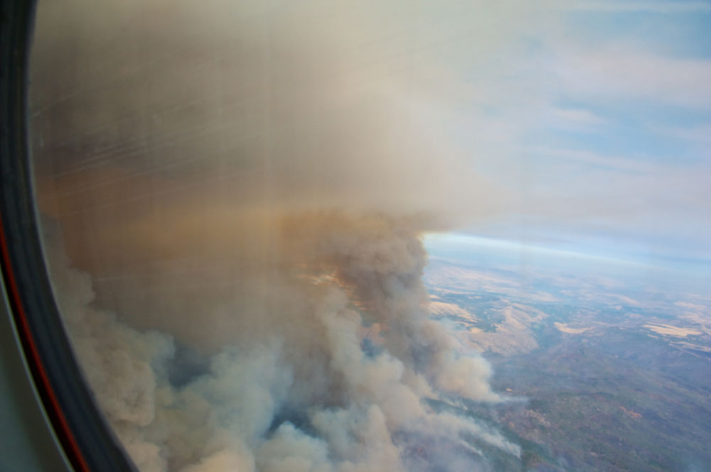
In 2013, the G-1 embarked on another science mission to measure downwind aerosols and trace gases emitted by biomass burning.
The Biomass Burning Observation Project (BBOP) sampled plumes above biomass burns in Arkansas and wildfires in the Pacific Northwest. The campaign was unique in that it was conducted away from ARM sites.
Since 2013, BBOP “has slowly but steadily produced substantive papers with more under review and in the pipeline,” says Brookhaven Lab’s Art Sedlacek, the campaign’s co-lead scientist.
So far, the highest-cited BBOP peer-reviewed papers include an investigation of the air-quality implications of wildfires versus prescribed burns; a study of the regional influence of wildfires on aerosol chemistry in the Western United States; and a summary of BBOP insights.
Scientists continue to analyze BBOP data and report on their findings. Sedlacek led a 2022 paper on characterizing carbon-containing aerosols from wildfires.
Flights Above the Amazon
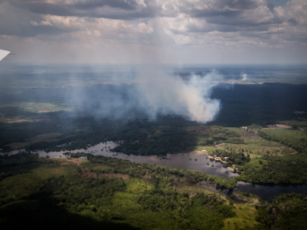
The Amazon Basin in South America is the primary heat driver of the Southern Hemisphere. Atmospheric processes above Brazil’s tropical rainforests affect climate throughout the world.
From 2014 to 2015, a major ARM campaign collected data needed to better understand the region’s aerosol and cloud life cycles, particularly cloud-aerosol-precipitation interactions within the central Amazon Basin.
The Green Ocean Amazon (GoAmazon2014/15) campaign took place near Manaus, Brazil, an industrial city of 2 million bordering a sea of nearly pristine tropical forest.
Stacked with more than 30 scientific instruments and sensors, the G-1 executed a busy flight plan. The air campaign was made possible through a cooperative program between PNNL and Brazil’s National Institute for Space Research (INPE).
The AAF supported the campaign’s research goals of better understanding the evolution of the aerosol and trace gas plume from Manaus, aerosol-cloud interactions, and ice formation in the middle of the troposphere.
By the close of GoAmazon, AAF operations above the Amazon Basin generated a wealth of data for the research community and a long list of publications, including a 2022 paper that filled in key knowledge gaps linking aerosol evolution to convective cloud properties.
Observing the Eastern Atlantic Marine Boundary Layer
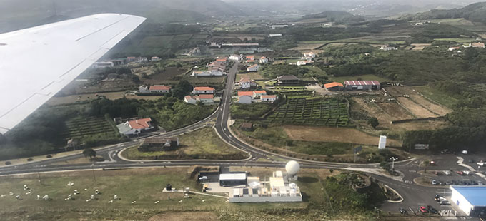
During two IOPs—summer 2017 and winter 2018—the G-1 operated in the Azores, the site of ARM’s Eastern North Atlantic (ENA) atmospheric observatory. There, the mission of the Aerosol and Cloud Experiments in the Eastern North Atlantic (ACE-ENA) field campaign was to improve understanding of the critical processes that drive properties and interactions between aerosols and low marine clouds.
Led by PI Jian Wang of Washington University in St. Louis, ACE-ENA addressed uncertainty in earth system model projections of marine low clouds. This uncertainty was partly due to inadequate aerial observations in remote oceanic regions like the eastern North Atlantic, where aerosol impact is the greatest.
During ACE-ENA, ENA site instruments provided observations of aerosols, trace gases, clouds, drizzle, and atmospheric thermodynamics. But there was also a need for what airborne observations could provide: characterizations of the vertical structure, horizontal variability, and detailed physical and chemical properties of aerosol and cloud particles.
Together, surface and air instruments swept up the data needed to understand and quantify the processes controlling the life cycle of marine boundary-layer clouds and cloud response to aerosol changes.
Despite issues with the aging G-1 during the winter portion of ACE-ENA, the AAF team got the aircraft back into full operational order.
By the close of ACE-ENA, the G-1 completed 20 flights in the summer and 19 in the winter. This air time added to a treasure trove of data for the research community and a robust collection of related publications that is still growing.
G-1’s Last Tango in Argentina
For six weeks in the fall of 2018, the G-1 returned to South America—this time to the rugged Sierras de Córdoba mountain range in north-central Argentina. The Cloud, Aerosol, and Complex Terrain Interactions (CACTI) field campaign would be the final mission for the G-1, which was deployed with an ARM Mobile Facility to observe the region’s legendary thunderstorms.
During CACTI, researchers led by Adam Varble of PNNL studied the life cycle of these large convective storms—how they form, grow, and interact with aerosols before dissipating.
The G-1 took measurements for characterizing in-cloud dynamics, microphysics, and aerosols, as well as the environmental variability around the clouds at multiple altitudes near the ARM Mobile Facility.
The G-1’s contributions to the CACTI campaign resulted in strong data sets for the research community and numerous publications.
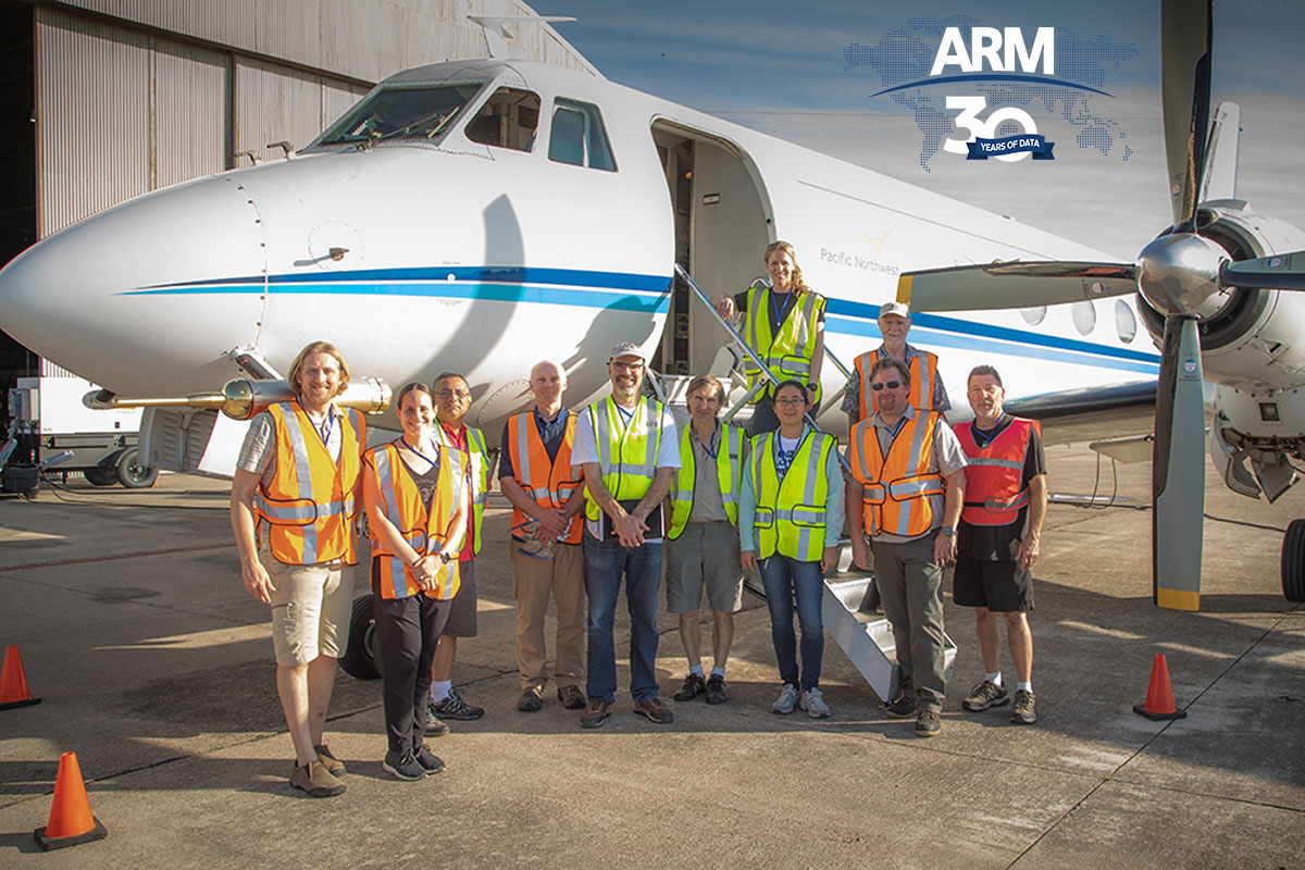
With its last tango in Argentina a success, the G-1 returned to its home hangar on a cold December morning at the Tri-Cities Airport in Pasco, Washington. A large group—AAF pilots, instrument scientists and engineers, maintenance technicians, and support staff—cheered as the vintage turboprop landed. Then, as it approached its hangar, it was met with a water salute by the airport’s firefighting vehicles.
Mather recognized staff who worked on the aircraft through its final mission.
“The people who keep the G-1 flying and keep its scientific instruments operating—up to 50 instruments at a time—deserve our heartfelt thanks,” said Mather. “We have been fortunate to make this research capability available to the scientific community for many years.”
DOE Leadership Sets Stage for Next Chapter
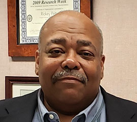
From its first day in 2006, the AAF benefitted from the even-handed leadership of program manager Rickey Petty.
During his 26-year DOE career, he witnessed the agency’s airborne systems in their infancy and helped shape their development. As detailed in a 2020 ARM article announcing his retirement, Petty was often part of multi-agency groups looking for common ground.
In 2010, for example, Petty oversaw negotiations with the Federal Aviation Administration (FAA) to open additional observational airspace in Alaska. As a result, in 2015, the FAA granted DOE flight access to special-use airspace north of Oliktok Point, enabling the use of UAS over the Arctic Ocean.
The action opened a new chapter of ARM-conducted polar atmospheric studies. ARM expanded its research footprint on Alaska’s North Slope, a key location for understanding fast-changing patterns of temperature, cloud cover, precipitation, and aerosols in polar regions.
Petty’s oversight of the AAF also helped lay the foundation for what was to come.
A New Jet, A New Vision for the AAF
The need to replace the much-loved G-1 was no surprise to Petty and ARM leadership. With an appreciation for the importance of the AAF’s mission, Congress allocated funding to purchase and retrofit a new research aircraft.
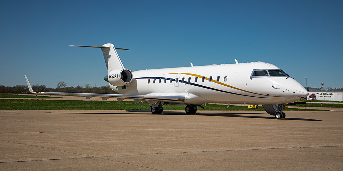
In 2019, ARM purchased a Bombardier Challenger 850 regional jet.
The Challenger will have the G-1’s capability of flying low and slow for some experiments, but it also can venture into higher elevations and more safely fly through and collect data in storms. For example, the G-1 could reach a top elevation of around 20,000 feet for scientific study. The Challenger 850 nearly doubles that to close to 40,000 feet.
Schmid says it is a big step forward in ARM’s capabilities. “It will allow us to offer the science community additional types of aerial sampling, the power to climb and descend more quickly within desired areas of interest, and the ability to fly much higher. For example, we will now be able to sample cirrus clouds.”
With a much more extensive geographic range, Schmid says the Challenger 850 can easily reach far-flung campaigns with a wide array of instrumentation. “We’re very excited about the aircraft, its capabilities, and how it will help us to continue to serve the needs of the science community.”
After the purchase, the Challenger 850 entered a modification phase to work toward FAA certification. According to Schmid, the AAF expects the jet to be delivered in early 2025. At that point, it will enter a readiness and testing phase. Then, by 2026, the Challenger 850 is expected to be available for proposal-driven campaigns.
To house the new jet, ARM’s ArcticShark UAS, along with maintenance and working space for AAF staff, a new hangar opened at the Tri-Cities Airport in 2020.
Charting ARM’s Aerial Future
In early March 2020—just before pandemic travel restrictions were implemented—five dozen atmospheric scientists gathered at PNNL for a workshop focused on aerial instrumentation.
The workshop provided a wide-ranging update on ARM’s crewed aircraft, UAS, and TBS operations. More important, it allowed the managers of ARM’s aerial capabilities to hear from researchers.
“We wanted to tap the expertise of attendees on aerial instrumentation, learn what technologies are available now or in the near future, and measure the capabilities of instrumentation against the science goals of the researchers,” says Schmid, who notes that the workshop provided a wealth of actionable information as ARM’s aerial leadership plans for the future.
Read the resulting workshop report.
Tethered Balloons Meet ARM User Needs
The transition from the G-1 to the Challenger 850 created a period of operations without active crewed aircraft. However, recent campaigns have made extensive use of TBS capabilities.

For example, TBS flights took place during the 2021–2022 TRacking Aerosol Convection interactions ExpeRiment (TRACER) in the Houston, Texas, area. Two more rounds of TBS flights are planned for the Surface Atmosphere Integrated Field Laboratory (SAIL) campaign, which ends in June 2023 near Crested Butte, Colorado.
TBS have been an integral part of both large campaigns and an expanding series of small campaigns. The capability of TBS to carry an instrument payload of up to about 110 pounds to elevations of approximately 4,920 feet (depending on meteorological conditions and regulatory restrictions) is contributing to the growth of these campaigns.
Managed by Sandia National Laboratories in New Mexico and offering users a suite of baseline instruments, TBS also frequently take atmospheric measurements at the SGP.
With access to special-use airspace, ARM conducted TBS flights at its Oliktok Point site, which ceased operations in 2021. TBS data from Oliktok Point and other past deployments are available in the ARM Data Center.
TBS have also played a key role in recent collaborations between ARM and another DOE scientific user facility, the Environmental Molecular Sciences Laboratory (EMSL). EMSL developed two instruments—a size- and time-resolved automated aerosol sampler and a time-resolved bulk aerosol collector—to fly on ARM’s TBS.
In addition, the two user facilities are jointly supporting research on aerosol processes, aerosol-cloud interactions, and land-atmosphere processes to help improve earth system models. Scientists are using EMSL instruments to analyze aerosols collected on ARM TBS flights.
A Renewed Focus on UAS
Long before the AAF’s growing UAS operations today, ARM was engaged with uncrewed systems. The first use was in 1994 at the SGP when the General Atomics Gnat 750 took to the Oklahoma skies.
Later, in 2015, 3-pound, low-cost DataHawk UAS were deployed during the Evaluation of Routine Atmospheric Sounding Measurements using Unmanned Systems (ERASMUS) campaign at Oliktok Point.
A larger UAS called Pilatus was deployed in the same campaign, providing temperature, humidity, pressure, wind, aerosol, and radiation measurements.
ERASMUS PI Gijs de Boer of the University of Colorado Boulder noted that the data sets generated during the campaign were a step toward further evaluation of UAS technology for the AAF’s future.
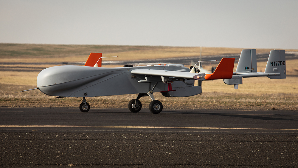
In recent years, the AAF has focused on the ArcticShark, a fixed-wing UAS with a 22-foot wingspan and a maximum gross weight of 650 pounds. The payload configuration is flexible, with multiple internal payload bays and four external attachment points.
Piloted remotely, the ArcticShark is rated to fly at altitudes up to 18,000 feet and long flight durations of up to eight hours.
Jason Tomlinson, who leads the AAF’s engineering program, compares the UAS to a computer: “Computers are really good at doing boring things, and that’s what they’re there for—repeating patterns over and over again. The computer doesn’t complain, doesn’t get tired; it just does it. Likewise, the ArcticShark is very good at flying long, very boring flight patterns that are very useful scientifically.”
In 2022, ARM completed several proving missions in Pendleton, Oregon, and at the SGP. In 2023, the ArcticShark began a series of scheduled missions at the SGP, with data now available to the research community.
Looking Up, Looking Ahead
From ARM’s early days, aerial observations have been an essential feature of data capture. First came small, single-pilot aircraft with just a few instruments. Today there are complex uncrewed aerial systems and TBS. And soon, there will be a “flying laboratory” in the form of a large jet.
ARM’s director promises a continued focus on the diverse needs of the research community—today and into the future.
“The ARM Aerial Facility is a central part of DOE’s long-term vision for ARM,” says Mather. “We are committed to a three-pronged approach to aerial measurements—piloted aircraft, uncrewed aerial systems, and tethered balloon systems—and the continued development of capabilities for each.”
Read other ARM30 stories.
Follow Us:


Keep up with the Atmospheric Observer
Updates on ARM news, events, and opportunities delivered to your inbox
ARM User Profile
ARM welcomes users from all institutions and nations. A free ARM user account is needed to access ARM data.


