

From Pole to Pole: ARM’s Research Reach in the High Latitudes
Published: 27 September 2022
Earth’s polar regions still hold much to be discovered by atmospheric scientists, many of them aided by ARM
This is the fifth article in the yearlong “ARM30” series of stories on the evolution of ARM―its data, sites, science missions, field campaigns, and people.
In the fall of 1928, the American Geographical Society released a collection of 31 essays called Problems of Polar Research. The book raised issues still at the forefront of polar science today.
For instance, the writers asked how to advance field study and tighten international cooperation. How to investigate sea ice and the effects of the Arctic and Antarctica on global atmospheric circulation. And how to meet the challenges of studying polar geology, biology, and oceanography.
Many of the writers had modern-like wishes for arctic research too: more research by aircraft, more attention to polar biology, and more studies of how the weather at the poles affects the rest of the world.
Some also dreamed of a network of permanent polar weather stations.
To some degree, that dream has come true. Modern weather and climate stations are arrayed across the Arctic and Antarctica.
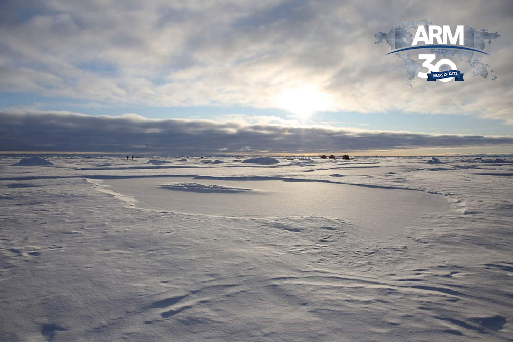
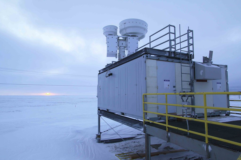
Unique among these stations is a fixed site maintained by the U.S. Department of Energy (DOE): the North Slope of Alaska (NSA) atmospheric observatory, which opened in 1997. It’s managed by the Atmospheric Radiation Measurement (ARM) user facility.
High latitudes are important to studies of Earth’s climate and weather. They begin at 50 degrees north and south of the equator. The poles are 90 degrees north and south latitude. (The NSA is at 71 degrees north.)
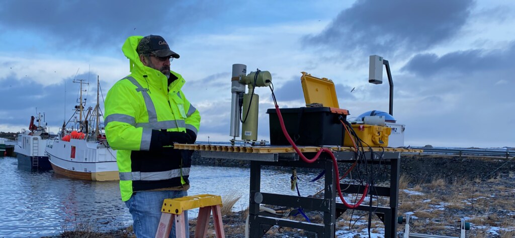
In addition to the NSA, ARM has conducted high-latitude research with all three of its mobile facilities. These rugged, containerized observatories can be deployed anywhere in the world for six months or more.
With its fixed and mobile observatories, ARM is helping to answer many of the polar science questions asked almost 100 years ago.
ARM’s Arctic Eyes
The NSA is at the southern edge of the Arctic Ocean, where the Chukchi and Beaufort seas converge. It was DOE’s earliest set of eyes in polar research.
“ARM has been incredibly influential in our collective understanding of the Arctic,” says Colorado-based atmospheric scientist Gijs de Boer, a specialist in using uncrewed aerial systems to gather data in the Arctic and elsewhere.
That collective understanding comes in part because researchers use ARM data from the high latitudes “for model advancement and development,” adds de Boer. “Those models, of course, have informed our current projections and understanding of where the climate system is headed.”
The climate system is “all connected, like the human body,” says Jessie Creamean, a cold-weather atmospheric scientist at Colorado State University. “Everything works together. What happens in the Arctic can affect climate all over the world.”
Continuous Data
In the 1990s, planners determined that the NSA was the best place for ARM to execute the arctic version of its initial science mission―to study clouds and radiation.
The heavily instrumented NSA main site was chosen for being within a mix of arctic atmospheric influences from land and sea. It is just outside Utqiaġvik (pronounced “ut-key-AHG-vic,” formerly Barrow), the northernmost town in the United States.
Since then, aerosols have become a big part of ARM’s mission. Aerosols are tiny particles in the atmosphere that affect weather and climate.
In 2022, the NSA marks 25 years of collecting continuous measurements. Since 1997, instruments there have raked in hundreds of terabytes of day-after-day data. (They are freely available from the ARM Data Center.)
The NSA and ARM’s two other current fixed observatories are unique in their collection of long-term, continuous data. Historically, scientists gather atmospheric measurements during intensive bursts of activity in field campaigns that last just weeks or months.
“Long-term data sets are a way that ARM distinguishes itself,” says Matthew Shupe, a researcher at the University of Colorado, Boulder, who has studied Earth’s polar regions since the 1990s. “That’s the value that ARM brings. If you want to understand arctic clouds (for instance), NSA data have been there for a couple of decades.”
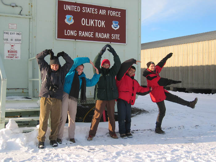
From 2013 to 2021, ARM operated a mobile facility at Oliktok Point, Alaska, about 160 miles east of Utqiaġvik. Data from this extended mobile facility deployment complemented NSA measurements.
Warming Warnings
Most of ARM’s high-latitude campaigns have taken place in the Arctic―many of them at the NSA.
“The Arctic is important to the DOE,” says ARM Technical Director Jim Mather.
In part, that’s because of polar amplification, the idea that surface temperatures at the poles are rising dramatically faster than in the rest of the world. In the Arctic, that rate has been shown to be four times faster.
NSA campaigns help sketch in details of atmospheric processes related to polar amplification.
The observatory also fits right into ARM’s tradition of ambitious field campaigns. These expeditions and experiments are bolstered by ground, ship, airborne, and mobile assets that have only grown since ARM began operations in 1992.
Beyond the Arctic, a region about the size of the United States, Mather acknowledges ARM-related field campaigns and collaborative research in other high-latitude places. These include the boreal margins of the Arctic, Antarctica, and the stormy Southern Ocean.
The Southern Ocean, churned by the world’s roughest seas, circulates around Antarctica. During the period 2016–2018, ARM supported two major field campaigns there.
From March 2016 to March 2018, the Macquarie Island Cloud and Radiation Experiment (MICRE) gathered data on Southern Ocean clouds and aerosols, which are poorly represented in models. In this region of dramatically sparse data, ARM instruments also measured surface radiative fluxes.
Starting in October 2017, researchers with the Measurements of Aerosols, Radiation, and Clouds over the Southern Ocean (MARCUS) campaign conducted a five-month investigation of aerosol transport, sea-air exchanges, cloud feedbacks, and other issues. An ARM Mobile Facility collected data aboard an Australian ship making routine trips across the Southern Ocean to resupply three Antarctic bases.
‘Vastly Different Worlds’
Polar amplification is dramatically evident in the Arctic. Scientists and citizens alike note sea level rise, intensified seasonal wildfires, and melting permafrost that destabilizes stocks of greenhouse gases stored underground.
Antarctica is also “subject to polar amplification in a warming world,” though not as intensely as the Arctic, says longtime polar researcher and ARM data user Dan Lubin of Scripps Institution of Oceanography at the University of California, San Diego.
In his massively researched, two-volume Polar Remote Sensing, Lubin writes that “the high latitudes are not one region but are really two vastly different worlds.” (His co-author is Robert Massom at the University of Tasmania.)
Why so different?
“It’s generally been very difficult to spin up long-term measurements of atmospheric properties in the Antarctic.”
Dan Lubin, who from 2015 to 2017 led an ARM field campaign in Antarctica
The relatively flat Arctic is frozen ocean surrounded by land, says Lubin. By contrast, terrestrial influences are minimal in Antarctica, a continent dominated by ice sheets the height of mountain ranges and encircled by water.
In addition, unlike the Arctic, cold and dry Antarctica has no tundra to thaw. Its high terrain drives cloud physics, unlike the Arctic’s level terrain.
Also radically different: Antarctica’s aerosol profiles and the mechanics of ice sheets. In Antarctica, these are not mostly on top of landforms; they are marine, grounded below sea level, and buttressed by floating ice shelves that protrude into the Southern Ocean.
Hard, Cold Antarctica
Conditions in the Arctic are harsh. But the South Pole is more so. It is the coldest and driest place in the world and sits atop an ice sheet that is miles thick and 10,000 feet high. Winds in Antarctica can blow at 100 miles an hour.
“Antarctica is very difficult to get to and do research,” says Lubin, who also studies sun-like stars in a second role as an astrophysicist. He compares Antarctica to Mars.
Harsh and remote, the continent also complicates doing multiyear and long-term research like the kind done at the NSA.
“It’s generally been very difficult to spin up long-term measurements of atmospheric properties in the Antarctic,” says Lubin.
ARM and Antarctica
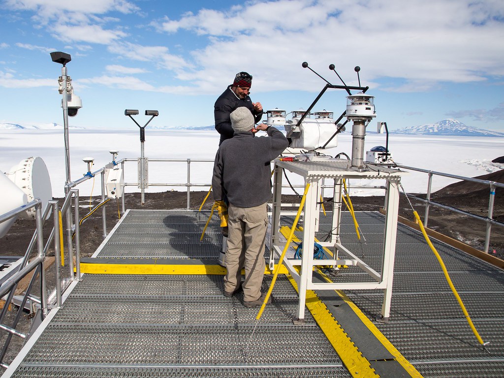
Lubin should know. He was the lead scientist for a 2015–2017 campaign called the ARM West Antarctic Radiation Experiment (AWARE).
The focus was on the continent’s most rapidly warming fraction, the West Antarctic Ice Sheet (WAIS).
For AWARE, Los Alamos National Laboratory in New Mexico set up an ARM Mobile Facility at McMurdo Station. Meteorologically, McMurdo is connected to the WAIS via circulation patterns in the Ross and Amundsen seas.
ARM also deployed a smaller set of instruments to the WAIS.
The ARM campaign represented the first substantial investigation of the WAIS since 1957. To date, it is also ARM’s only significant research footprint on the continent of Antarctica―one that stands out worldwide.
“To my knowledge, AWARE is the single largest atmospheric and climate science field program ever sent to Antarctica,” says Lubin, who first worked there as a graduate student studying ozone levels in the 1990s. “That’s in terms of the sheer number and sophistication of the instruments that were deployed.”
In the end, he adds, “AWARE provided a huge wealth of data that was never before available.”
Going With the Floe
As soon as AWARE concluded, Lubin began exploring ways to get versions of core ARM instruments back into action. He started with what he calls a “miniaturized field program” that uses small aircraft to deploy equipment at very remote sites.
With support from the National Science Foundation (and some from DOE), in late 2019 Lubin successfully deployed a suite of instruments on West Antarctica’s Siple Dome.
The Siple Dome deployment was the subject of a talk he delivered in late August 2022 at the Year of Polar Prediction Final Summit in Montreal, Canada, which Shupe helped organize and lead.
That both Lubin and Shupe were at the summit, a four-day international affair, shows the prominence of DOE’s polar mission and ARM’s part in it.
The summit, in a way, was a kinetic version of the gathering of experts represented nearly a century before in Problems of Polar Research. Both book and summit express the wide range of disciplines involved in polar investigations.
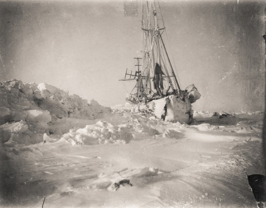
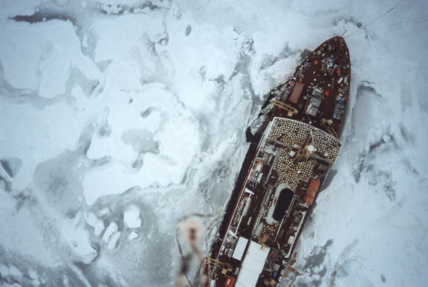
Fridtjof Nansen, one of the book’s essayists, was a Norwegian explorer-turned-diplomat (and later Nobel Peace Prize laureate). In the summer of 1893, he was chief scientist during a daring and dangerous three-year Arctic Ocean shipborne campaign of his design. Researchers deliberately froze the three-masted, 128-foot Fram onto an ice floe to drift through the Arctic.
Nansen hypothesized that a current flowing beneath the arctic ice sheet could carry the drifting Fram to the North Pole. (The ship fell just a few degrees short.)
His drifting experiment foreshadowed two important arctic shipborne campaigns for ARM.
Mother SHEBA
One was an international 1997–1998 effort called Surface Heat Budget of the Arctic Ocean (SHEBA). The National Science Foundation largely funded SHEBA, but most ARM veterans call it the first true NSA field campaign, mother to all the rest.
Starting in the Arctic Ocean a few hundred miles northeast of the NSA, SHEBA researchers took a page from Nansen by freezing an icebreaker to an ice floe. That set off a one-year, nine-day drifting experiment to gather data in the Arctic.
The icebreaker took along two dozen cold-hardened ARM instruments, including a lidar and cloud radar. Two ARM staffers were also aboard. Shupe was too. Barely out of college then, he spent seven months at sea.
SHEBA turned into a dry run for the NSA science mission. It also lit the fuse on many efforts to test and develop simplified representations of complex processes for arctic models.
The campaign provided the first comprehensive measures of mixed-phase clouds in all seasons, which Shupe calls a “real breakthrough.”
Mixed-phase clouds, common in the Arctic, contain both ice and liquid water.
More than two decades later, SHEBA still serves arctic science. Its durable data include measurements of shrinking ice cover, temperature swings, and climate feedbacks from ice, clouds, and radiation.
Sister MOSAiC
In 2019 and 2020, DOE and ARM took a big part in a campaign similar to SHEBA: the Multidisciplinary Drifting Observatory for the Study of Arctic Climate (MOSAiC).
This epic international expedition involved hundreds of scientists, engineers, and technicians from 20 nations.
The mission was to observe the state of the central Arctic, from the ocean below, up through the sea ice, onto the snow and ice, and into the atmosphere, the realm of ARM’s strongest contributions.
The German research icebreaker R/V Polarstern, frozen into a floe, served as a hotel, power plant, laboratory, and instrument platform. It was also an airport for tethered balloons and uncrewed aerial systems flown by a de Boer team.
ARM instruments on the Polarstern included cloud radars mounted near the bow and an elaborate Aerosol Observing System.
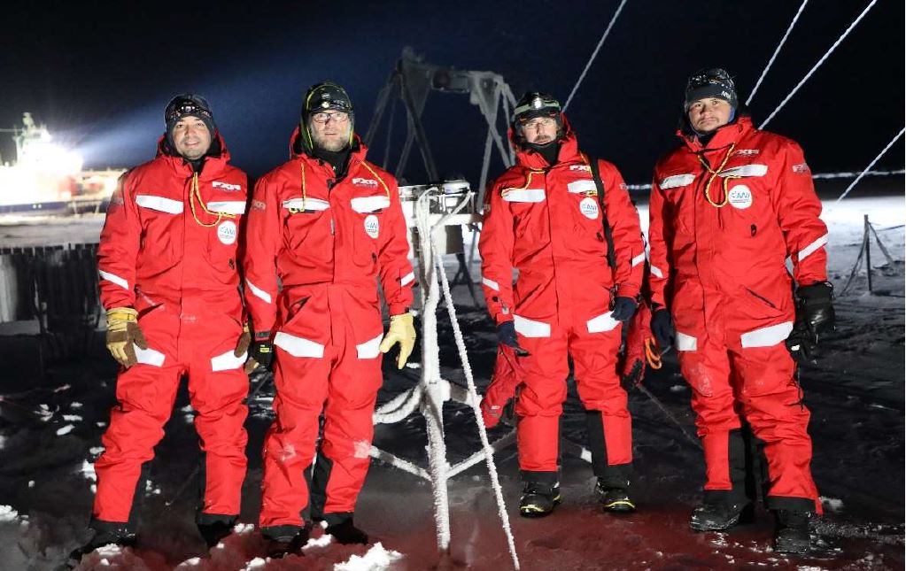
On the ice, ARM instruments were arrayed within 500 meters of the ship―about a third of a mile. Creamean, Shupe, and others got used to donning arctic garb. It was like dressing for a moon walk.
Teams of technicians rotated in and out of the Arctic to monitor and maintain ARM’s instruments.
To date, MOSAiC has spawned “a feeding frenzy” over the expedition’s estimated 150 terabytes of data, says Shupe, who led a 2021 ARM field campaign report on MOSAiC. “There’s so much research going on, in so many different directions. ARM data plays a big role in that.”
Lubin says SHEBA and MOSAiC are reminiscent of the duration and comprehension of AWARE. “These efforts come along once a generation.”
‘A Baseline for Understanding’
Mixed-phase clouds run like a strong thread through ARM’s high-latitude work.
Lubin has studied them in Antarctica. In the Arctic, de Boer has studied them too, including via ARM data. Creamean looks at the way aerosols affect the microphysics of mixed-phase clouds, as in her 2022 paper in Nature Communications on aerosol-cloud interactions.
For Shupe, mixed-phase clouds have been the object of investigation for more than two decades. He co-authored a 2004 study on the influence of such clouds on the surface radiation budget over sea ice. This paper drew on SHEBA data.
In the fall of 2004, the Mixed-Phase Arctic Cloud Experiment (M-PACE) unfolded at and around the NSA.
Johannes Verlinde of Pennsylvania State University led this massive, multisite cold-weather deployment of ground and air resources.
Mather calls it the most impactful ARM arctic field campaign on mixed-phase clouds to date.
He suggests pairing data sets from M-PACE with those from an April 2008 field campaign at the NSA called the Indirect and Semi-Direct Aerosol Campaign (ISDAC). Together, they give researchers a two-season view of ice and liquid water in clouds, one in autumn and one in spring.
Shupe was on the science teams for both campaigns, which he says established “a baseline for understanding aerosol-cloud interactions” in the Arctic.
He also pointed to a series of “golden days,” intervals of observations in ideal conditions.
“They were an important kind of foci for model studies,” says Shupe. “One of the great accomplishments (of ARM) is confronting models with great observations.”
Radiative Heating and Cooling
The surface-atmosphere-space radiation exchange was also a strong thread for ARM, starting with the 1998 FIRE Arctic Clouds Experiment at the NSA.
Longwave radiation, the kind sent back into space from the Earth’s surface and lower atmosphere, was part of ARM’s radiation mission. A March 2001 campaign at the NSA gave researchers a way to study this atmosphere-warming phenomenon during low temperatures and clear skies.
After M-PACE and ISDAC, it was a logical next step for the NSA to host a field campaign on global atmospheric radiative heating and cooling. Wintertime at the NSA, the thinking went, could serve as a proxy for studying clouds across the world with low water vapor.
In 2007, that campaign became another signature ARM research exercise in the Arctic, the Radiative Heating in Underexplored Bands Campaign (RHUBC).
Dave Turner, now at NOAA’s Global Systems Laboratory in Colorado, led the RHUBC campaign.
“RHUBC set out to expand understanding of the interactions of infrared radiation with the atmosphere,” says Mather. “This work requires very dry conditions, and the winter atmosphere in the Arctic is one of the driest places on Earth.”
Two years later, Turner led RHUBCII in the coastal Atacama Desert in Chile. The Atacama, west of the Andes Mountains, is the world’s driest desert outside the poles.
Findings in Finland and Norway
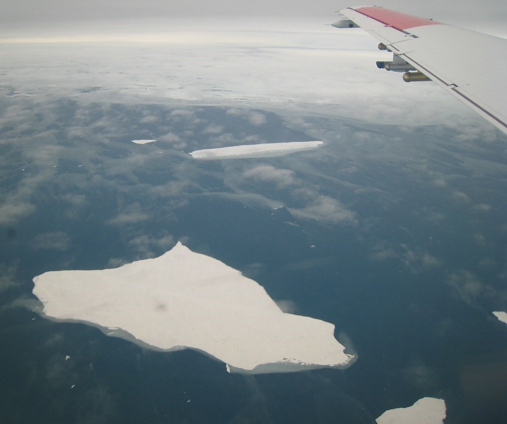
The high latitudes are more than the charismatic places we know from images—the fractured spikes of colliding sea ice near the North Pole, for instance, or wind-battered, frigid peaks near the South Pole.
Consider, also, the deep green boreal forest and tundra in the Arctic. Or the Southern Ocean, studied during MICRE and MARCUS.
The northern and southern high latitudes both are climatic transition zones. Each eventually gives way to milder conditions in the midlatitudes.
Two ARM field campaigns took place at the greening, warming edge of the Arctic.
One happened from February to September 2014 in Hyytiälä, Finland. ARM deployed a mobile facility there for the Biogenic Aerosols – Effects on Clouds and Climate (BAECC) field campaign, led by Finnish scientist Tuukka Petäjä.
BAECC recorded data on how aerosols from plant matter influence cloud formation. It also measured high-latitude snow processes.
Another ARM campaign investigated how the Arctic influences cloud formation in warmer areas of the lower latitudes.
In 2019 and 2020, ARM managed a mobile facility on the island of Andøya in northern Norway as part of the Cold-Air Outbreaks in the Marine Boundary Layer Experiment (COMBLE). Researchers from 20 nations sampled the south-moving arctic air mass as the relatively warm Norwegian Sea modified it.
Farther north, a smaller set of ARM instruments operated on remote Bear Island.
University of Wyoming atmospheric scientist Bart Geerts led COMBLE. He described the Norwegian Sea as a climate transition zone, where the warm waters of the Gulf Stream “penetrate further into the Arctic than anywhere else” and persist all year long.
The ocean-cloud heat exchanges in the arctic climate system need more study, he says, and COMBLE can help. “The data set is very special.”
Combining Arctic Data
Lubin has an ambitious three-year project underway, thanks to funding from DOE’s Atmospheric System Research (ASR) program.
He and two colleagues are investigating cloud-phase transitions in the arctic climate system. These turn out to be especially important in the Arctic, where warming temperatures are associated with clouds just below or just above the freezing point of water.
Lubin is looking at arctic cloud-phase transitions in a warming climate, primarily with ARM data.
“We have NSA in Alaska,” he says. “We have MOSAiC in the central Arctic, and we have COMBLE just at the edge of the eastern Arctic.”
That gives his ASR team “extensive geographic coverage with a lot of contrasts,” says Lubin.
Team. Coverage. Contrasts. Those words put ARM’s high-latitude work in a nutshell.
Follow Us:


Keep up with the Atmospheric Observer
Updates on ARM news, events, and opportunities delivered to your inbox
ARM User Profile
ARM welcomes users from all institutions and nations. A free ARM user account is needed to access ARM data.


