

Mountains and Trees: ARM Tangles With Complex Terrain
Published: 23 March 2023
Acquiring data in mountainous and forested terrain brings about unique challenges and opportunities
This is the eighth article in the yearlong “ARM30” series of stories on the evolution of ARM―its data, sites, science missions, field campaigns, and people.
Earth system models often begin with mathematically handy assumptions about nature.
Models, for instance, might represent the shape of land beneath the atmosphere as flat. In reality, of course, land rises and falls, and surface features change.
“Historically, we have tried to simplify the surface-atmosphere interaction and focus on atmospheric processes,” says Jim Mather, director of the U.S. Department of Energy’s (DOE’s) Atmospheric Radiation Measurement (ARM) user facility, which operates six observatories in climate-critical regions of the world. “But the reality is, there are a lot of places you can’t do that.”
One dramatic example that defies simplicity is mountainous, or orographic, terrain, dominated by rising slopes that complicate calculations of airflows and their effects.
Then there are forested mountains and forests all by themselves—hard-to-observe terrain where ARM has also collected data over the past 30 years.
All of it is “complex terrain,” a term that atmospheric scientist Adam Varble broadens to include any number of “highly variable surface properties.”
The idea of complexity in terrain may also include the variety of land use in a region: farm fields, roads, houses, factories, and cities.
“We are constantly changing the nature of the surface,” says Mather, who like Varble is based at Pacific Northwest National Laboratory in Washington state. “That’s all going to play into how the land interacts with the atmosphere.”
Mountains, especially, have “a large impact on atmospheric circulations,” says Varble, who investigates and models how clouds evolve in the atmosphere. “They’re a barrier, so by altering atmospheric circulation, they change the distribution of temperature and humidity where clouds and precipitation form.”
ARM’s Mountain Campaigns
COPS: In 2007, Germany’s Black Forest was the site of ARM’s first field campaign in a mountain setting, says participant Mark Miller of Rutgers University.
The region’s Murg River threads through wide meadows, a forested gorge, a deep valley dotted with riverside settlements, and finally a wetland river plain where the Rhine borders France in southwestern Germany.
ARM’s contribution to the multi-nation Convective and Orographically-induced Precipitation Study (COPS) used the Murg Valley (“Supersite M”) as one of five natural laboratories during COPS for investigating how summertime rain develops in mountain terrain. Regional-scale models did not represent this very well. ARM data complemented measurements taken by others at higher elevations, including the highest peak in the Black Forest about 6 miles away.
COPS was led by Volker Wulfmeyer of The University of Hohenheim. He was also lead author on a detailed campaign report.
An ARM Mobile Facility (AMF)—consisting of baseline instruments, portable shelters, and communications and data systems—was one of five COPS observation supersites positioned across 62 square miles. Data from 10 aircraft platforms, radiosondes, and satellites supplemented the surface observations.
The aim of COPS was to measure environmental conditions before, during, and after storms and to improve the predictive acuity of regional precipitation models. ARM and its COPS partners deployed remote-sensing instruments to study notoriously hard-to-measure thin clouds.
COPS laid a climatological foundation for studying thin clouds at all ARM sites, says Miller. Logistically, he adds, the campaign also provided lessons on hosting guest instrumentation and getting permits.
In a 2011 overview paper, Wulfmeyer outlined the broader advances COPS represents. These include the first-time synergies from such a comprehensive set of networked instruments in a mountain setting. COPS also improved regional forecasting, sharpened models that simulate precipitation in complex mountain terrain, and delivered key insights into how orography influences patterns of rain and snow.
STORMVEX: Varble was still a graduate student when he took part in the 2010–2011 Storm Peak Lab Cloud Property Validation Experiment (STORMVEX). Led by Gerald “Jay” Mace at the University of Utah, it was ARM’s second large-scale investigation of atmospheric properties in orographic terrain.
Wintertime cloud properties were the target. During the five months of STORMVEX, researchers endured record snow (about 500 inches), high altitudes (up to 10,500 feet), intense cold (wind chills commonly at 30 degrees below zero), and conditions that required skiing to work, which all together Varble described as “a thrill.”
Heavy instruments, including an AMF deployed at a ski lodge 9,065 feet up, had to be inched up snowy slopes by ski lift, snowmobile, and tracked vehicles called snowcats.
Part of the large STORMVEX data set on wintertime clouds and precipitation came from about 100 research flights. However, surface instruments placed at three altitudes collected most of the data.
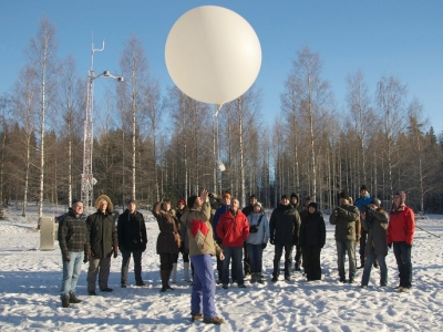
Radiosonde launches took place eight times a day, penetrating as high as 100,000 feet into the troposphere.
“What was unusual about STORMVEX,” says Mather, “was having instruments deployed on a mountaintop that were naturally within clouds much of the time.”
CACTI: From October 2018 through April 2019, Varble led the Cloud, Aerosol, and Complex Terrain Interactions (CACTI) field campaign on the eastern slopes of the Andes Mountains in Argentina.
More than 50 ARM instruments, including scanning radars, measured the properties of orographically generated clouds as they formed, matured, and dissipated. The final data sets included measurements from 1-minute-resolution satellite retrievals as well as observations from ARM research flights.
“Mountains focus a lot of specific processes we are interested in,” says Varble.
Most ARM instruments were set up at 3,740 feet on the eastern slope of a north-south ridgeline reaching 9,000 feet high, the birthplace of some of the world’s most powerful storms.
“Mountains are a good natural laboratory where we can sit in one location and observe the whole life cycle of clouds,” says Varble.
In one respect, mountain campaigns resemble many others in the ARM timeline: the inevitable opportunities for collaboration with other DOE national laboratories, federal agencies, and local and international partners.
COPS was part of a larger six-year German campaign on forecasting precipitation. STORMVEX drew in partners from throughout the Western United States, including the Storm Peak Laboratory, a Rocky Mountain satellite of the Nevada-based Desert Research Institute.
CACTI was joined by Remote Sensing of Electrification, Lightning, and Mesoscale/Microscale Processes with Adaptive Ground Observations (RELAMPAGO), a sister campaign largely sponsored by the National Science Foundation and featuring many Argentine university and agency collaborators.
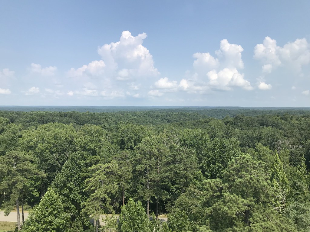
The Complication of Forested Terrain
Add forests to mountainous terrain and “you’ve added a significant level of complexity,” says Mather.
For one, forested landscapes have canopy profiles that complicate wind patterns.
In addition, trees and other vegetation change air circulation and give off biogenic aerosols―fragments of plant matter that help form clouds. Their size, shape, and chemistry vary widely, adding to the complexity of complex terrain.
The Signature Example of SAIL
The Surface Atmosphere Integrated Field Laboratory (SAIL) is ARM’s ongoing 2021–2023 campaign near Crested Butte, Colorado. It takes place in a Rocky Mountain watershed that feeds the vital Upper Colorado River.
Mountains provide more than 60% of the world’s fresh water, yet earth system models are not very good at predicting how much water they store or when the water will appear.
Five DOE national laboratories are SAIL partners, along with at least nine universities, the Desert Research Institute, the National Center for Atmospheric Research, and the venerable Rocky Mountain Biological Laboratory, founded in 1928.
The 186-square-mile study area is complex terrain by any definition. There are steep slopes, both bare and forested, brush, meadows, hills, and valleys. The region also experiences seasonal heavy snow and hard rain, buffeted by high winds.
SAIL is a hotbed of collaboration, with 12 sister projects also taking place in the region. One of the biggest is the Study of Precipitation, the Lower Atmosphere and Surface for Hydrometeorology (SPLASH), led by ARM data veteran Gjis de Boer and funded by NOAA.
The AMF and other SAIL instruments are on track to bring in rare long-term data on the land-to-atmosphere processes behind a representative segment of midcontinental mountain hydrology.
The data will help answer SAIL’s five research objectives:
- precipitation processes
- aerosol regimes and radiation
- aerosol-precipitation interactions
- surface energy balance
- wind distribution and snow sublimation.
When frozen water evaporates, a process called sublimation can immediately change ice to vapor, skipping the water phase. That means less water for downstream users.
Sublimation is the subject of another big SAIL sister project, funded by the National Science Foundation: Sublimation of Snow (SOS), led by Jessica Lundquist at the University of Washington.
Wide-ranging SAIL comes at a critical time. A 2021 paper in Nature Reviews Earth & Environment posits a persistent low-to-no snow scenario in 35 to 60 years if warming trends persist and snowpack continues to decline.
Co-authors include SAIL Principal Investigator Daniel Feldman and co-investigator William D. Collins, both of Lawrence Berkeley National Laboratory in California.
SAIL is slated to wrap up in June 2023 after 21 months of unprecedented observations in critical mountainous terrain. That’s a “long runway,” says Feldman, with plenty of mountain hydrology data still to land.
Campaigns in Forests Alone
“Operating in a forest regime is a real challenge to our sampling systems,” says Mather.
He offered two signature examples of ARM campaigns focused on forested terrain alone.
GoAmazon2014/15: With ground and airborne support from ARM, Scot Martin of Harvard University led the 23-month Green Ocean Amazon (GoAmazon2014/15) field campaign.
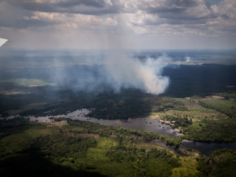
GoAmazon investigated the hydrologic cycle of Brazil’s Amazon Basin. It was ARM’s first major campaign to focus on complex terrain dominated by forest alone―in this case, a forest of several billion trees in an area two-thirds the size of the United States.
The Amazon Basin’s hydrologic cycle has its own environmental and societal effects. It is one of the main heat engines of Earth’s Southern Hemisphere and generates deep convective storms, a chief source of moisture.
Despite its importance, however, the Amazon Basin and its complex water-cycle dynamics are not well understood, observed, or modeled. GoAmazon scientists set out to bring more data to the scientific community. They measured both pristine air as well as areas of the basin perturbed by modernity―chiefly pollution from Manaus, the region’s one major urban center.
Martin compared ARM research flights to an atmospheric time machine. Airborne instruments measured conditions over pristine forest, a pre-industrial kind of experience, and then back over what he called “a fire hose” of particulates shot into the air over Manaus, an industrialized city of more than 2 million.
Scientists wondered: In these two regimes, the polluted and the pristine, what role do biogenic aerosols play? How do various atmospheric conditions affect cloud life cycles and rainfall?
GoAmazon deployed nine instrumented ground sites. One of them included a 177-foot aluminum tower, which enabled measurements above the forest canopy.
BAECC: Another ARM forest campaign began a month after GoAmazon: the 2014 Biogenic Aerosols – Effects on Clouds and Climate (BAECC) campaign, led by the University of Helsinki’s Tuukka Petäjä.
The forest setting in Finland, however, was vastly different than the Amazon. Science moved from sizzle to drizzle.
“It rained, then it snowed, then it froze,” remembers Mike Ritsche, who helped set up ARM instruments for BAECC almost a decade ago.
Ritsche is now the site manager for ARM’s Southern Great Plains atmospheric observatory, which spans parts of Oklahoma and Kansas, and a new long-term mobile observatory under development in Alabama.
BAECC took place over eight months at the Hyytiälä Forestry Research Station in southern Finland, an area of frigid boreal forest and icy blue lakes. ARM packed more than 35 instruments into seatainers. None of the containers was high enough to see over the forest canopy.
To overcome the height problem, the BAECC team constructed one tower and took advantage of a canopy-topping, 416-foot tower already onsite. It is part of the Station for Measuring Ecosystem-Atmosphere Relations II (SMEAR II), one of the world’s preeminent observation sites in a boreal environment.
Both BAECC and GoAmazon collected data on processes related to the formation of aerosols, clouds, and precipitation in a forested setting, where forest-atmosphere processes are not currently well represented in earth system models.
However, BAECC also provided new data on the microphysics of snow and its effects on the global water cycle.
As with any measurement attempts in a forest setting, BAECC scientists confronted the challenge of tree height.
“Many of our instruments don’t like trees,” says Mather, explaining the necessity of towers. “They need to see through trees, and they can’t.”
Forest settings also mean a lack of open, tree-free space. For GoAmazon, there were forest-adjacent clearings and farm fields. During BAECC, ARM reduced the AMF footprint to an unusually compact 180 by 240 feet.
“We always start from the ideal, then we deal with whatever we have to,” says BAECC setup veteran Nicki Hickmon, who is now ARM’s associate director for operations.
ARM’s Future Forest Observatory
If Hickmon prefers starting from the ideal, how about starting from scratch?
That’s what ARM is contending with as it moves closer to beginning a planned five-year deployment in northwestern Alabama.
The new Bankhead National Forest (BNF) atmospheric observatory is expected to be operational by September 2023, says Hickmon, who joins Ritsche and others within ARM in nailing down the final details.
Chongai Kuang, an atmospheric scientist at Brookhaven National Laboratory in New York, leads a site science team funded by ARM and DOE’s Atmospheric System Research (ASR).
The broad aim, says Ritsche, is to go beyond ARM’s typical measurements of solar radiation at the top of a forest. Instead, BNF instruments, including some on a planned 140-foot tower, will collect long-term measurements of radiation, aerosols, and other properties “as they filter through (the canopy) all the way down to the (forest) bottom,” he says.
Why put a sophisticated atmospheric observatory on U.S. Forest Service property in northern Alabama?
The site, says Hickmon, “is really intentional,” designed to capture atmospheric processes within forest canopy, away from significant urban, orographic, or ocean influences.
“It was hard to find a forest,” says Hickmon―at least one that is free from other atmospheric influences. “You just narrow and narrow and narrow until you find the right place.”
The BNF is also interesting to scientists because the area is so active convectively―to say nothing of periodic visits from hail, high winds, and even tornadoes.
While embedding a long-term AMF in the middle of a forest “is a real measurement learning curve for us,” says Hickmon, the BNF has collaborators already in the region taking environmental measurements that will complement ARM’s data. These partners include local universities; the National Science Foundation’s National Ecological Observatory Network (NEON); and AmeriFlux, a network of community sites measuring ecosystem-scale carbon, water, and energy fluxes across the Americas.
Scientists want to know what land-forest-atmosphere interactions drive cloud formation or enhance storms. They also want to understand the aerosol, cloud, and land-surface properties within the mixing bowl of forest canopy.
Five years of continuous data from the BNF will fill in knowledge gaps.
Follow Us:


Keep up with the Atmospheric Observer
Updates on ARM news, events, and opportunities delivered to your inbox
ARM User Profile
ARM welcomes users from all institutions and nations. A free ARM user account is needed to access ARM data.


