From the User Executive Committee (UEC) Subgroup Chairs: May 2024
Published: 23 May 2024
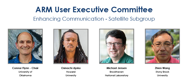
Editor’s note: Members of ARM’s User Executive Committee (UEC) participate in subgroups that aim to help broaden community outreach. In a four-part series of blogs, each subgroup chair during the 2023–2024 UEC term will introduce their subgroup, share their subgroup’s ideas and recommendations to ARM, and ways in which the ARM community can engage with subgroup members. Connor Flynn shares an update from the Enhancing Communication with the Satellite Community subgroup.
The UEC is charged with providing feedback to ARM leadership with respect to the user experience. Members are typically elected for four-year terms with elections staggered every other year to promote continuity of operational and institutional knowledge and subgroup membership.
There are currently 14 members, self-selected into four subgroups:
- Undergraduate Engagement with a Focus on Diversity
- Measurement Uncertainty and Communicating Calibration
- Enhancing Communication with the Satellite Community (ECSC)
- Enhancing Communication with the Modeling and Energy Exascale Earth System Model (E3SM) Communities.
During last year’s meeting, the UEC discussed each subgroup’s progress and recommendations to ARM, summarized in a recent report. The ECSC subgroup (yes, I like acronyms) is composed of four members. Because of the staggered UEC election cycle, this was the first “full” UEC meeting with the new ECSC membership.

In preparing for the UEC meeting, the ECSC subgroup had an initial web meeting to allow members to introduce themselves, learn about one another’s connections to ARM, and share specific interests in and ideas for enhancing communication with the satellite community.
Subsequent to the web meeting, we reviewed the previous ECSC subgroup recommendations and were surprised at the commonality! This left us feeling inspired and empowered to carry their torch forward.
Recommendations to ARM
The current ECSC subgroup proposed recommendations to ARM in three different tiers:
- short-term: possible within a single fiscal year
- medium-term: implementable in a three-year cycle to support ARM users working on projects funded by DOE’s Atmospheric System Research (ASR) program
- long-term: requiring planning and execution spanning more than three years.
Under short-term recommendations, we proposed two additions to the ARM Data Discovery tool that might increase the visibility of ARM’s satellite-derived science data products:
- a satellite icon under “Search by Category” on the main landing page
- the keyword “satellite” as a category choice in the Data Search text box.

Another short-term item was to update the ARM Satellite Data page to include:
- a link inviting the use of enhanced JupyterHub access through the ARM Data Workbench to reduce participation barriers related to data storage and processing power
- files in the Keyhole Markup Language (KML) format identifying ARM fixed sites to promote ordering ARM-co-located satellite data from satellite data portals
- links to satellite science teams involved with ARM-relevant topics.
Some medium-term recommendations included:
- extending the KML file concept to include measurements from ARM Mobile Facilities (AMF), ARM aerial platforms, and sondes
- further extending the KML file concept with user-specified domains around ARM fixed sites and AMF deployments
- developing Jupyter Notebook tutorials that can access ARM-hosted satellite data, or creating tools to facilitate co-location of satellite measurements with ARM sites
- maintaining an up-to-date table of ARM-relevant satellite science team meetings and webinars.
We had just one item on our long-term “wish list”: development of an ARM data product comparing ARM active remote sensors with co-located satellite products. Think matched ARM radar and lidar measurements with CloudSat and CALIOP. Wow!
We Want to Hear From You!
One of the exciting things about enhancing communication with the satellite community is that things keep changing. For example, new user interfaces are released, new ordering capabilities are introduced, new data products are developed, and even new satellites are launched!
If you are using a satellite-related resource that you want the ARM community to know about, please contact the UEC. We can help raise its visibility within the ARM community. If you have tricks or tools for coordinated use of ARM and satellite data that you’d like to share, please contact the UEC. We can facilitate sharing with a broader audience. If you have questions about techniques for co-locating ARM and satellite data, please contact the UEC! We can connect you with experts applicable to your challenge. Or if you just have a desire to be involved in the energetic, dynamic ARM and satellite community (and really, who wouldn’t?), please contact the UEC and reference the ECSC subgroup. We’d love to hear from you, and you’re sure to hear back from us.
Keep up with the Atmospheric Observer
Updates on ARM news, events, and opportunities delivered to your inbox
ARM User Profile
ARM welcomes users from all institutions and nations. A free ARM user account is needed to access ARM data.


