

Hopping Continents in the Name of Atmospheric Science
Published: 18 May 2020
ARM Mobile Facilities continue to collect valuable data 15 years after first deployment
Take sophisticated scientific instruments and send them around the world in shipping containers to collect atmospheric data in remote locations for months—even years—at a time. This is a signature piece of the Atmospheric Radiation Measurement (ARM) user facility’s research portfolio.
Early in the 21st century, ARM, a U.S. Department of Energy (DOE) scientific user facility, expanded its data-gathering capabilities from fixed sites to portable instrumented observatories. This year marks the 15th anniversary of the first field campaign data to flow from an ARM Mobile Facility (AMF).
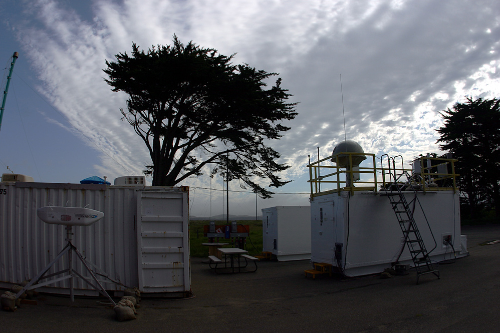
From March to September 2005, the Marine Stratus Radiation, Aerosol, and Drizzle (MASRAD) Intensive Operational Period used the first ARM Mobile Facility (AMF1) on the Northern California coast.
A few months after MASRAD, AMF1 went international. The observatory traveled to Niamey, Niger, to begin the Radiative Divergence using AMF, GERB, and AMMA Stations (RADAGAST) field campaign in January 2006.
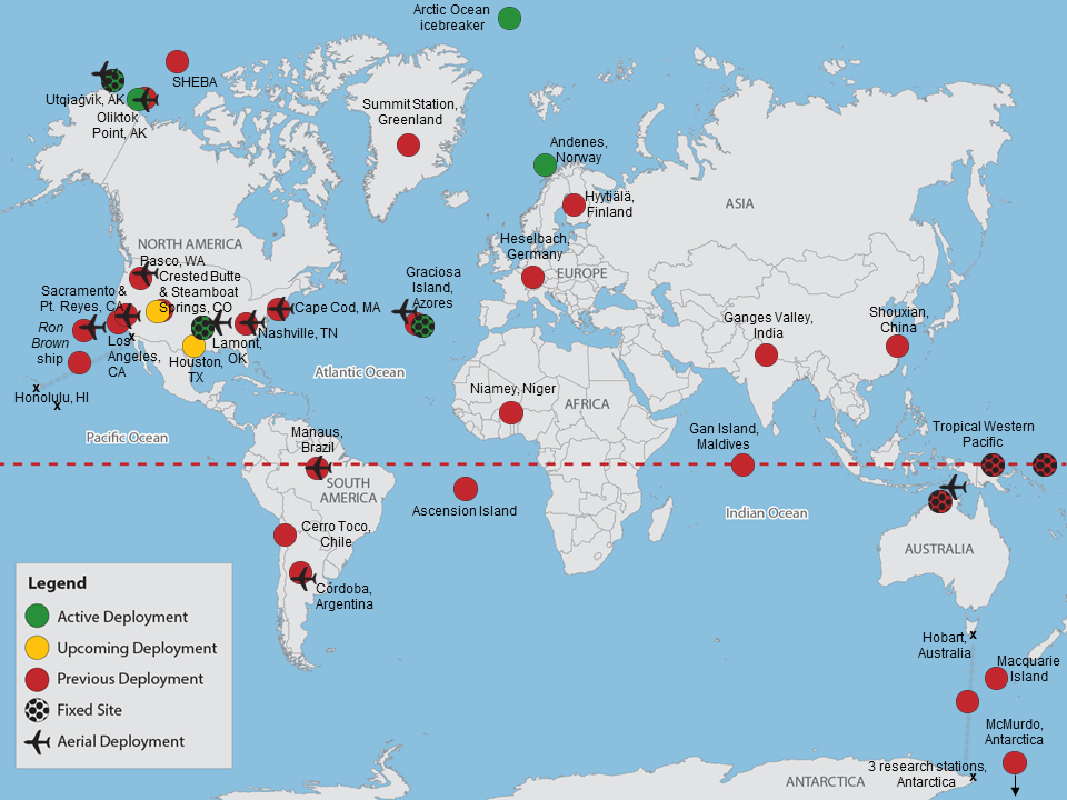
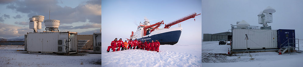
As AMF1 wound its way around the globe, gathering information in climate-critical and under-observed regions, two more mobile facilities came online in 2010 and 2013. All three are out in the field as of May 2020, amassing data on clouds, precipitation, aerosols (tiny particles in the air), energy, and other meteorological variables. (Users can find the full 15-year treasure trove of AMF data in the ARM Data Center.)
While AMF1 is wrapping up its deployment on a Norwegian island for the Cold-Air Outbreaks in the Marine Boundary Layer Experiment (COMBLE), the second ARM Mobile Facility (AMF2) is on an icebreaker in the central Arctic during the Multidisciplinary Drifting Observatory for the Study of Arctic Climate (MOSAiC) expedition. Meanwhile, the third ARM Mobile Facility (AMF3) continues its extended deployment in Oliktok Point, Alaska.
“It’s not always a glamorous job,” says ARM Associate Director for Operations Nicki Hickmon, “but it’s a pretty satisfying one a lot of times too, in realizing the ability of what you can accomplish.”
Fitting the Pieces Together
“There’s a lot of technical problem-solving that has to happen in the field to be able to get the instruments and the equipment and everything working as well as we need it to, to be able to provide the level of data that ARM requires.”
Heath Powers, site manager for the first and second ARM Mobile Facilities
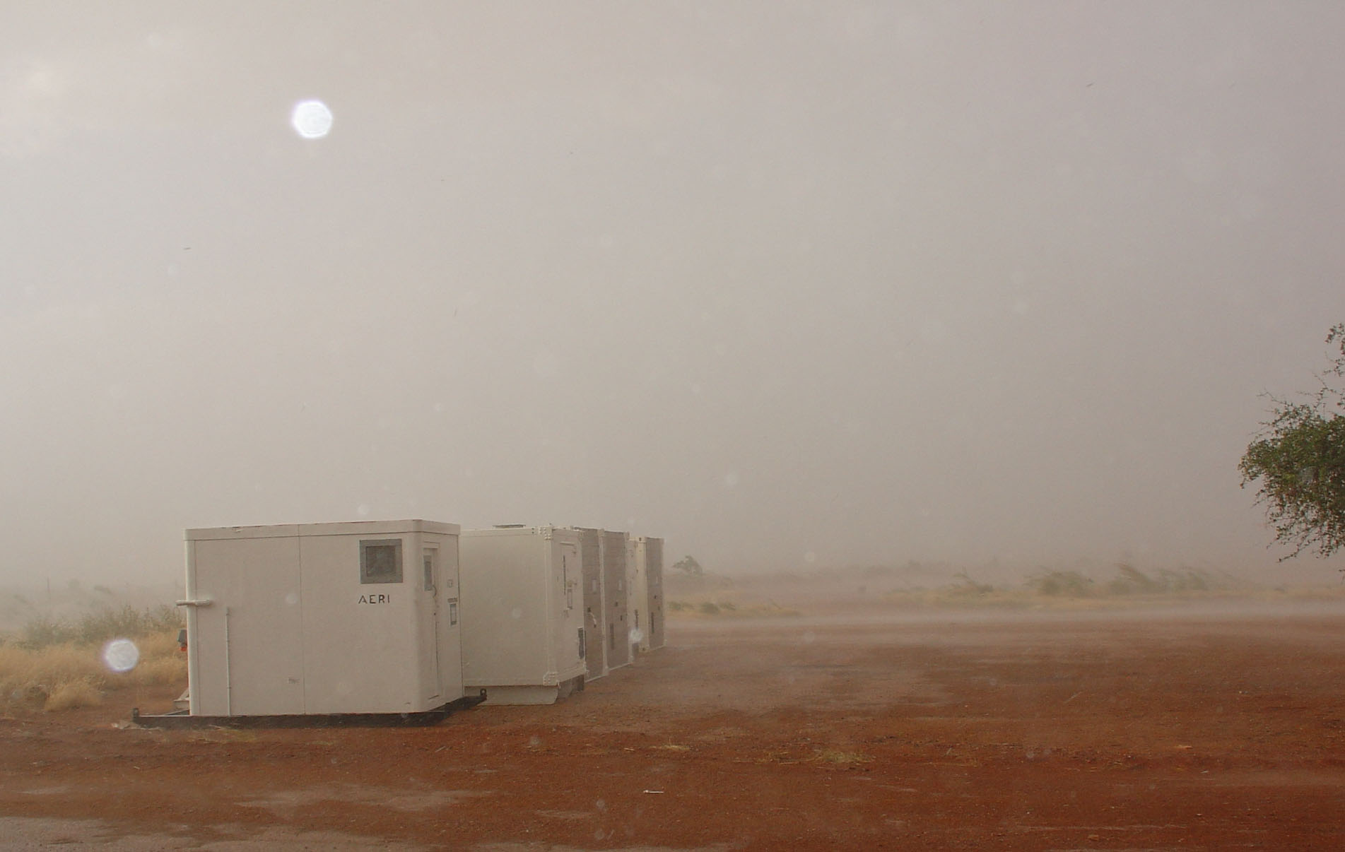
If the walls of ARM’s mobile facilities could talk, they might speak of stifling humidity in the Amazon, bitter polar cold, or fierce African dust storms. ARM technicians, instrument mentors, and facility managers prepare and maintain the mobile facilities in some of the most extreme conditions on the planet.
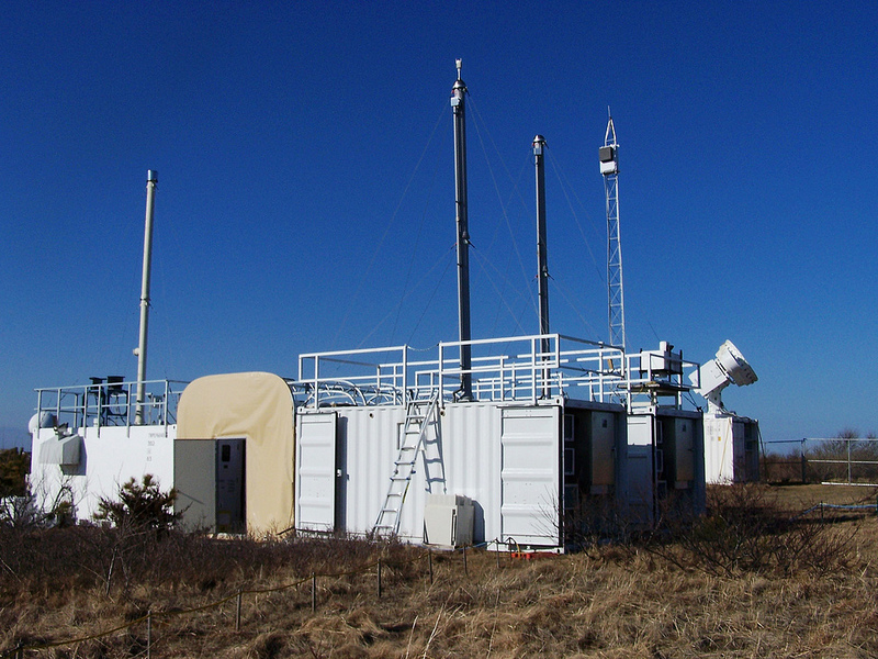
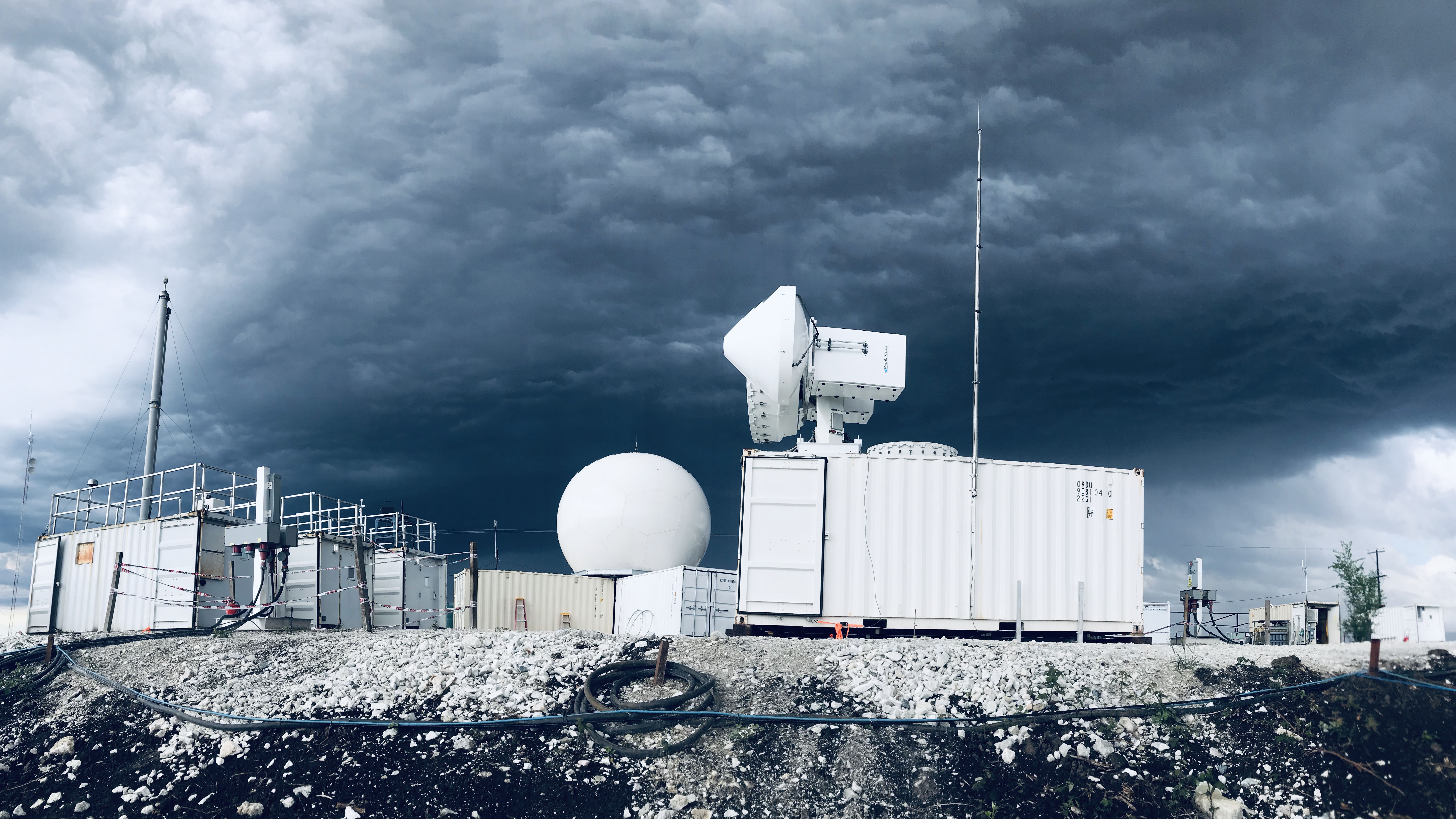
More than 50 instruments, including radars, lidars, radiometers, and meteorological instrumentation, are deployed as part of each AMF.
“There’s a lot of technical problem-solving that has to happen in the field to be able to get the instruments and the equipment and everything working as well as we need it to, to be able to provide the level of data that ARM requires,” says Heath Powers, site manager for AMF1 and AMF2. Powers is based at Los Alamos National Laboratory in New Mexico.
Sending data back to the ARM Data Center can present even greater challenges.
“It’s not always through an internet pipe,” says Hickmon. “A lot of times it’s on disk.”
Oftentimes, those disks are shipped to the ARM Data Center, but occasionally, other measures are required. Misha Krassovski, an information technology engineer at Oak Ridge National Laboratory in Tennessee, came home from the MOSAiC expedition with hard drives full of AMF data. Once he returned to his job at the lab, he hand-delivered the hard drives to colleagues at the ARM Data Center.
Introducing the ARM Mobile Facility
At the turn of the millennium, ARM operated fixed sites in the Southern Great Plains, North Slope of Alaska, and Tropical Western Pacific. But those sites “were only touching the surface of some of the important cloud systems on the planet,” says Mark Miller, a Rutgers University professor and longtime ARM contributor.
Still, the fixed observatories helped ARM refine cloud radar and background measurement capabilities that could be deployed to other areas.
Then-DOE ARM Program Manager Wanda Ferrell and then-ARM Chief Scientist Thomas Ackerman helped lead the charge for a mobile facility. The AMF vision began to crystallize during the 2000 ARM Science Team Meeting and a follow-on workshop at Pacific Northwest National Laboratory (PNNL) in Washington state. In 2001, Ackerman announced the AMF development initiative at the ARM Science Team Meeting.
Within the next few years, AMF construction and beta testing took place at PNNL. In 2003, Miller, then at Brookhaven National Laboratory in New York, was named the AMF site scientist.
(In the ARM monograph, which chronicled ARM’s first 20 years, Miller was the corresponding author of a chapter documenting the background of the ARM Mobile Facilities.)
The First Campaign
As work ramped up on the AMF, Miller wrote the science plan for MASRAD. The marine clouds that reside close to the surface, which are at the heart of MASRAD, are crucial to the Earth’s energy balance.
“When these low clouds overlay the ocean surface, it’s like having snow cover over those areas of the planet,” says Miller. “When it’s gone, it’s ocean underneath, which basically absorbs any incoming solar radiation.”
In December 2004, ARM announced Point Reyes National Seashore, which is north of San Francisco, as the site of MASRAD and the AMF’s first deployment.
MASRAD was not without its trials, even before it started. A truck carrying the AMF to Point Reyes slid off the road an hour from its destination. Luckily, the incident caused only minor damage to an air conditioning unit on one of the two AMF shelters.
On location, the AMF was a half-mile from the beach, and that distance made a difference in the cloud structure observed. Also, the cloud radar was not as well characterized as present-day radars.
“That said, there were a lot of very cool results that came from MASRAD,” says Miller, “mostly dealing with aerosol indirect effects and aerosol chemistry, and also the aircraft data that were collected just offshore—there were lots of papers written about that—so MASRAD was quite successful for an early first experiment.”
Going Global
As MASRAD got going, planning was underway for the 2006‒2007 RADAGAST campaign in Niger, led by Anthony Slingo of the University of Reading in the United Kingdom.
“It is a fragile region ecologically, being in a semi-arid region adjacent to the Sahara Desert, and so sometimes sees dramatic dust storms,” says ARM Technical Director Jim Mather. “But it is also a region of strong tropical storm systems that propagate through Niger, across the continent—sometimes initiating cyclones that eventually develop into Western Hemisphere hurricanes.”
Slingo and Peter Lamb, a key member of the RADAGAST science team, have since passed away, but the campaign’s legacy stands firm. Mather and Miller both count RADAGAST among the milestone AMF campaigns. Part of a major study of the West African monsoon system—the African Monsoon Multidisciplinary Analysis (AMMA)—RADAGAST contributed findings on how dust can affect convection in the region and radiative transfer in the atmosphere.
After RADAGAST and deployments in Germany (2007‒2008) to study orographic cloud systems and China (2008) to study aerosol-cloud interactions, AMF1 went to the Azores in 2009 for the Clouds, Aerosol, and Precipitation in the Marine Boundary Layer (CAP-MBL) field campaign. The marine cloud system in the northern latitudes is “incredibly important in the Earth’s radiation budget,” says Miller, who left his role as AMF site scientist in 2014.
CAP-MBL was a sign of things to come for ARM in the Azores: The facility established its long-term Eastern North Atlantic observatory on Graciosa Island in 2013.
The Road Show Continues
AMF1 had one more foreign deployment—the Ganges Valley Aerosol Experiment (GVAX) in India from 2011 to 2012—before returning to the United States. In 2012 and 2013, it was stationed on Cape Cod, Massachusetts, for the Two-Column Aerosol Project (TCAP). That campaign marked the first combined deployment of AMF1 and ARM’s Mobile Aerosol Observing System, and it also included flights by ARM’s Gulfstream-159 research aircraft.
In January 2014, AMF1 started collecting data downwind of Manaus, Brazil, as part of the DOE Green Ocean Amazon (GoAmazon2014/15) field campaign. GoAmazon aimed to improve understanding of aerosol and cloud life cycles within the Amazon Basin. At least 90 papers have come out of GoAmazon since it ended in November 2015. Research revealed how urban pollution can influence natural aerosol processes within the rainforest and thunderstorm intensity.
AMF1’s travel log kept growing after GoAmazon.
While on Ascension Island in 2016 and 2017, AMF1 brought in data that are now helping researchers better understand how smoke particles wafting westward from Africa can affect clouds over the remote South Atlantic Ocean.
From October 2018 through April 2019, the observatory gathered data in a storm-riddled region of Argentina for the Cloud, Aerosol, and Complex Terrain Interactions (CACTI) field campaign. With 80 days of deep convective activity seen during CACTI, those data will be important for examining the transition from shallow to deep convection.
In the fall of 2019, AMF1 headed to northern Norway for the COMBLE campaign. Led by Bart Geerts of the University of Wyoming, COMBLE is studying what happens when cold air masses move over open water.
“ARM essentially manages everything—the data collection, the logistics of the deployment, data quality control, archiving,” says Geerts. “It’s wonderful to have such an organization that is so organized in terms of its mission to collect data using these facilities.”
The Next 15 Years
After COMBLE finishes at the end of May, AMF1 will go through a refurbishment phase. Then it will ship out to the Houston, Texas, area to start the yearlong TRacking Aerosol Convection interactions ExpeRiment (TRACER) in April 2021. The next location for AMF1 is unknown—DOE is now considering preliminary proposals recently submitted for the AMF1 deployment that will follow TRACER.
The next couple of years also promise to be active for AMF2 and AMF3.
Post-MOSAiC, AMF2 will return to Colorado, where it first collected data a decade ago, for the Surface Atmosphere Integrated Field Laboratory (SAIL) field campaign. During the nearly two-year SAIL campaign, which begins in September 2021, researchers will study seasonal cycles of processes that influence mountain hydrology.
By the end of fiscal year 2021, AMF3 is scheduled to end operations in Alaska ahead of a five-year deployment in the Southeastern United States. A site science team led by Brookhaven National Laboratory will help drive the science and narrow down potential landing spots for AMF3 in the Southeast. An AMF workshop in August 2018 identified the Southeast as a priority area of interest for further study.
With all three mobile facilities headed for deployments in the contiguous United States, it will be the first time that they are so close to one another.
Beyond that, the future is wide open for ARM and its mobile facilities.
“There are a lot of observatories—small, large—but they’re very narrowly focused in what they can do and how they do it,” says Hickmon. “We’ve really maintained and grown our flexibility with where we’ve gone with all of ours, and I want to keep being able to do that.”
Follow Us:


Keep up with the Atmospheric Observer
Updates on ARM news, events, and opportunities delivered to your inbox
ARM User Profile
ARM welcomes users from all institutions and nations. A free ARM user account is needed to access ARM data.


