

Science Data Products Update
Published: 22 March 2023
ARM makes web changes to help users learn about different data sets; conference provides opportunities to highlight products from MOSAiC expedition
Editor’s note: This is an update from ARM Associate Director for Research Jennifer Comstock.

ARM has a long history of providing derived data products, known as value-added products (VAPs), to the user community. There are currently over 100 VAPs available for users.
VAPs are higher-order geophysical variables derived from an array of in situ sensors and passive and active remote-sensing instruments. Examples include aerosol optical depth, cloud height and microphysical properties, and profiles of cloud condensation nuclei and thermodynamic profiles.
Over the years, ARM has expanded its data product offerings to include external data products, such as satellite data and model reanalysis output; principal investigator (PI) data; field campaign data; and aerial data. More recently, high-resolution modeling and data epochs have come online.
To help users better understand the differences between these products, ARM has a new Science Data Products landing web page. This page provides a short description of each data type with links to learn more details and browse data in ARM Data Discovery.
Also linked from the science products page is a new web page highlighting satellite products and partnerships with other agencies, such as NOAA and NASA, which provide a variety of satellite products over ARM sites and use ARM data for validation exercises.
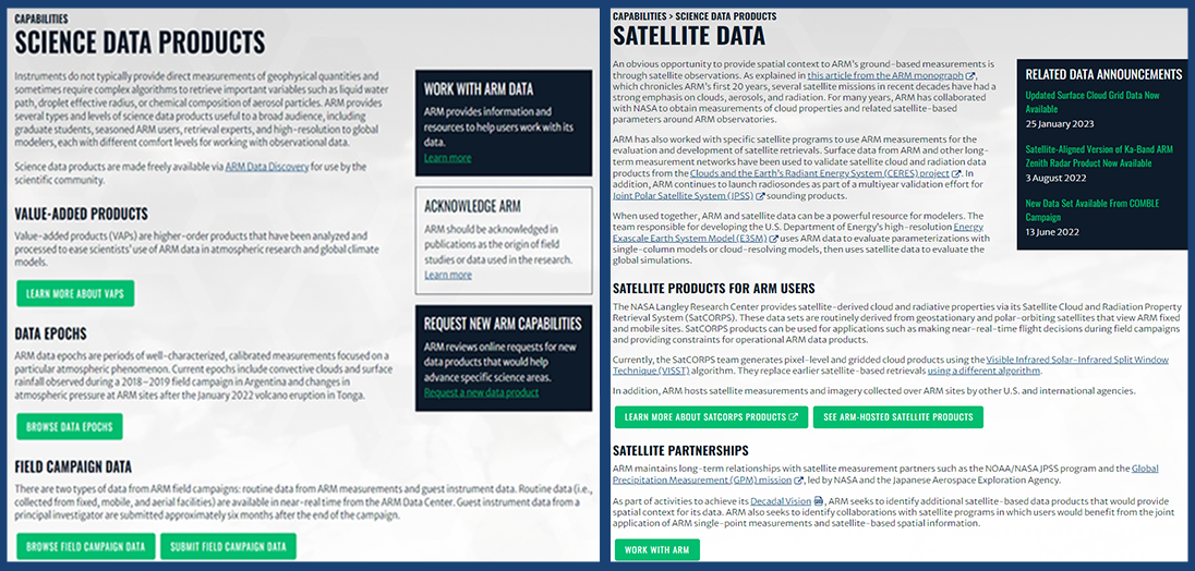
The science products landing page provides a one-stop shop for learning about ARM data sets and guides users to order and download these data.
Other avenues for finding ARM data include Data Discovery; the Data Sources page, which lists the data that are available from multiple sources, including VAPs and instruments; and individual field campaign, instrument, and VAP web pages. The search navigation has been recently updated for the Data Sources, Instruments, and VAPs pages to make it easier to visualize and apply filtering options.
You can read more about the recent web changes in this ARM article.
If you have comments about the new data pages, search navigation changes, or other parts of the ARM website, please click on the red Feedback tab on the right side of the screen to provide your input. We want to know what we are doing right, but also where we can make improvements to help you access the data and information you need for your science.
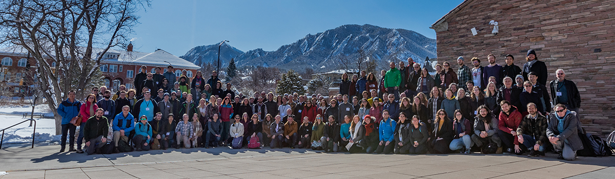
Scientists Dig Into Arctic Data Sets
The Second International MOSAiC Science Conference was held February 13 to 17, 2023, in Boulder, Colorado, with scientists from around the world showcasing data sets and science activities from the four MOSAiC themes: Atmosphere, Ice, Ocean, and Biogeochemistry.
The conference included a series of plenary talks and topical breakout sessions highlighting these different themes while encouraging integrated, cross-cutting science exploration across themes.
Breakout sessions included diverse topics such as observations in the historical context, aggregated data sets for model evaluation, modeling across scales, remote sensing from ice to space, and sessions integrating topics from atmosphere to ocean.
Several longtime ARM users and ASR PIs participated in the conference and presented results using ARM data for a wide range of topics, such as characterizing ice-nucleating particle sources, evolution, and impacts throughout the Arctic; atmospheric boundary-layer processes, cloud impacts, and surface energy balance; and remote-sensing retrievals.
The conference also highlighted research from early career scientists, such as a detailed study using self-organizing maps to characterize boundary-layer structure and atmospheric stability during MOSAiC.
I got to attend the conference, present an update on ARM measurements and VAPs, and learn more about data needs from the broader MOSAiC user community. One area in which ARM can contribute is the development of aggregated data sets for exploring relationships between different variables and comparing with model simulations. Building case libraries for single-column model or large-eddy simulation studies or data epochs around periods of interest are additional ways we can highlight ARM data.
During the 2019–2020 MOSAiC expedition, ARM also collected measurements at the North Slope of Alaska atmospheric observatory in Utqiaġvik (formerly Barrow); at Oliktok Point, Alaska; and in northern Norway during the Cold-Air Outbreaks in the Marine Boundary Layer Experiment (COMBLE). These data sets provide spatial context across the greater Arctic.
The measurements collected at Utqiaġvik are part of a 25-year ARM data set available for long-term analyses.
ARM measurements and VAPs from MOSAiC, plus data from COMBLE, Utqiaġvik, and Oliktok Point, are freely available for download through Data Discovery.
Data from the broader MOSAiC community are linked through several data portals, such as DataOne and the Marine Data Portal, which can be found on the MOSAiC expedition website. Links to ARM data are also available from the Marine Data Portal.
Now is a good time to explore these rich data sets, which will help characterize the Arctic’s changing climate for years to come.
Follow Us:


Keep up with the Atmospheric Observer
Updates on ARM news, events, and opportunities delivered to your inbox
ARM User Profile
ARM welcomes users from all institutions and nations. A free ARM user account is needed to access ARM data.


