

SAIL, 1 Year Later
Published: 21 June 2024
Scientific investigations, data analysis, and model improvements follow the June 2023 end of a Colorado field campaign on mountain hydrology
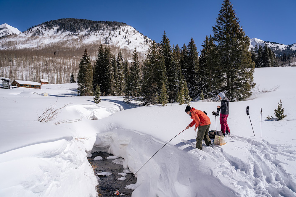
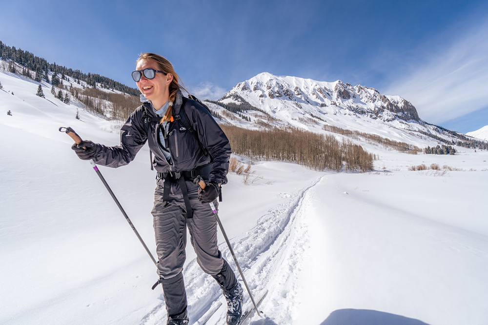
One winter day in early 2023, William “Will” Rudisill, a hydrologist and postdoctoral researcher at Lawrence Berkeley National Laboratory (LBNL) in California, joined a few friends for some backcountry skiing in the East River Watershed high up in Colorado’s Rocky Mountains.
“It was a reminder that we were in the wilderness,” he says, and that the work he and his friends were doing took place “very much in nature.”
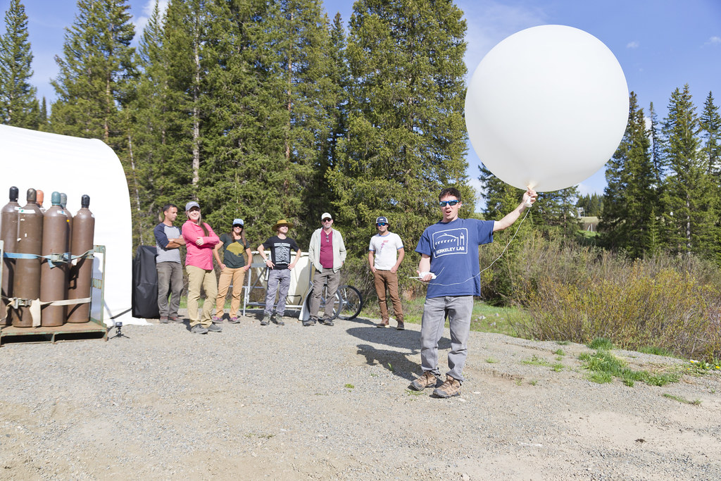
Rudisill and his companions were among many dozens of researchers who took part in the 2021–2023 Surface Atmosphere Integrated Field Laboratory (SAIL) campaign.
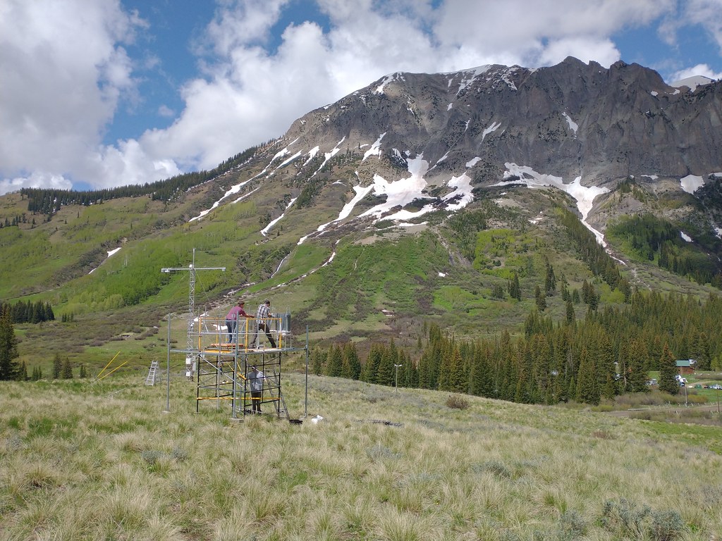
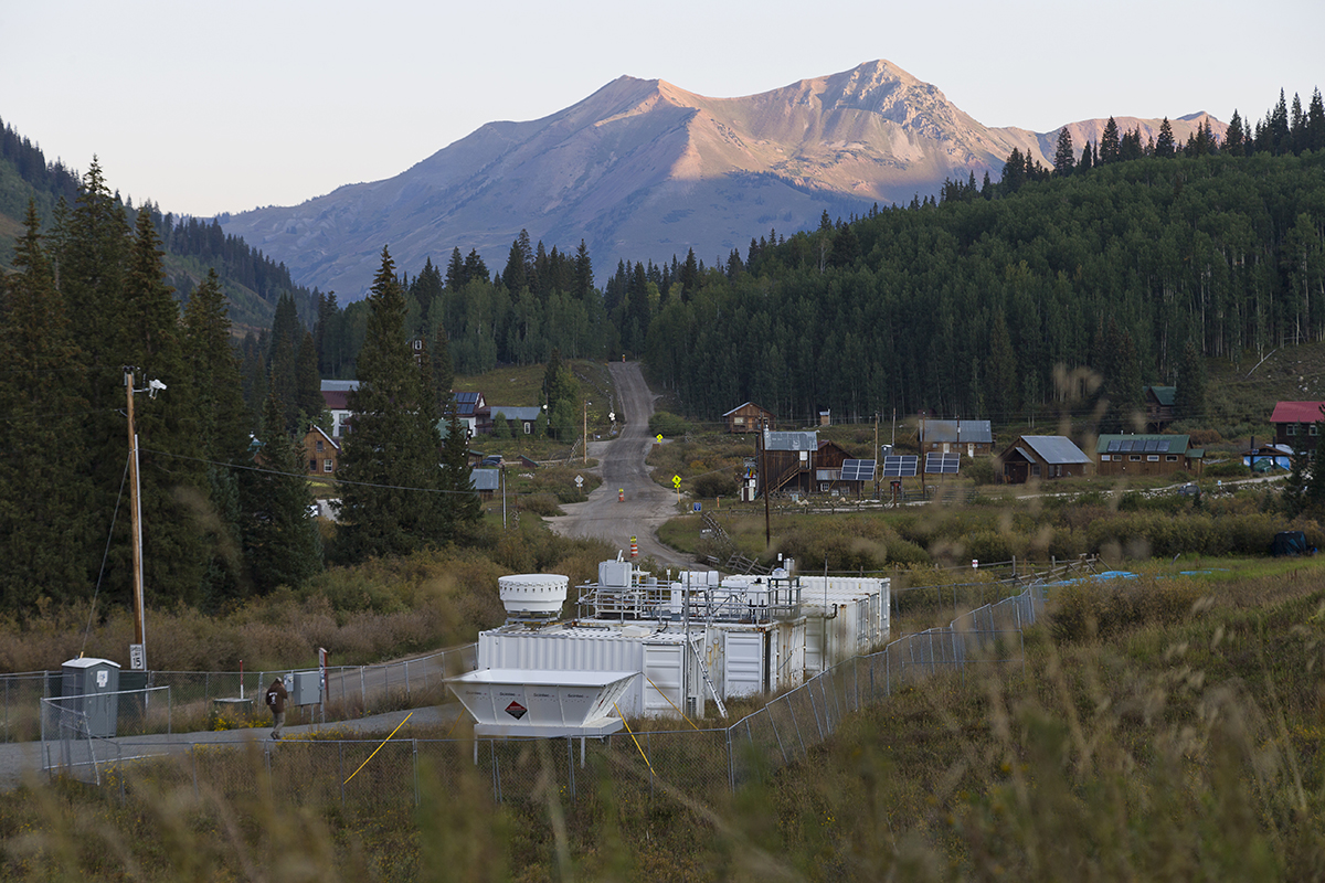
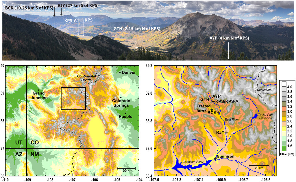
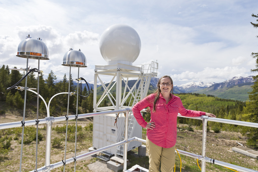
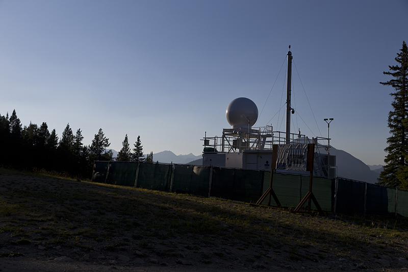
With Daniel Feldman, an LBNL climate scientist, as the campaign’s principal investigator, SAIL deployed a suite of instruments near Crested Butte, Colorado. Most were from the U.S. Department of Energy’s (DOE’s) Atmospheric Radiation Measurement (ARM) user facility. They included 50-plus instruments in a containerized observatory called an ARM Mobile Facility.
Over 21 months, SAIL collected continuous, all-season measurements of the evolving surface and atmospheric conditions that control hydrometeorology, hydroclimatology, and hydrology within the East River Watershed.
The last day of campaign operations was June 15, 2023. A year later, Feldman, Rudisill, and other scientists are busy analyzing data, writing papers, testing models, and working with a quickly expanding community of SAIL researchers.
They are pursuing vital knowledge about ways the atmosphere, surface, and subsurface interact to influence how much watersheds collect and retain snow and other forms of precipitation, and how they then release water downstream.
In the future, seasonal snow in a warming world will likely create less and less water downstream. And such “snow drought” will be more frequent and severe.
So concludes a 2023 letter in Environmental Research Letters by University of California, Berkeley, PhD candidate Marianne Cowherd and two co-authors. They combine historical data and modern simulations to “pinpoint snow drought as an emerging global threat to water resources.”
An Information Gap
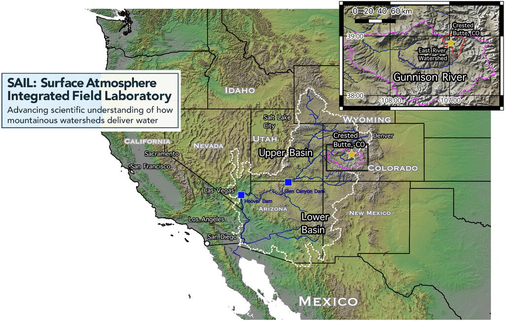
In the case of the East River Watershed, that global threat takes the form of impacts to 40 million people downstream in seven U.S. states and Mexico.
The watershed, a dot on the Colorado map, takes up only 300 square kilometers (186 square miles). But it is a significant source of water flowing into the Colorado River, where about 70% of its water originates as runoff from mountain snowfall.
Globally, the kind of terrain studied during SAIL—peaks, steep slopes, scattered forest, and deep valleys—constitutes less than a quarter of the land surface. Yet mountain rivers, streams, and groundwater supply 60% to 90% of the world’s fresh water, giving this terrain a wildly outsized impact on society.
Earth’s higher elevations are warming faster than lower elevations, and stores of snowpack are declining. That puts water supplies from mountainous watersheds increasingly at risk.
Meanwhile, real-time measurements of the changing atmospheric and surface processes in such hard-to-access complex terrain remain scant.
SAIL’s comprehensive observations will help create “higher resolution future models” of the kind Cowherd’s team calls for in its 2023 letter, which would, among other things, “better capture complex mountain topography.”
A Haul of Data
“The data is so dense, you could have an entire career just looking at it.”
William “Will” Rudisill, postdoctoral researcher at Lawrence Berkeley National Laboratory
Feldman calls SAIL’s haul of data “the largest and best archive ever collected on mountain hydrology in North America.”
The numbers are indeed big. There are 227 terabytes of quality-checked SAIL campaign measurements on hand, says ARM Chief Data and Computing Officer Giri Prakash. “By far, that’s the most gathered from the last four ARM Mobile Facility deployments.”
That many terabytes are equivalent to nearly 15 billion document pages—enough to fill almost 300,000 filing cabinets. (Remember those?)
As of mid-June 2024, SAIL has 166 data products, 233 datastreams, and 398 primary measurements, which are freely accessible from ARM’s Data Discovery portal.
“Those numbers are not static,” says Feldman. Researchers are still adding their own observational and model products to the archive. Measurements there cover critical information bases: clouds, aerosols, solar and thermal energy, precipitation, temperature, pressure, humidity, and wind.
“The data is so dense,” says Rudisill, “you could have an entire career just looking at it.”
Partners in the Field
The trove of mountain hydrology data collected during SAIL also benefited from the efforts of a long list of other institutions. Some of them funded nearby field campaigns in conjunction with SAIL.
NOAA was the primary supporter of the Study of Precipitation, the Lower Atmosphere and Surface for Hydrometeorology (SPLASH), which ran from fall 2021 through summer 2023. Gijs de Boer of the University of Colorado Boulder was SPLASH’s principal investigator.
A 2023 paper led by de Boer outlines the campaign’s surface sensors (networked across five sites), uncrewed aerial systems, and freely available data sets.
The National Science Foundation’s Sublimation of Snow (SOS) campaign, led by University of Washington snow hydrologist Jessica Lundquist, published its own overview paper in 2024. SOS data are also available for free.
Another major SAIL collaborator was DOE’s longstanding Watershed Function Science Focus Area, led by LBNL biogeophysicist Ken Williams to collect surface and subsurface observations in the East River Watershed.
SAIL also had two strong regional partners: the Rocky Mountain Biological Laboratory in Gothic, Colorado (where ARM sited some instruments), and the Aspen Global Change Institute.
The Mystery of Missing Water
Feldman says SAIL data may help solve some universal questions about mountain hydrology. One such question was among the early motivations for the campaign: Where does the missing water go?
The East River Watershed’s recent hydrological history shows snowpack reserves that are not historically low. But it is evident that not all that snowpack melts and shows up as fresh water downstream.
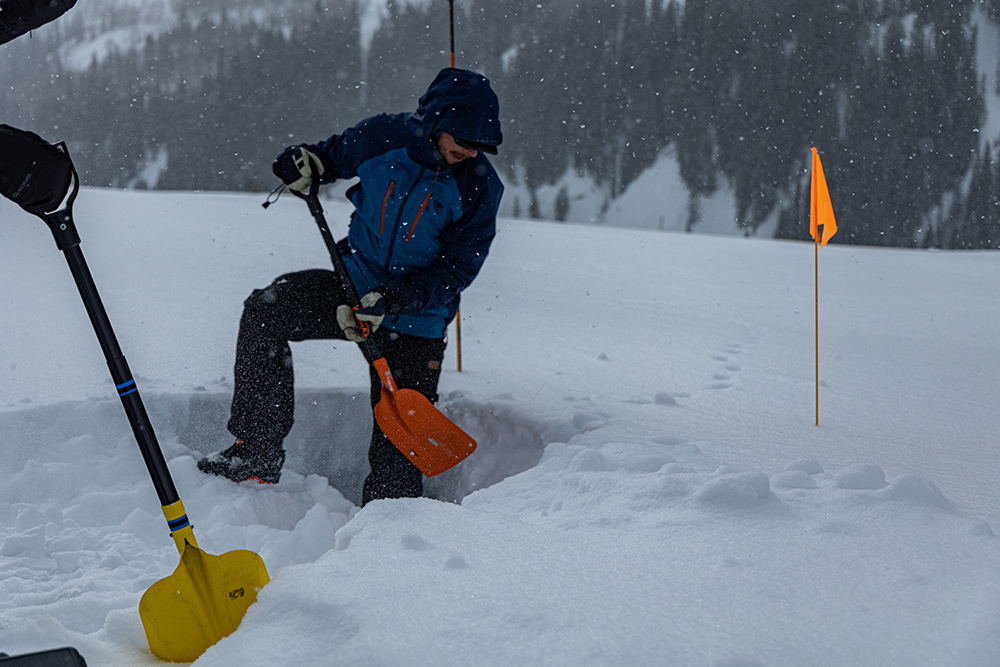
SAIL scientists are investigating the causes of missing water, including precipitation, evaporation, transpiration, and sublimation processes.
Sublimation occurs when snow bypasses the melting stage and dissipates in the atmosphere as vapor. This process has been particularly difficult to measure in the past.
Scientists have been able to constrain this process in models by using data from SAIL, SPLASH, and SOS.
Modeling work is still in its early stages, says Feldman, “but there are clear areas where SAIL research is making headway.”
One is in basic radiative processes, including the representation of the terrain effects on longwave radiation. This is lacking in most atmospheric process and earth system models. So is the representation of surface air temperature, its process controls, and its impacts on surface processes.
“Scientists will never be able to measure everything, everywhere, all at one time. So, modelers are key to taking lessons learned about processes and using them to accurately predict when mountain water will be available downstream and how much there will be.”
SAIL Principal Investigator Daniel Feldman
“Scientists will never be able to measure everything, everywhere, all at one time,” says Feldman. “So, modelers are key to taking lessons learned about processes and using them to accurately predict when mountain water will be available downstream and how much there will be.”
Publications Rolling In
As scientists and policymakers worry about mountain water drying up, SAIL publications are flowing in. There are 13 SAIL-related papers so far, as well as 28 technical reports.
The latest paper, led by Cowherd, “looks at how automated snowpack measurement sites will work under future climates,” she says.
The study was published June 18, 2024, in Communications Earth & Environment. It outlines a scheme that salvages the utility of around 900 existing snowpack measurement sites.
Such “snow pillow” stations measure snow-water equivalent but may be less useful “as climate change shifts snow to higher elevations,” says Cowherd. “We use artificial intelligence models to produce accurate (snowpack) estimates that work even in new climates.”
The paper, which features data from SAIL and other entities, acknowledges funding from DOE’s Atmospheric System Research (ASR) program for co-authors Feldman and Utkarsh Mital, an LBNL earth scientist. In addition, the paper acknowledges Cowherd’s support from DOE’s Computational Science Graduate Fellowship (CSGF) program.
More papers are on the way.
SAIL co-investigator Allison Aiken, an aerosol scientist at Los Alamos National Laboratory in New Mexico, recently submitted a paper on scientists’ quest for real-time, single-particle bioaerosol data in high mountain terrain.
Single-particle bioaerosols include bacteria, pollen, and fungi emitted from plants and the soil microbiome. They influence clouds, precipitation, and surface hydrology.
The authors found that this class of bioaerosols made up a significant concentration of the total particles measured at SAIL in the spring and summer of 2022.
The paper captures the diurnal cycles of the particles and their weather-related changes in type and abundance. The heavier the rain, the authors found, the higher the concentration of bioaerosols.
“To our knowledge,” says Aiken, “these are the first measurements of this type at a high-altitude site in the United States and North America.”
Aiken co-authored a SAIL campaign overview paper published in December 2023 by the Bulletin of the American Meteorological Society (BAMS).
Sometime this summer, her team will submit a paper reporting SAIL-enabled insights on supermicron particles—those larger than 1 micron in diameter.
Aiken also contributed to some of the dozen or so smaller campaigns that deployed guest instruments in the SAIL study area. One was SAIL Supermicron Bioaerosol, which Aiken led from April 2022 through June 2023. It characterized and quantified supermicron particle events and bioaerosol activity in real time.
Another was SAIL Aerosol Vertical Profiles (SAIL-AVP), which relied on ARM tethered balloon system flights in 2022 and 2023.
In all, says Aiken, there are “lots more data we hope to keep working on for years to come.”
Drilling Down Into Cold Biases
“SAIL reached a high-water mark for data density” related to complex terrain, says Feldman. “With this density, we don’t have to wonder what is going on. We can drill down and figure out exactly what is going on.”
As an example, Feldman recommends a 2024 study led by Rudisill on cold bias in models of the atmosphere in mountainous terrain. Until this study, based on temperature readings at a height of 2 meters (6.5 feet), the pervasiveness of cold bias had not been systematically identified in the literature.
Rudisill compared observations from SAIL and elsewhere with regional climate model simulations of mountainous watersheds across the world, such as those from his 2022 Boise State University dissertation.
The authors, including Feldman and two other LBNL scientists, examined how well current models estimate mountain temperatures, which is important for predicting whether it will rain or snow.
After looking at 44 studies of mountain ranges worldwide, the authors found that each study overestimated how cold temperatures were by several degrees or more, especially on mountain peaks and ridges.
Previous studies of cold bias pointed to snow albedo (reflectivity) as a culprit. But Rudisill says the most compelling finding in the paper is that there is no one prominent cause, no “single variable (in a model) we can tweak and fix.”
However, the many causes of cold biases seem to be “quite heavily tied to topography,” he adds. In turn, this means there is a need for more studies of complex wind circulations in mountainous terrain and how snowpack exchanges energy with the atmosphere.
With measurements from a heavily instrumented, long-duration mountain field campaign such as SAIL, the authors conclude, cold bias and similar inaccuracies can be “uprooted” from models.
Keeping in Touch
Growing waves and ways of collaboration show that “we have not retreated back to our little research groups” a year after SAIL observations have ended, says Feldman, but instead are explicitly growing a new research community.
Feldman, Aiken, Rudisill, and others have maintained strong science ties through biweekly SAIL/SPLASH teleconferences, which began before official data were collected. Topics have included snowpack estimation, canopy effects, radiative surface energy budgets, blowing snow, and the history of East River Watershed precipitation.
The most recent presentation, on June 12, 2024, was by Zezhen “Jay” Cheng, a chemist at DOE’s Environmental Molecular Sciences Laboratory (EMSL) in Washington state. He and others looked at the chemistry, shape, and warming effects of wildfire aerosols (measured by Aiken’s instruments) that penetrated the SAIL site in September 2022 from a blaze in Idaho.
At EMSL, analysis of the data revealed the surprising, widespread occurrence of tarballs in soot particles.
This work, says Feldman, “highlighted the value of SAIL’s multidisciplinary science and capabilities.”
During and after each teleconference, as researchers recognize new convergences of field data, ideas for collaboration pop up.
Getting SAIL exposure at conferences and workshops helps too.
The campaign inspired presentations at the Joint ARM User Facility/ASR Principal Investigators Meeting (August 2023), a SAIL/SPLASH/SOS science workshop (November 2023), the American Geophysical Union Fall Meeting (December 2023), and the American Meteorological Society (AMS) Annual Meeting (January 2024).
At the annual Western Snow Conference in April 2024 in Corvallis, Oregon, says Feldman, presentations on the East River Watershed took up nearly a third of the meeting.
In July 2024 in Boise, Idaho, and online, the AMS will host the 21st Conference on Mountain Meteorology. SAIL science, says Feldman, “will be a major part of it.”
Breakout Groups
Among the latest developments in the SAIL collaborations saga is a new aerosol discussion series initiated by Aiken, Feldman, and four others. It is part of an interdisciplinary project to link dust transport, deposition on snow, and changes in surface radiation to changes in albedo.
The series is also “the kind of organic, curiosity-driven exploration that supports improvements in predictive models,” says Feldman. In this case, it’s an exploration of how surface albedo affects the timing of snowmelt and therefore the output of water in mountainous terrain.
In the same vein, Aiken joined with Sonia Kreidenweis at Colorado State University and Jim Smith at the University of California, Irvine, to start a new SAIL Aerosol Science Monthly Telecon. (They are soliciting new participants.)
Its first meeting, in June 2024, drew 20 participants from universities and national labs, “including students, postdocs, and staff,” says Aiken. “Some have already submitted papers while others are just getting started on their SAIL science.”
‘They Are So Bright’
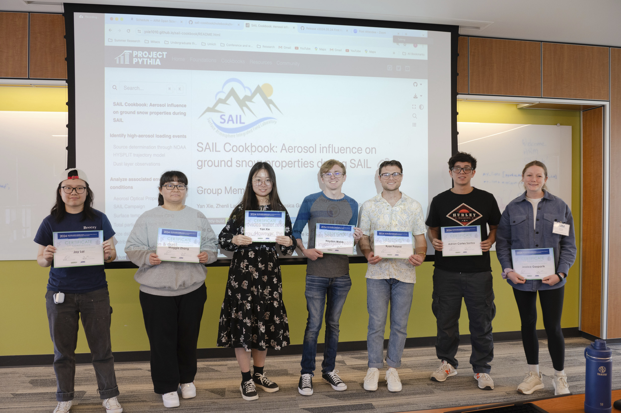
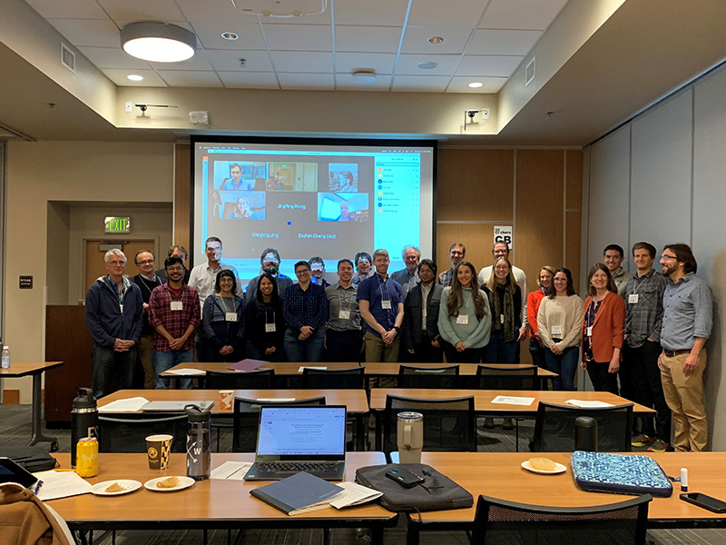
SAIL enjoyed some novel exposure in May 2024 at the ARM Open Science Summer School in Cleveland, Ohio. The campaign was one of four featured tracks intended to teach undergraduates through postdoctoral researchers about ARM data and open-source software.
Virtually, Feldman taught the track on SAIL data, which became a project that focused on linking aerosol deposition and surface albedo in mountainous terrain.
“The students and postdocs who participated in the summer school,” he says of his students before pausing. “Let me put my sunglasses on here. They are so bright.”
Team SAIL, with Feldman as a guide, “dove very quickly into how aerosols impact albedo,” he says, “getting to sophisticated levels of analysis in a matter of hours using advanced, open-source tools developed by ARM.”
All four summer school teams used collaboration and modeling tools that emerged within the last decade, including Slack and Jupyter Notebooks. These tools helped the group “really accelerate,” says Feldman, compared to the days of downloading data and writing large pieces of software from scratch to analyze data.
“When students don’t have to reinvent the wheel,” he says, “they can and do move forward far and fast.”
The Next Generation
The research community growing around SAIL, SPLASH, and SOS data even features its own next generation.
Rudisill, only two years past receiving his PhD, says joining SAIL was a rich and attractive idea.
“I cannot imagine a project that more aligned with my interests and aspirations for science than SAIL,” says Rudisill, who studies how the atmosphere interacts with water on the surface.
Along the way, DOE’s Office of Science Graduate Student Research (SCGSR) program supported a paper he led in 2023 on cold-season precipitation.
Cowherd is also building her early career, in part, through SAIL-related research, such as her published work on global snow drought and snowpack estimation.
She is part of an ongoing collaboration with Feldman and Ethan Gutmann at the National Center for Atmospheric Research in Colorado, funded by the National Science Foundation. They are using terrestrial scanning lidar and weather data to investigate “bedforms” on the snow surface.
These peak-like features, says Cowherd, “increase the surface area of the snowpack and create bumpiness that can affect turbulence in the air above the snow. We want to know how large they are and how they are moving or changing shape.”
From January through mid-March 2023, Daniel “Danny” Hogan and Eli Schwat, PhD students working on SOS with Lundquist at the University of Washington, undertook research in the East River Watershed. They dug snow pits to collect data on snow temperature, density, and morphology.
Later, Hogan and Schwat helped co-author the 2024 SOS campaign overview paper.
Interns Step In and Step Up
Internships are another way for scientists just starting out to learn about SAIL and its data.
An intern on Aiken’s team, Elijah Valverde, an applied mathematics student at San Francisco State University, was matched through the Shin Institute’s Sustainable Research Pathways program. He is investigating trends in supermicron data from SAIL-AVP.
Aiken says that Valverde will look for “events of interest,” anomalies, and opportunities to make predictions using Bayesian statistics.
At LBNL, two interns from DOE’s Science Undergraduate Laboratory Internships (SULI) program are working with Feldman in summer 2024 to contextualize SAIL data. Emily Ammeraal of Oregon State University and Felix Yu of the University of Michigan will develop a cloud climatology of the Colorado River Basin and high-resolution surface albedo products from satellite data.
Getting a view of the basin from surface instruments across complex terrain is not easy, says Feldman, “but is straightforward to measure with satellites.”
Interested in SAIL data? Check out past data announcements, and go to the ARM Data Center.
The satellite data, compared with SAIL’s ground-based measurements, he adds, may reveal little-known links between clouds and snow albedo.
Finding such insights is the central impetus of SAIL, its curious data users, and its growing collaborations—a convergence of factors that may unravel the hydrological puzzles wrapped so tightly in mountainous terrain.
Solving puzzles appeals to Feldman.
“I like mysteries,” he says. “They give us an opportunity to explore.”
Follow Us:


Keep up with the Atmospheric Observer
Updates on ARM news, events, and opportunities delivered to your inbox
ARM User Profile
ARM welcomes users from all institutions and nations. A free ARM user account is needed to access ARM data.


