

A Measurement Treasure Turns 10
Published: 26 October 2023
Now a decade old, ARM’s Eastern North Atlantic atmospheric observatory has gathered a rich data set on remote marine conditions
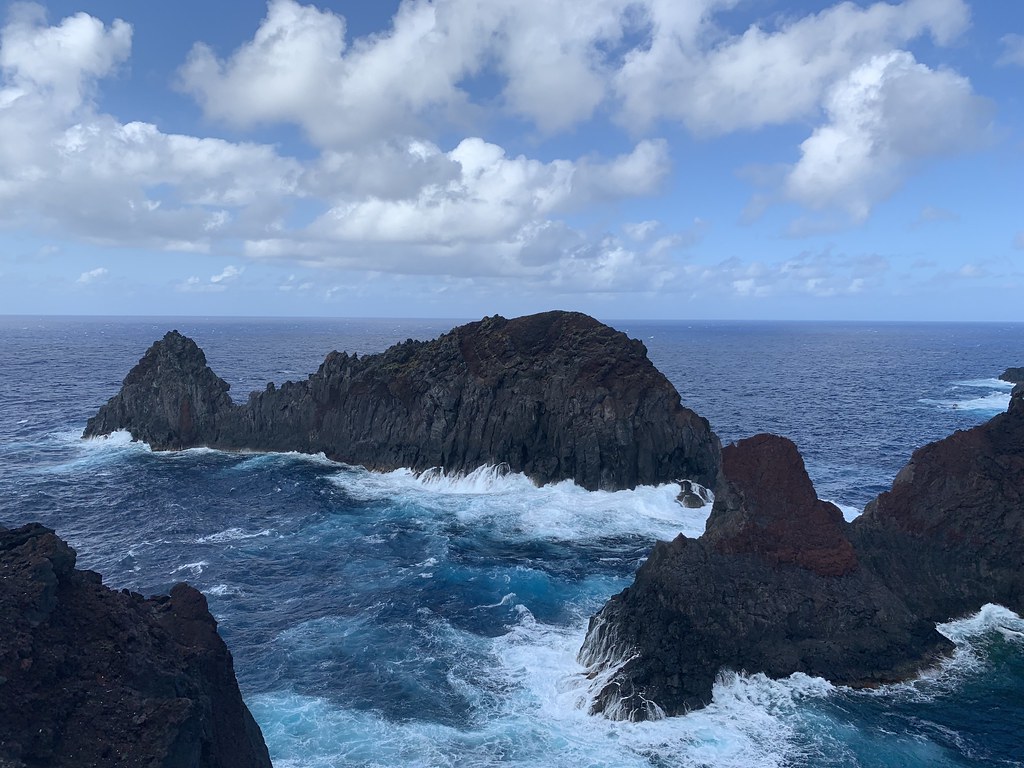
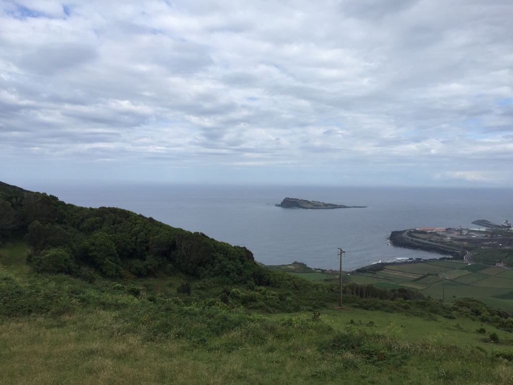
There are nine volcanic islands in the Azores archipelago west of mainland Portugal. One is Graciosa, a temperate dot on the map whose name in Portuguese means “enchanting.”
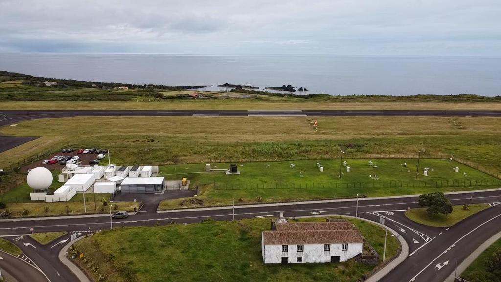
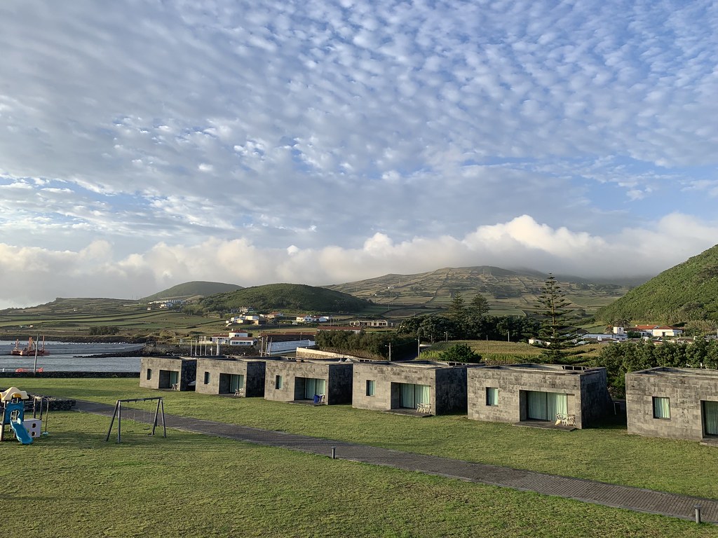
Graciosa, egg-shaped and only 6 miles long, has been the home of the Eastern North Atlantic (ENA) atmospheric observatory since 2013.
In a decade of work, remote sensing instruments at the ENA have made it possible to collect the world’s largest trove of continuous long-term data on atmospheric conditions in the Earth’s marine midlatitudes.
The ENA, situated at not quite 40 degrees north, is managed by the U.S. Department of Energy’s (DOE’s) Atmospheric Radiation Measurement (ARM) user facility. ENA data are freely available in the ARM Data Center.
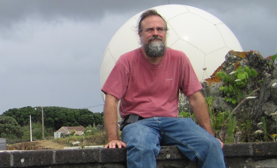
With the ENA in place, “we can study (marine clouds) in great detail,” says cloud systems researcher Mark Miller, a professor of atmospheric science at Rutgers University. “In the last 10 years, I have learned more about stratocumulus in that region and other regions than I had in all the 20 years before that.”
Location, Location
Miller, an early advocate for siting an atmospheric observatory in the Azores, says the ENA is important because it is “right in the middle” of a region of low stratocumulus clouds. Stratocumulus clouds cover about one-fifth of the Earth’s surface, with most occurring over oceans.
The ubiquity of such clouds makes them a critical component of the Earth’s climate system. By reflecting incoming solar radiation, stratocumulus clouds have a net cooling effect globally. Knowing more about them is important to modeling the Earth’s energy budget.
Marine low clouds are very sensitive to even small changes in atmospheric conditions. In a climatically changing world, that adds urgency to improving models of the stratocumulus clouds that predominate over oceans.
An observatory in the Azores also makes it easier to study an important transition between two cloud regimes. In the northern latitudes, solid overcast conditions eventually yield to partly cloudy skies in the tropics. In between, the marine midlatitudes set the stage for stratocumulus to become smaller, broken, rain-bearing cumulus clouds.
Understanding the formation of marine clouds and their properties “is a fundamental problem in the atmospheric sciences,” writes Rob Wood of the University of Washington in his landmark 2012 paper on stratocumulus clouds.
Starting in 2015, Wood led the ENA site science team for DOE’s Atmospheric System Research (ASR) program, which funds projects aimed at reducing uncertainties in global and regional climate models.
Of course, establishing such an elaborate and scientifically important observatory depends on more than a science team.
From the beginning, DOE and ARM relied on close collaboration with the Regional Government of the Azores, one of Portugal’s autonomous regions, which granted the ENA land, environmental authorizations, and customs facilities. The municipality of Graciosa also pledged cooperation.
At the same time, the University of the Azores led negotiations regarding the site, including arranging approvals from the Regional Government. The university, together with its foundation, Fundação Gaspar Frutuoso, also assumed local operational management.
“Such partnerships are critical to the success of any ARM atmospheric observatory,” says ARM Director Jim Mather. “They literally give us the ground to stand on and access to local scientific and technical expertise.”
The Wisdom of Waiting
In 1991, early ARM planners identified 20 locales across the world as potential observatory sites. They winnowed the list to five, including a candidate in the eastern North Atlantic Ocean.
Miller, then a DOE Fellow at Brookhaven National Laboratory in New York, was part of what was to become the ENA site science team.
When the plan fell through soon after, “I was scientifically crushed,” he remembers.
Since then, Miller has reflected on what now seems like the wisdom of waiting longer for an observatory in the Azores.
“It may have been we did not have mature enough technology,” or the right radar calibration techniques, he says. “But now the stuff we have in the Azores is up to the task.”
Island Insights
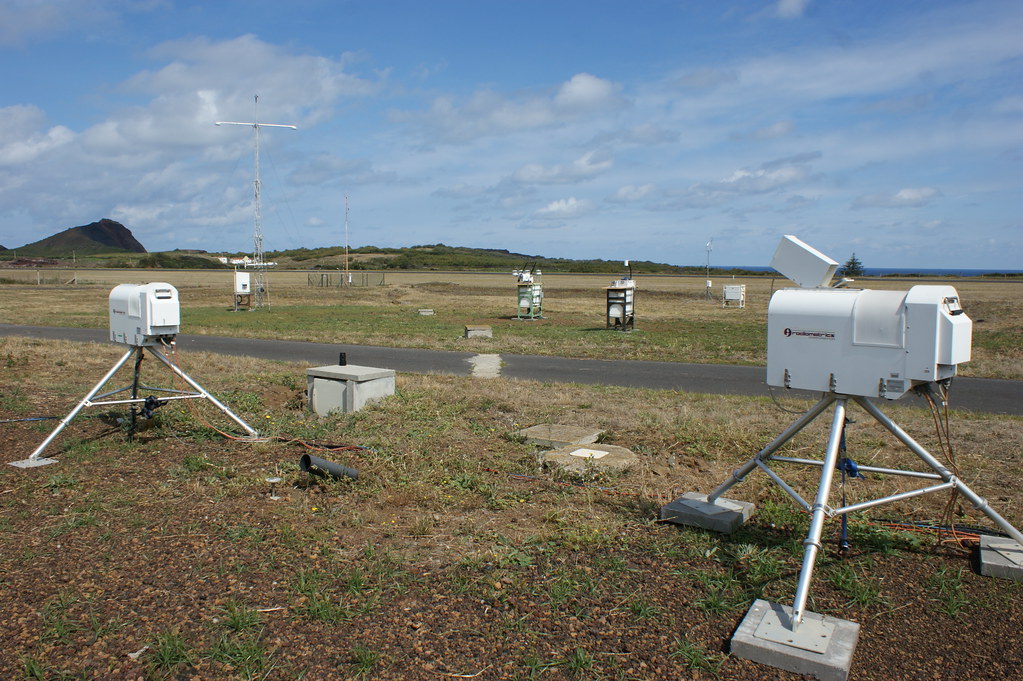
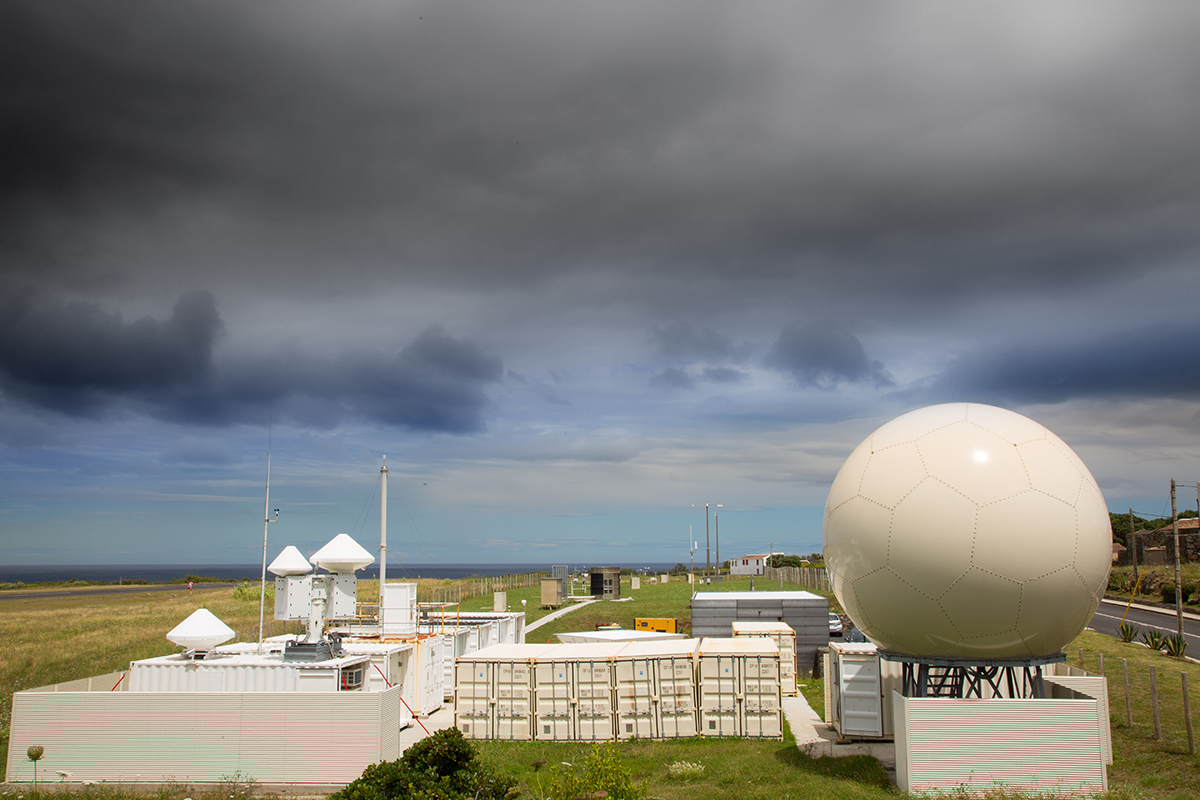
A team from Los Alamos National Laboratory in New Mexico oversees ENA site operations for ARM. The instruments on Graciosa, and the campaigns the island makes possible, provide insights into how clouds form in the eastern North Atlantic, how clouds morph from one cloud type to another, “and even information on how those clouds might change in the future,” says Miller. “Without the ENA site, none of that would have been possible.”
For long-term marine measurements, “you need an island,” says ENA veteran Jian Wang, a researcher at Washington University in St. Louis. “Where else would you put such a site?”
Perhaps on buoys, teases Wood. These floating instrumented platforms, unlike islands, do not create clouds, weather, wind, or coastal aerosols from breaking waves. Such “island effects,” as they are known in the trade, often muddy the meaning of data.
But ARM concluded long ago that island sites or ocean coastlines will have to do as proxies for studying marine climate regimes.
They offer reliable power sources, ease of instrument maintenance, and room for visiting researchers, whose sophisticated guest instruments get deployed during field campaigns.
Meanwhile, islands can house instruments of the scale and complexity needed to study the marine environment, as well as runways for research aircraft.
‘A 3D Picture’
Aircraft measurements were vitally important to an ARM field campaign that Wang led in 2017 and 2018: Aerosol and Cloud Experiments in the Eastern North Atlantic (ACE-ENA).
So far, 38 journal articles have emerged from ACE-ENA data—the most of any ENA campaign.
One was a 2021 paper on new particle formation in Nature Communications, led by Guangjie Zheng, who recently became an assistant professor at Tsinghua University in China. She used both ACE-ENA aerial and surface data.
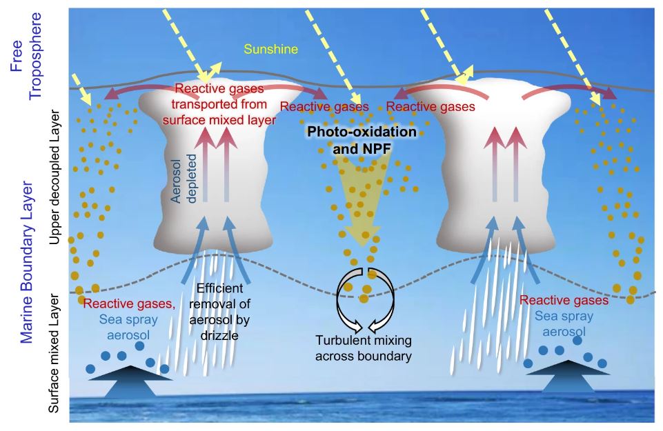
New particle formation influences cloud formation and radiative processes, but it typically occurs aloft—and is not directly detected by surface instruments.
“It’s pretty important,” says Wood of Zheng’s paper. “We’ve been struggling to find new particle formation going on in the boundary layer. Some people will tell you it doesn’t exist.”
During ACE-ENA, two separate aerial deployments—20 flights in the summer of 2017 and 19 in the winter of 2018—featured ARM’s now-retired Gulfstream-159 (G-1) research aircraft.
With the help of research aircraft, says Wang, “you have the ability to measure not only near the surface but also aloft, which gets you a 3D (three-dimensional) picture of conditions.”
Typically, field campaigns happen over relatively short periods of time and do not collect years of measurements like a fixed-location observatory such as the ENA.
This is why combining ACE-ENA measurements with long-term ENA data “is really powerful,” says Wang. “We can better understand aerosol and cloud processes and how important they are over the long term.”
Wang led a 48-author summary of ACE-ENA that appeared in 2022.
He also co-organized a joint special journal issue on marine aerosols, trace gases, and clouds over the North Atlantic. The issue includes several ACE-ENA papers.
ENA Field Campaigns
Including ACE-ENA, there have been 16 field campaigns at the ENA so far.
With funding from a five-year DOE Early Career Research Program award, for instance, Naruki Hiranuma of West Texas A&M University led a campaign in 2020 and 2021 called Examining the Ice-Nucleating Particles from ENA (EXINPENA).
The abundance of ice-nucleating particles, a subset of atmospheric particles, influences precipitation and the Earth’s radiative balance.
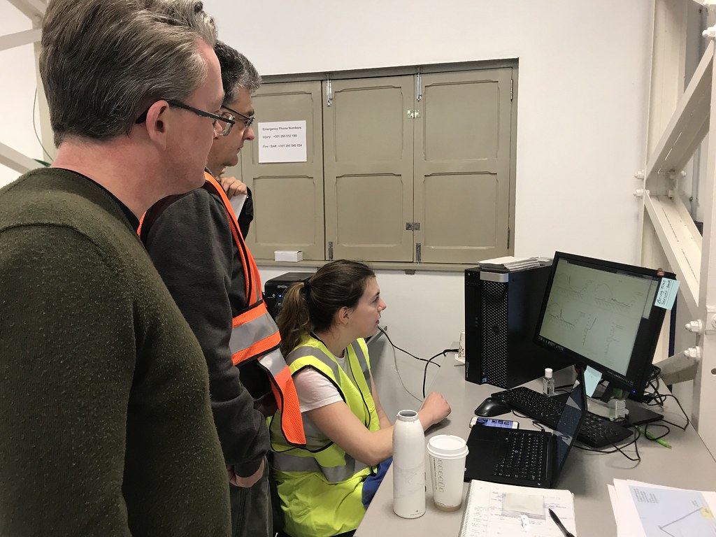
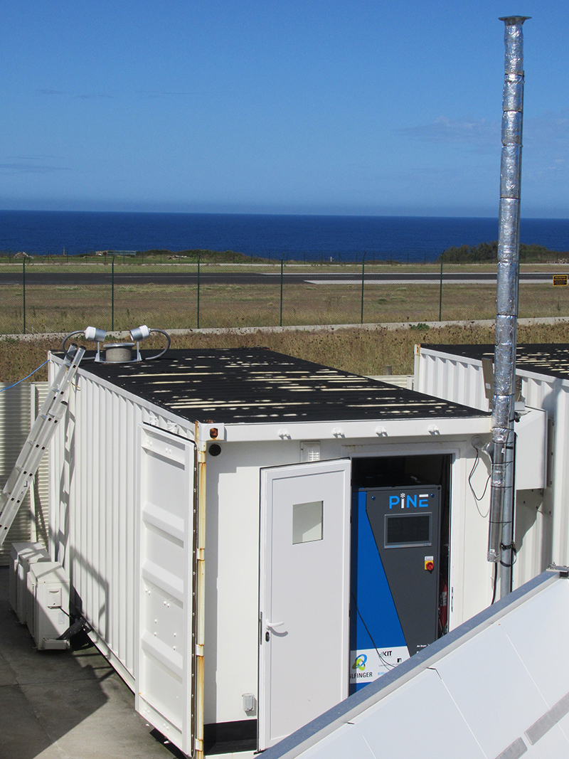
For more than six months of the COVID-19 pandemic, Hiranuma’s Portable Ice Nucleation Experiment (PINE) chamber operated at the ENA. Hiranuma’s team controlled the instrument from West Texas and worked virtually with ARM technicians to check data and address issues.
PINE has the distinction among ARM guest instruments to have been also emplaced during campaigns at the Southern Great Plains and North Slope of Alaska observatories.
In the summer of 2022, the University of Wisconsin–Madison’s Tim Bertram led a six-week campaign that also had an aerosol-related theme. The Aerosol Growth in the Eastern North Atlantic (AGENA) campaign aimed to identify the chemical composition of emissions from the ocean, as well as the materials that lead to growing cloud condensation nuclei.
So far, AGENA team members have created four conference research abstracts.
ENA Influences
A few field campaigns predating the ENA provided “very small pieces of information from limited projects,” says Miller, whose interest in cloud cover in the Azores dates to the early 1990s.
“We really had no idea about the climatology, the long-term characteristics, and the variability in morphology. We can now study the cloud structure in that region in great detail.”
Miller led a 1995 paper that refers to investigations of midlatitude marine boundary-layer clouds going back to 1984.
That paper also refers to the first grand-scale field campaign to study such clouds: the 1987 aircraft-and-island First International Satellite Cloud Climatology Project Regional Experiment (FIRE) off the coast of California.
FIRE marked the first time, wrote Miller, that the “turbulent, microphysical, radiative, and chemical characteristics of stratocumulus” were measured at both the mesoscale and detailed local scales.
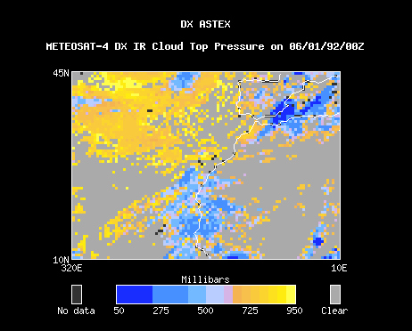
As a graduate student, Miller took part in the next big attempt to study marine stratocumulus clouds, this time in the Azores. The 1992 Atlantic Stratocumulus Transition Experiment (ASTEX), based on the island of Santa Maria, deployed both surface and aircraft instruments. ASTEX also tapped a trove of ship-based data.
Among other things, ASTEX was the testing ground for early forms of microwave millimeter radars, cloud-penetrating instruments that remain workhorse instruments for ARM.
CAP-MBL to ENA
Two decades after ASTEX, ARM’s 2009─2010 Clouds, Aerosol, and Precipitation in the Marine Boundary Layer (CAP-MBL) field campaign, led by Wood, continued to inspire the need for the ENA.
During CAP-MBL, ARM deployed a mobile observatory to Graciosa, the ENA’s future home. Early data were stunning enough that ARM extended the campaign’s original seven-month footprint to 21 months.
Among many insights from CAP-MBL, says Wood, scientists realized “how frequently these low marine clouds precipitate. It was a bit of a surprise.”
Campaign data showed that 50% or more of marine stratocumulus clouds produce rain. Canonical models of the 1990s assumed that these low clouds did not precipitate.
CAP-MBL also deepened what scientists know about how atmospheric particles transported over long ranges affect marine clouds. These aerosols often originate from North American pollution, Canadian wildfires, Saharan dust, and arctic air.
Doppler lidar from CAP-MBL captured continuous data on related aerosol properties, including drop-size distributions and particle chemical composition.
The ENA in general has inspired deeper investigations of marine aerosols, including what Miller says is a growing emphasis on aerosols with biological origins.
“There is a diversity not only of the cloud structure,” he says, “but in the building blocks (aerosols) that create clouds.”
Wood calls the Azores “a crossroads” for studying cloud influences of every kind in a critical midlatitude marine regime. “ENA has been very powerful for expanding ARM’s measurement reach.”
Crunching Through Big Data
Every terabyte of data the ENA adds makes it more likely that analysts will turn to machine learning, a form of predictive analytics based on novel mathematical algorithms.
“Machine learning is very data-hungry,” says Wood, and it allows you to “understand complex relationships when you’ve got a lot of data.”
Machine learning was central to an ENA-related 2020 paper led by Christine Chiu at Colorado State University. The study helped correct how global models represent warm rain in marine cloud decks.
Getting the rate of warm rain correct is important. Even drizzle, a small-droplet form of precipitation, has a big influence on cloud life cycles, radiation, and hydrological budgets.
Researchers are also using advanced computing capabilities to work with ENA data.
Miller co-authored a 2020 study on stratocumulus transition processes with Melissa Kazemirad, then a Rutgers PhD student. They used a supercomputer to simulate, for the first time, how clouds organize into marine boundary-layer convective complexes. Scientists first noted these heavily drizzling clusters, which resemble mini thunderstorms, during ASTEX.
For global climate and weather models, Miller says his work with Kazemirad was the “first real modeling attempt at a regional scale” to simulate the midlatitude transition state between overcast conditions in the high latitudes and broken clouds in the tropics.
In a related ASR project, Miller is working with Katia Lamer of Brookhaven Lab to improve how models represent marine stratocumulus clouds in the midlatitudes. They are focusing on developing a simulated mesoscale view of how such clouds undergo the climatically critical transition from a single-layer state to increasingly broken cloud structures.
Turbulence and Precipitation
A March 2021 ACE-ENA paper led by Neel Desai at San Jose State University investigated turbulent mixing in clouds near Graciosa. These critical air motions occur beneath stratocumulus clouds.
Along the same lines, an October 2021 paper led by Virendra Ghate leveraged six years of ENA data to characterize marine boundary-layer turbulence and how drizzle and turbulence interact.
“We are just now quantifying annual and seasonal cycles of the meteorology, clouds, and aerosols in the region.”
Virendra Ghate, Argonne National Laboratory
More broadly, says Ghate of ENA-related work at Argonne National Laboratory in Illinois, “we are just now quantifying annual and seasonal cycles of the meteorology, clouds, and aerosols in the region.”
The Argonne researchers are also studying the impacts of small islands, he says, “which are hard to capture in models.”
Ghate led a 2011 paper that recorded the first observations of turbulence in marine trade-wind cumulus clouds. That study illustrates the synergy that still remains between more recent papers and older work that used Graciosa Island as a measurement platform during CAP-MBL.
Wood, for instance, points to a 2012 study led by Jasmine Rémillard at McGill University. Her work, he says, “gives a really nice overview of clouds in the Azores and is the (first) paper to set out the importance of frequent precipitation in that location.”
Two years later, in 2014, another formative paper and Wood favorite appeared: a study led by Julian A.L. Mann of the U.K.’s University of Reading. The paper investigated the impact aerosols have on drizzle.
Rémillard showed how much precipitation there was in the region, says Wood, and Mann showed “how that can be suppressed by aerosols.”
Pioneering Radar Work
Wood was a co-author of the Rémillard paper. So were two other researchers whose Azores footprints go back almost 15 years.
Miller calls Pavlos Kollias and Edward “Ed’ Luke, both at Brookhaven Lab, a “symbiotic” team of radar experts whose skills mutually benefit each other.
Kollias has a deep knowledge of radar and cloud microphysics, he says. Luke is an expert in signal processing.
The two co-authored a 2007 paper that described new operational parameters for millimeter radar, whose cloud-penetrating properties enable investigations of marine boundary-layer clouds.
In 2011, Kollias and Luke co-authored a seminal paper that provided the theoretical basis for using the skewness of Doppler radar spectra as a more sensitive indication of the presence of drizzle particles in clouds. Skewness measures deviations from the norm in what would be an otherwise symmetrical distribution of data in radar signals.
The two researchers also co-authored a 2013 paper using CAP-MBL data to introduce a new radar technique for distinguishing the separate radar signatures of clouds, drizzle, and turbulence.
Years later, scientists are still struggling to understand the microphysics of drizzle, in part because radar has historically captured only data on larger drizzle particles.
Most recently, Kollias and Luke took part in a 2022 paper led by Brookhaven Lab’s Zeen Zhu. The study introduced a machine learning algorithm that detects small particles marking the early stages of drizzle’s life cycle.
Miller says that Kollias in particular “has really pushed the frontiers of radar science,” often with the ENA as a backdrop, including improved operating strategies and radar artifact removal. “Pavlos is the person who produces the radar eyes for us.”
Papers and the Test of Time
Wood and others identified papers by Chiu, Desai, Ghate, and others as key studies to emerge so far from the ENA.
Other papers derived from the observatory’s data may take longer to have an impact, says Miller. “It’s hard to say how papers will fare in the future.”
He co-authored a 2022 observational study of the summertime marine boundary layer led by Rutgers PhD candidate Qiuxuan Zheng. They used four years of ENA data, including ACE-ENA measurements, to quantify the region’s cloud morphology, thermodynamics, and drizzle.
Miller says the paper illustrates how “models struggle mightily with hybrid cloud types in the boundary layer,” where more than one cloud type exists simultaneously. “Model improvement is really, really necessary.”
In the paper’s reanalysis of an older model, Zheng and Miller identified four distinct morphological regimes in the boundary layer based on cloud thickness, the intensity of drizzle, and the geometric complexity of cloud cover.
Zheng’s paper, predicts Miller, “will stand the test of time in the literature.”
With almost 130 papers and counting, the ENA—ARM’s remote, data-rich outdoor marine laboratory—is on pace to do the same.
Follow Us:


Keep up with the Atmospheric Observer
Updates on ARM news, events, and opportunities delivered to your inbox
ARM User Profile
ARM welcomes users from all institutions and nations. A free ARM user account is needed to access ARM data.


