

Smoke Studies: Crucial Cloud-Deck Science
Published: 21 July 2021
An ARM field campaign called LASIC has a pivotal role in multi-campaign data on clouds and aerosols over the South Atlantic Ocean
Editor’s note: This article is part of a series exploring ARM field campaigns and data on biomass burning events.
Decks of low marine clouds blanket the southeast Atlantic Ocean off the coast of Africa, often spanning hundreds of miles in any direction. They are part of a natural stratocumulus system drawn like cooling shades over glittering expanses of ocean.
These cloud decks, generally close to deserts, help reflect solar radiation that otherwise would super-heat the Atlantic, altering the Earth’s temperatures and oceanic circulatory systems.
One aspect of these climate-critical cloud formations has been studied very little: the influence of the smoky layers that mingle with them.
Such smoke, laden with fast-changing aerosols that scatter or absorb light, comes from seasonal biomass burning events in southern Africa about four months out of every year. (Aerosols are ultrafine liquid and solid particles suspended in the air. They influence cloud formation, precipitation, and surface energy budgets.)
The smoke advects―moves horizontally―over the southern Atlantic. At times, it overlies the cloud cover or mixes directly with the cloud cover―or sometimes the smoke does both.
Scientists say that about one-third of the world’s fire-related aerosol particles emit from these African fires, which farmers intentionally set to manage cropland waste.
Hence, LASIC
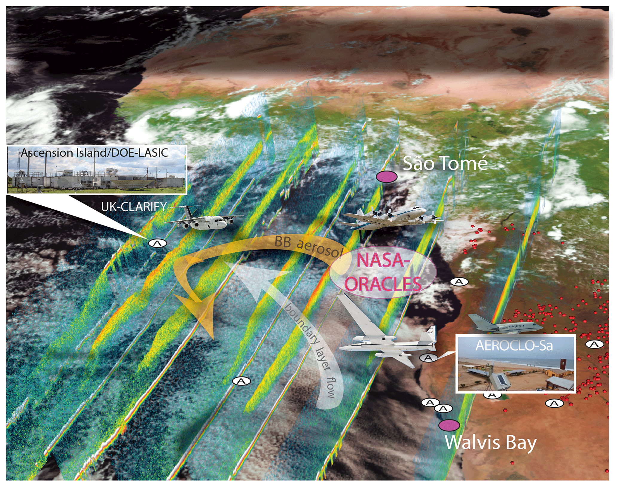
To help close the knowledge gap regarding the climate effects of aerosols from African biomass burning, scientists in 2016 and 2017 executed a field campaign in the southeast Atlantic called Layered Atlantic Smoke Interactions with Clouds (LASIC). It was led by atmospheric scientist Paquita Zuidema at the University of Miami and conducted by the Atmospheric Radiation Measurement (ARM) user facility.
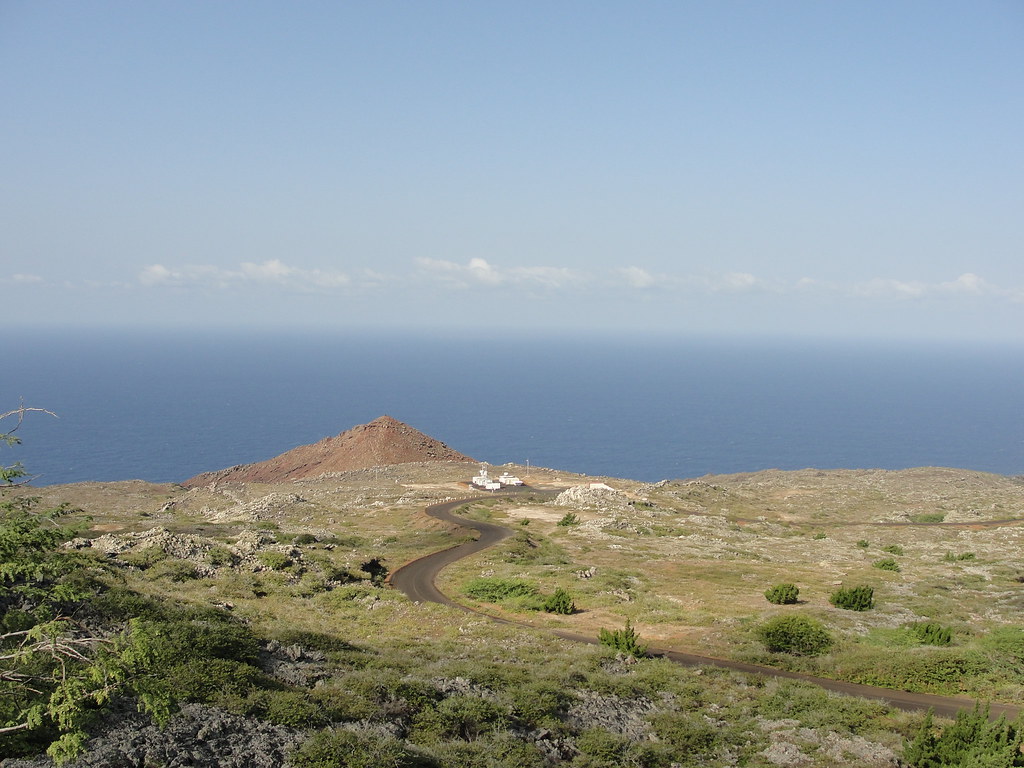
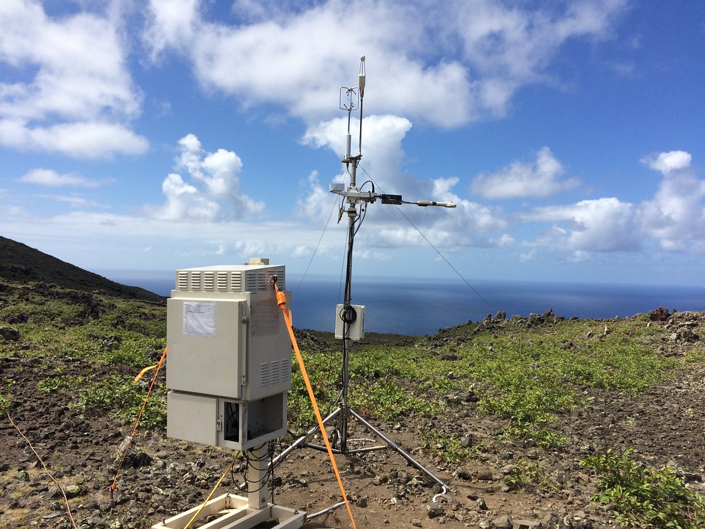
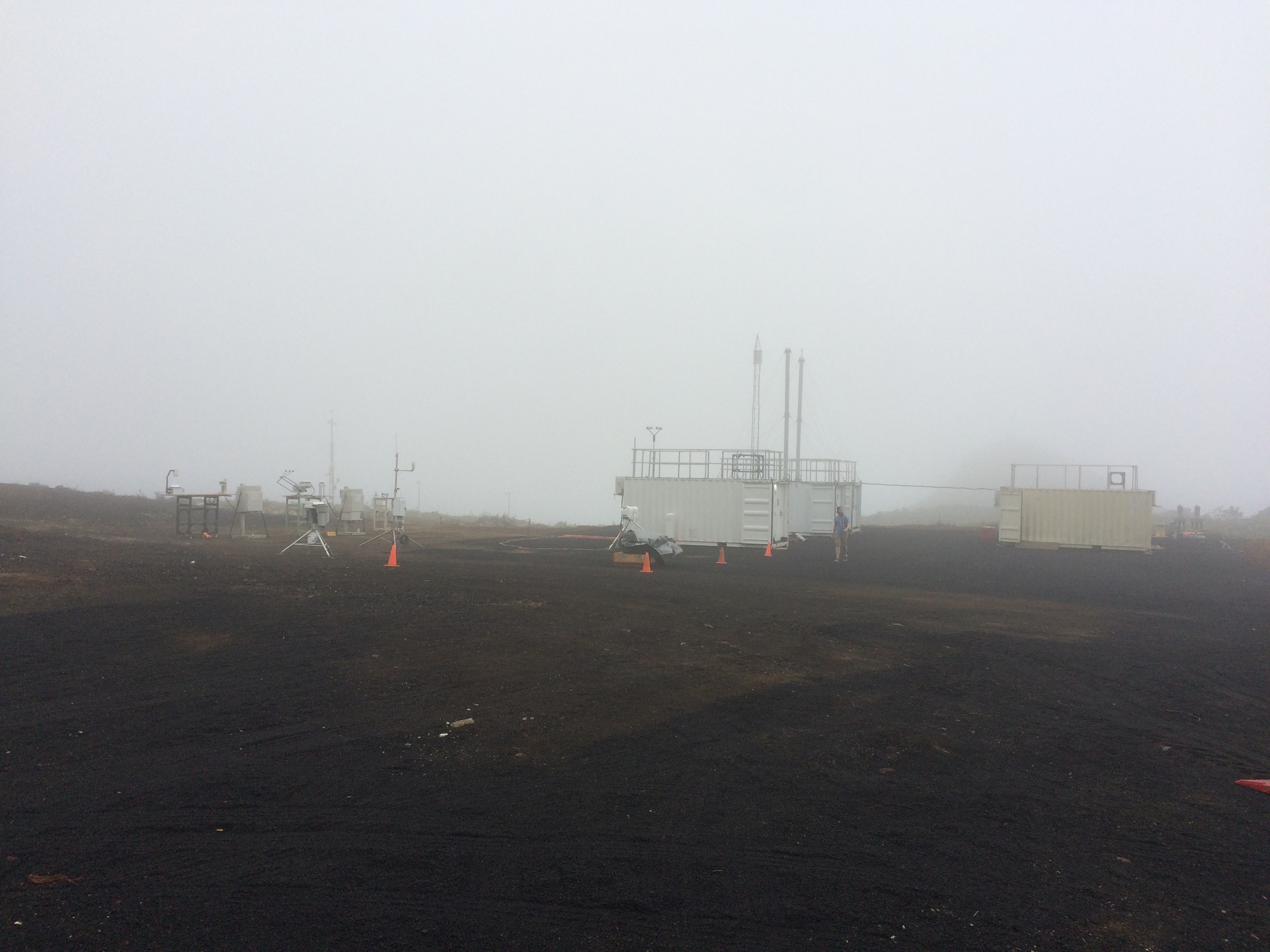
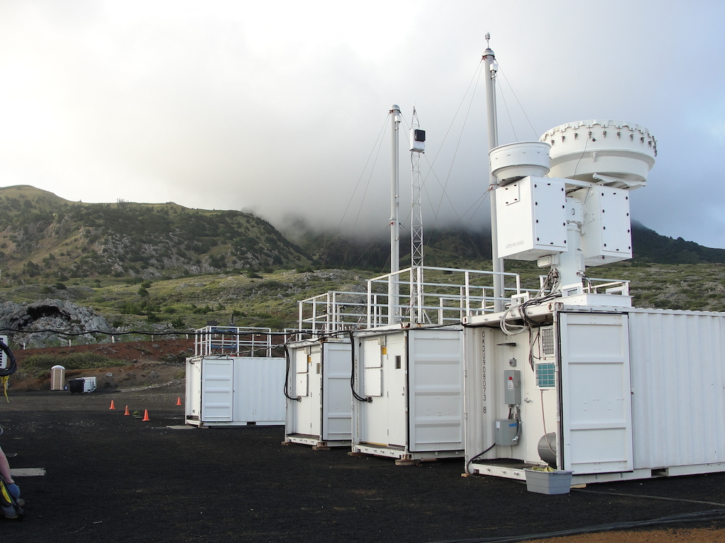
Technicians with ARM, a U.S. Department of Energy (DOE) Office of Science user facility, sited ground instruments and established regular radiosonde launches on Ascension Island. This isolated volcanic remnant is about 1,000 miles off the west coast of Africa.
Among other technical installations, the U.K.-governed island is home to a Royal Air Force base, which hosted atmospheric research aircraft peripheral to LASIC.
LASIC researchers took advantage of synergistic links with U.S., French, German, Swiss, and British field campaigns pursuing similar science goals. Part of that medley of coordinated efforts included a five-year NASA investigation called ObseRvations of Aerosols above CLouds and their intEractions (ORACLES).
Until LASIC and its sister campaigns, smoke-cloud interactions had mostly been inferred from satellite data.
Satellites provide wonderful large-scale contexts for atmospheric processes, but small-scale processes and their vertical structures are captured better with ground and airborne instruments.
The nature of LASIC and its overlapping companion studies fits well with Zuidema’s governing sense of science as a “global enterprise,” she says.
Enduring Issue, Durable Data
“Many important papers will still come out of LASIC. In part, that’s because of the integration of the LASIC data with that from complementary aircraft campaigns.”
Paquita Zuidema, lead scientist for the 2016–2017 LASIC campaign
Since LASIC closed in the fall of 2017, its data have proved durable and flexible. Now in review, a paper by atmospheric chemist Art Sedlacek at Brookhaven National Laboratory in New York weaves together data from LASIC, ORACLES, and a 2013 ARM field campaign on near-source wildfire aerosols called BBOP. That’s the acronym for the Biomass Burning Observation Project, an aircraft campaign in the U.S. Pacific Northwest and Lower Mississippi Valley. (Sedlacek was a co-lead of BBOP.)
“Many important papers will still come out of LASIC,” says Zuidema, who noted the impending Sedlacek study. “In part, that’s because of the integration of the LASIC data with that from complementary aircraft campaigns.”
An overview paper about ORACLES was published in February 2021. (Zuidema was a co-author, along with Sedlacek and other DOE-supported scientists.)
The paper, partly informed by data from a combined 450 flight research hours, reported on “significant new findings” that Zuidema says future papers will cover in greater detail. Some of this paper’s findings, meanwhile, relate to aerosol aging, aerosol indirect effects, cloud condensation nuclei, and the vertical structure of the physical and chemical properties of biomass burning aerosols.
In addition to ORACLES, Zuidema pointed to a British campaign called CLoud-Aerosol-Radiation Interaction and Forcing: Year 2017 (CLARIFY-2017). The CLARIFY-2017 team aimed to coordinate surface, airborne, and satellite measurements to retrieve the best possible data set on the radiative impacts of the sea-blanketing clouds in the southeast Atlantic and the aerosols that influence them.
Overview papers from both CLARIFY and ORACLES “discuss overlap with LASIC,” says Zuidema.
Modeling Work
Zuidema also pointed to ongoing modeling work that relies on data from LASIC and its related campaigns: a Lagrangian large-eddy simulation (LES) intercomparison study led by Michael Diamond, a postdoctoral visiting fellow at NOAA’s Chemical Sciences Laboratory in Boulder, Colorado.
Zuidema says it’s based on “trajectories that end at Ascension Island, begin at locations sampled by ORACLES aircraft, and sampled during transit by CLARIFY aircraft.”
She explains that “Lagrangian” refers to a conceptual simplification of the movement of an air mass, constructed so you can understand how its properties change without needing to consider influences from outside the air mass.
Diamond puts “Lagrangian” this way: “It’s a bit like the difference between standing on the ground and watching clouds go by, versus flying along with clouds as they move.”
In early July 2021, Diamond sent out the last section of what he calls his “ORACLES-CLARIFY-LASIC multi-campaign paper” for a final review by co-authors. The study uses one LES and one regional climate model, he says, “but is informed by observations from all three campaigns,” including LASIC.
Overlapping data also helped Diamond run a sensitivity test that compared different aerosol values from LASIC and ORACLES, where data came from farther east than Ascension and at a higher altitude.
Diamond has a second study underway that is more strongly tied to LASIC. Still in the development and test phase, this project is based on what he calls “composite conditions” from August 2017 instead of conditions from just one research flight.
Both of his projects, the one nearly done and the other still in development, “are heavily informed by LASIC data,” says Diamond.
Zuidema’s campaign was important in two main ways, he adds:
- model setup, which requires deciding on what aerosol properties to include
- model output evaluation―that is, determining how closely simulations match the reality of data from ground instruments and radiosondes.
Hard-to-See Smoke
Zuidema identified a number of LASIC-related papers already published “that I think are significant.” These papers also acknowledge DOE funding, including through Atmospheric System Research (ASR).
The granddaddy of those studies is a 2018 paper led by Zuidema that documented significant smoke within the boundary layer above Ascension from June through August 2017.
“This could not have been known without the LASIC measurements,” she says, mainly because “it is very difficult to discern boundary-layer smoke separately from the larger sea-salt particles (as calculated) from space). I personally think this is the most important finding to come out of LASIC to date.”
Zuidema also pointed to a 2021 paper she co-authored with NOAA’s Jianhao Zhang. It demonstrates that the fraction of low clouds is reduced when smoke is co-located with the clouds and is higher when smoke stays above the clouds.
“This means the seasonal cycle in the cloud radiative effect is amplified,” says Zuidema.
She adds a caveat, however―that “we don’t think the cloudiness changes are solely from smoke. The same meteorology that sends aerosol far offshore also affects the cloud and, conversely, can generate ultra-clean episodes.”
That caveat, she says, is illustrated in a 2020 study led by Sam Pennypacker of the University of Washington. (Diamond was a co-author, along with University of Washington cloud scientist Rob Wood.)
The researchers studied 41 days of ultra-clean (low aerosol count) conditions above Ascension during the biomass burning season from June to October. They found that during this crucial season, aerosol numbers from smoke intrusion could be both at their highest and lowest.
A Special Issue
LASIC is getting continued attention in another way.
The journals Atmospheric Chemistry and Physics and Atmospheric Measurement Techniques are jointly sponsoring a special issue on observation and modeling studies related to aerosol, cloud, and climate studies in the southeast Atlantic. Zuidema is one of eight editors.
It’s a “living” document―that is, one that accepts papers on a continuing basis. By the end of June 2021, the special issue had compiled 50 peer-reviewed papers stretching back to October 2017. The latest study, on atmospheric water vapor influences, appeared June 29, 2021. Zuidema, Diamond, and Wood were among the co-authors.
By the summer of 2022, the special issue will also include an overview paper devoted solely to the LASIC campaign.
The hope is to compile studies from five scientifically related international field deployments that unfolded between 2016 and 2018. The focus of each was complementary to the others―looking at how natural and human-caused aerosols (including from biomass burning) interact with clouds, climate, and atmospheric radiation in the South Atlantic Ocean and in southern Africa.
Overlapping Deployments
In addition to LASIC, CLARIFY, and ORACLES, the campaigns highlighted by the special issue include AErosol RadiatiOn and CLOuds in Southern Africa (AEROCLO-SA), funded by France; and the Namib Fog Life Cycle Analysis (NaFoLiCA), funded by Germany and Switzerland. The campaign deployments were variously based―on Ascension Island; in Namibia in southwestern Africa; and in São Tomé, the capital of São Tomé and Príncipe, an African island nation in the Atlantic’s Gulf of Guinea.
These overlapping deployments gathered data from ground-based instruments, airborne operations, satellite platforms, and even uncrewed aerial systems. (A paper now in review, but available as a preprint, demonstrates a quadcopter uncrewed aerial system as a platform for a miniaturized optical particle counter.)
All of these platforms represent a collective attempt to link aerosols to the weather and other atmospheric processes that influence aerosol emissions and transport, with every platform “eminently useful for the remote Ascension Island location,” says Zuidema.
The airborne and ground-based observations, as well as the related satellite measurements and climate modeling studies, address all aspects of aerosol-cloud-climate interactions. That includes the link of aerosol properties to meteorological fields and dynamical processes that influence aerosol emissions and transport.
The projects drove advancement in the remote-sensing techniques used to investigate aerosols during complex interactions involving ocean, clouds, and land.
This fruitful nexus of campaigns in the southeast Atlantic also advanced model-observational intercomparison studies. This is especially true of the studies intended to ultimately improve model depictions of the direct aerosol radiative effects of the combined aerosol-cloud system.
On that score, a special-issue paper in review and available online as a preprint shows how repeated observations and aerosol sampling over multiple years will continue to reveal and help correct model biases.
In a nutshell, that’s an argument for future overlapping cycles of fieldwork in the southeast Atlantic, as demonstrated by LASIC and its sister campaigns.
Also in the biomass burning series: Read about the BBOP campaign.
Coming up: an overview of instrument development, modeling methods, and laboratory experiments inspired by BBOP
Follow Us:


Keep up with the Atmospheric Observer
Updates on ARM news, events, and opportunities delivered to your inbox
ARM User Profile
ARM welcomes users from all institutions and nations. A free ARM user account is needed to access ARM data.


