

The COMBLE Campaign: A Review
Published: 28 June 2022
A new paper reports on transformational data from an investigation of marine boundary-layer clouds in arctic cold-air outbreaks
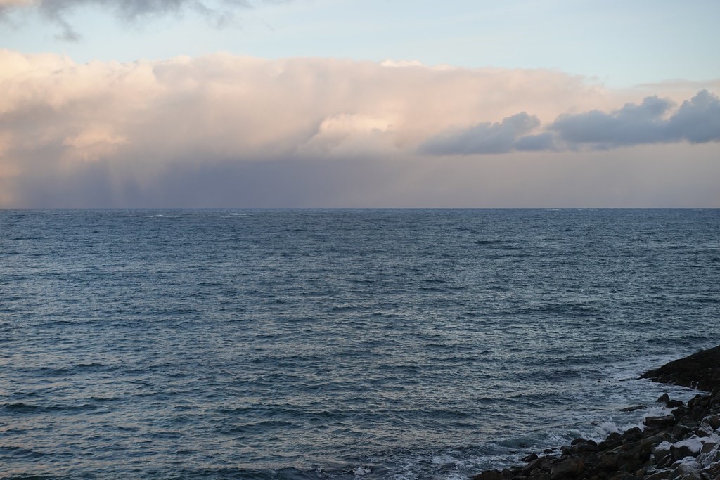
For years, satellites have captured beautiful images of cold-air outbreaks (CAOs). These cloud regimes represent one of the world’s most intense transformations of atmospheric air masses.
Ubiquitous over oceans in the Earth’s chilly high latitudes, CAOs signify the thermal instability that occurs when cold-air masses from frozen surfaces hit expanses of adjoining, relatively warm water.
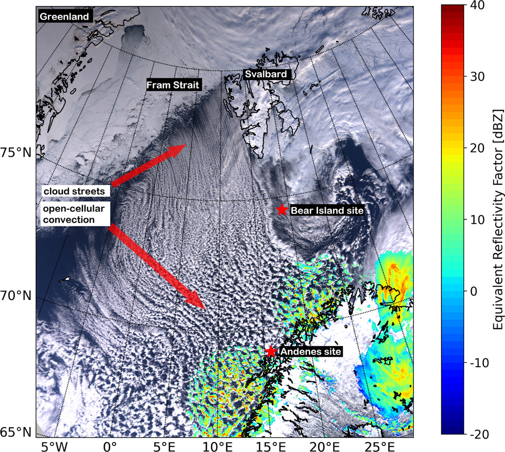
One region of such dynamic exchange is the Arctic Ocean ice edge abutting the Norwegian Sea, which is kept ice-free year-round by the Gulf Stream.
For air masses leaving the Arctic sea ice, it’s about 1,000 kilometers (620 miles) south over open water before they make landfall in northern Scandinavia.
This ice-to-water transition zone was the backdrop for a 2019–2020 field campaign, the Cold-Air Outbreaks in the Marine Boundary Layer Experiment (COMBLE). A review paper on COMBLE, supported by the U.S. Department of Energy (DOE), is in the May 2022 issue of the Bulletin of the American Meteorological Society.
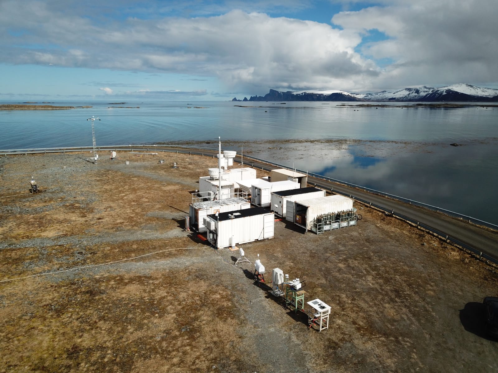
Led by the University of Wyoming’s Bart Geerts, COMBLE took place at two sites in northern Norway. The campaign’s primary instruments came from DOE’s Atmospheric Radiation Measurement (ARM) user facility.
DOE’s Atmospheric System Research (ASR) program funded the research in the new paper, also led by Geerts.
COMBLE was part of a larger ASR study of mixed-phase clouds in the polar marine boundary layer. Mixed-phase clouds are those containing both liquid and ice.
One common feature of marine CAOs is that they begin as linear, yarn-like twists of shallow cumulus clouds over the marine boundary layer. Their distinctive “cloud streets” widen and split before finally dispersing into large cloud cells.
Scientists think that CAOs might greatly influence energy and water cycles, precipitation rates, and aerosol distributions. They might even play a role in how climate change is amplified in the Arctic.
CAO properties are little known, however. That makes such cloud regimes challenging to represent in numerical models of regional weather and global climate.
Rich New Data
Two years after COMBLE wrapped up, researchers are using its unprecedented six-month observational data set to help address such modeling challenges.
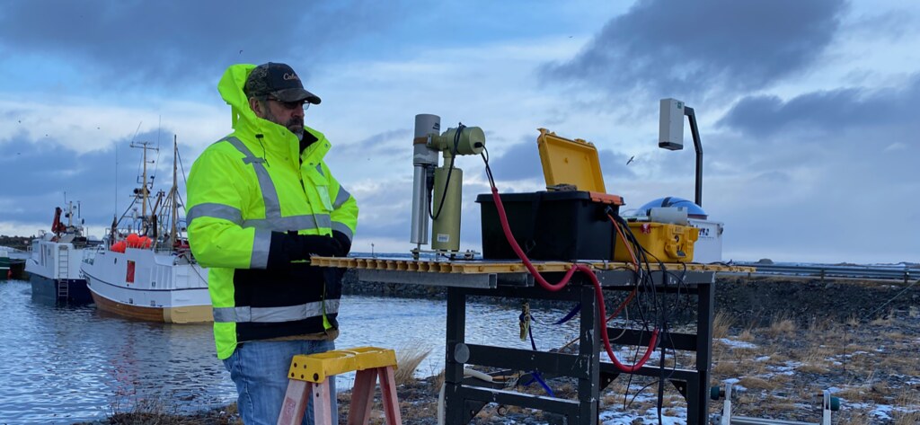
The main observation site was an ARM Mobile Facility near Andenes, Norway, a fishing port on the island of Andøya. This site is 1,200 kilometers (745 miles) from the Arctic’s ice edge. Instruments recorded 34 days of CAO conditions, or about 19% of the campaign’s duration.
A secondary instrument site was on Bear Island, about 500 kilometers (310 miles) from the Arctic’s ice edge. Instruments there captured 38 days of CAO conditions, or about 21% of COMBLE.
Campaign data include measurements of wind, temperature, atmospheric structure, and cloud properties.
In a rarity for high-latitude ocean studies, there are also aerosol data, with a focus on ice-nucleating particles, which are linked to cloud formation. Scientists are comparing the results with similar ARM samples from near Antarctica.
So far, say the authors, ice-nucleating particles typically are “an order of magnitude” more plentiful during CAO conditions at COMBLE’s coastal site near Andenes than they are in the Southern Ocean’s marine boundary layer.
COMBLE aerosol data are especially relevant because the campaign was conducted at the same time as the Multidisciplinary Drifting Observatory for the Study of Arctic Climate (MOSAiC) expedition in the central Arctic.
MOSAiC involved an icebreaker drifting in ice some 2,000 kilometers (1,240 miles) north. Occasionally, air masses drifted from around the icebreaker down to COMBLE’s main observation site. That provided a unique pair of detailed upstream and downstream profiling and aerosol measurements.
Case Studies and a Model
COMBLE yielded three particularly intense and long-lived CAO events, which included convective storms. All three case studies linked Andenes with conditions at the Arctic’s ice edge.
Geerts and his co-authors conducted a “limited-area model” (LAM) simulation based on a case study of a CAO event from March 27 to 30, 2020. The team used a Weather Research and Forecasting (WRF) framework with outer and inner domains of 3 and 1 kilometers (1.9 and 0.6 miles), respectively.
The model’s vertical grid cell spacing gradually stepped up from around 50 meters (160 feet) at the ice edge to 5 kilometers (3.1 miles) at Andenes.
The authors say that coupling observations with model simulation is more powerful than just one approach alone―in this case for gaining insights into the evolution of CAO physical processes.
Models like this also seem good at simulating the life cycle of the cell-like convective clouds that trail like a mop at the end of a CAO’s streets.
The WRF-LAM simulations serve as surrogate data sets, say the authors. Modelers can use them to develop and test simulations of CAO activity in climate models.
The Challenge of Sheer Distance
As the paper’s authors point out, modeling challenges remain that are unique to COMBLE.
One is the distance from the Arctic’s ice edge to Andenes.
To capture the vertical energy transfer and cloud structure depicted in satellite imagery, models must be able to resolve fine-scale details of atmospheric motion. That means they need to be divided into very small grids—about 10 meters (33 feet) to a side. Doing that over a domain as large as 1,000 kilometers (620 miles) would require 100,000 grid points in one direction alone.
A grid resolution that small also requires a very short representation of time, measured in seconds. Yet in modeling CAO events, these time steps must be represented over the whole duration of the trip between the ice edge and the Scandinavian coast, which takes about a day. Computationally, this is not yet feasible.
However, several modeling groups have tackled this challenge. They design and run a small grid box that is still large enough to capture the upscale growth of convective cells. It “moves” with the wind in what is called a quasi-Lagrangian simulation of atmospheric motion.
COMBLE data are being used to evaluate these high-resolution simulations. In turn, these simulations help researchers evaluate climate models, whose resolutions are too coarse to capture clouds in CAOs.
The Challenge of Data
Another challenge unique to COMBLE is that the closer you get to the ice edge, the harder measurements are to acquire. That means case studies are hard to formulate.
However, future COMBLE simulations may benefit from measurements that appear to link CAO case studies near Andenes with air sampled during two nearly simultaneous field campaigns farther north.
One was MOSAiC, which included shipboard and ice-camp instruments. ARM provided more than 60 instruments to record atmospheric conditions during the expedition.
The other was the Ny-Ålesund Aerosol Cloud Experiment (NASCENT), centered on Svalbard, a Norwegian archipelago in the Arctic Ocean.
Modeling Hopes Ahead
Geerts says that COMBLE data can be a modeling testbed for investigating mixed-phase clouds and how they organize on regional scales.
Meanwhile, he has another ASR project underway―on numerical models of the multiscale interactions that drive convective circulations as CAOs move over open water. The work is part of a broader investigation of the global climate system that Geerts and other scientists are pursuing. They ask: How is the amplified response to climate change in high latitudes linked to cloud and other processes in the middle latitudes?
In all, says Geerts, “the exciting thing about the COMBLE data is that they are being used not just to learn about CAO clouds.”
Follow Us:


Keep up with the Atmospheric Observer
Updates on ARM news, events, and opportunities delivered to your inbox
ARM User Profile
ARM welcomes users from all institutions and nations. A free ARM user account is needed to access ARM data.


