

3-Dimensional Cloud Positions Produced for CACTI Campaign
Published: 21 October 2021
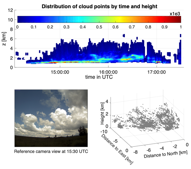
A data set providing three-dimensional (3D) positions of clouds captured by stereo cameras is now available for the 2018–2019 Cloud, Aerosol, and Complex Terrain Interactions (CACTI) field campaign in Argentina.
The Point Cloud of Cloud Points (PCCP) data enable 3D representations related to macrophysical cloud features such as the cloud-base and cloud-top heights, structure of cloud boundaries, and cloud-level horizontal velocities.
The data set is composed of 3D coordinates describing the position of cloud features and images from which these coordinates are reconstructed. During CACTI, two ARM cloud digital cameras (located in Córdoba at 32.1274oS, 64.7139oW and 32.1185oS, 64.7237oW) captured images in the daytime at 20-second intervals. The 3D positions were detected with respect to the ARM Mobile Facility base location at 32.1264oS, 64.7284oW and 1,141 meters above sea level.
Scientists can use the PCCP data from CACTI now. The data are available in a netCDF format.
More information can be found on the PCCP web page. For questions or to report data problems, please contact Rusen Öktem or David Romps.
Access the data set in the ARM Data Center. (Go here to create an account to download the data.)
Data can be referenced as doi:10.5439/1804892.
Follow Us:


Keep up with the Atmospheric Observer
Updates on ARM news, events, and opportunities delivered to your inbox
ARM User Profile
ARM welcomes users from all institutions and nations. A free ARM user account is needed to access ARM data.


