

Comprehensive trajectory data sets supplementing ARM deployments
Submitter
Silber, Israel — Pacific Northwest National Laboratory
Area of Research
Cloud-Aerosol-Precipitation Interactions
Journal Reference
Silber I, J Comstock, M Kieburtz, and L Russell. 2025. "ARMTRAJ: a set of multipurpose trajectory datasets augmenting the Atmospheric Radiation Measurement (ARM) user facility measurements." Earth System Science Data, 17(1), 10.5194/essd-17-29-2025.
Science
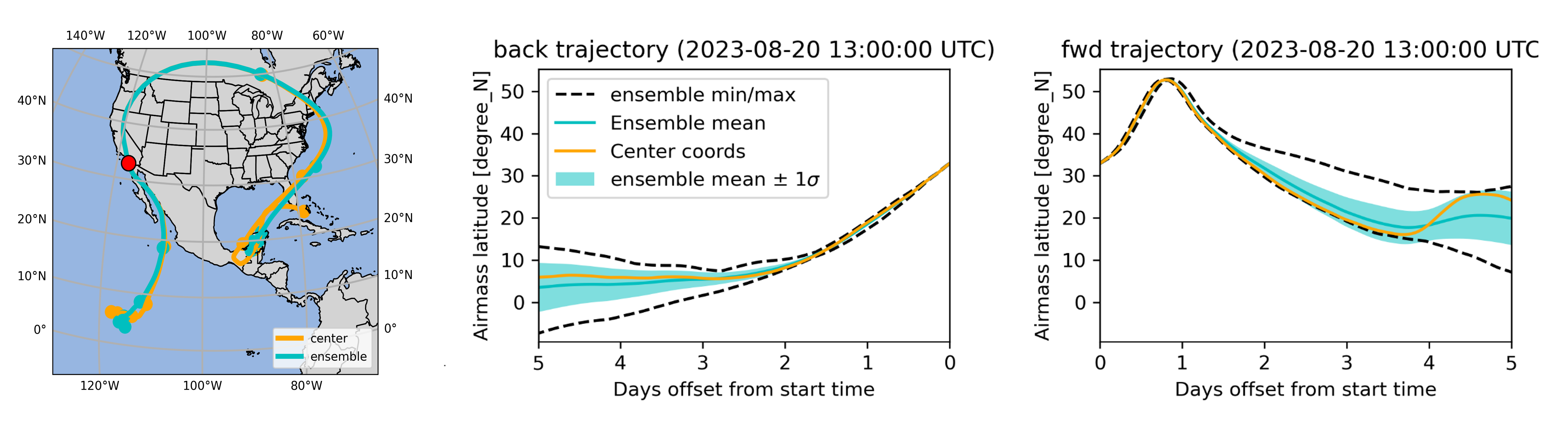
5-day back and forward trajectories of a cloudy airmass detected over the EPCAPE deployment on August 20, 2023 using the 13 UTC sounding (processed through ARMTRAJ-CLD). (Left) Trajectory maps; the larger markers denote 24-hour increments from initialization time. (Middle and right) Temporal evolution of airmass latitude along back and forward trajectories initialized at the EPCAPE deployment coordinates, and the ensemble mean, minimum, maximum, and the mean ±1 standard deviation (σ) (see legend). Image from journal.
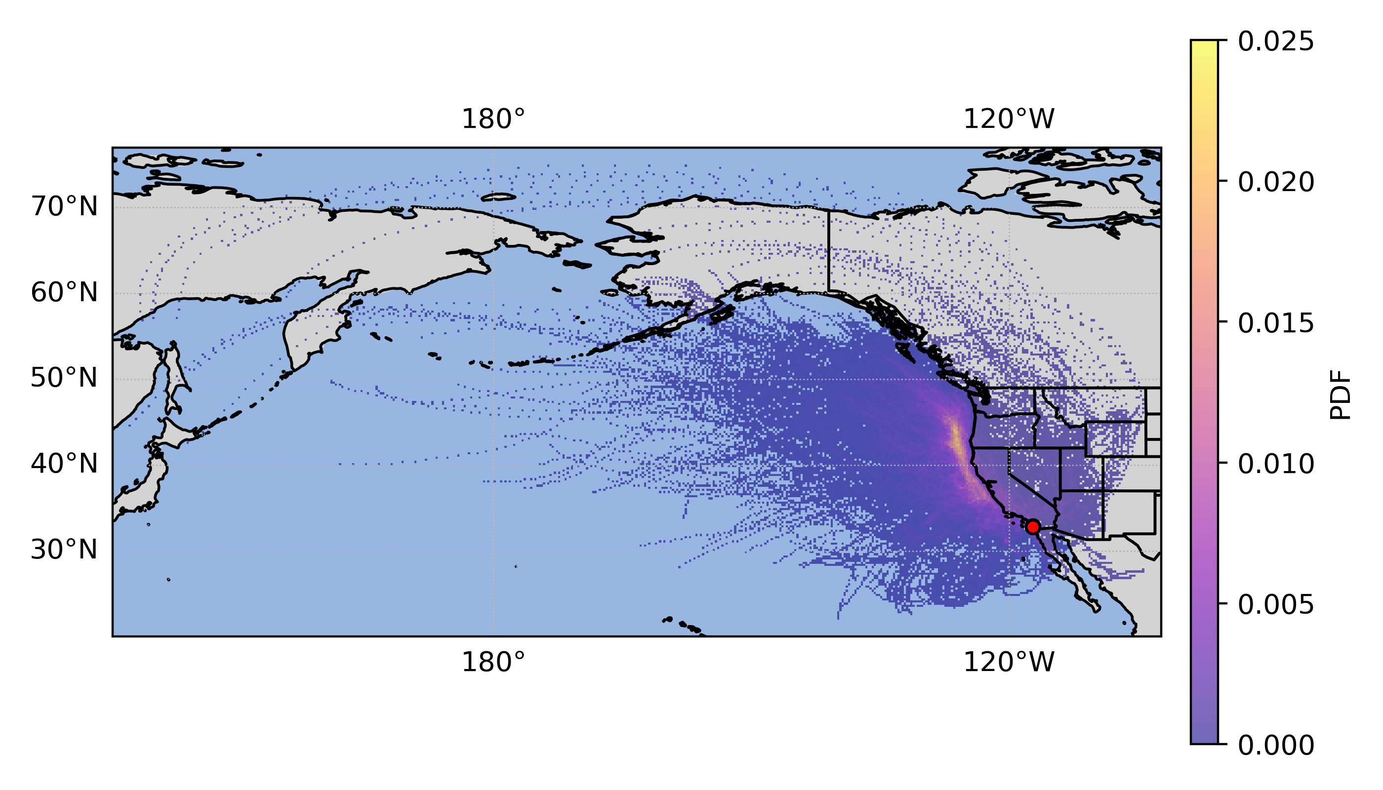
Probability density function of 48-96-hour back-trajectory samples using the surface trajectory data set (ARMTRAJ-SFC; initialized in 3-hour increments) for the full EPCAPE deployment (bin dimensions of 0.25°×0.25°). Image from journal.
ARMTRAJ is a set of multi-purpose trajectory data sets that augments cloud, aerosol, and boundary-layer studies using U.S. Department of Energy Atmospheric Radiation Measurement (ARM) user facility data.
Impact
ARMTRAJ data include ensemble run statistics that enhance consistency and serve as uncertainty metrics for airmass coordinates and state variables. ARMTRAJ will soon become an operational near-real-time product that will accompany past, ongoing, and future ARM ground-based and airborne deployments, thereby promoting the achievement of scientific research goals relying on ARM observations.
Summary
Ground-based instruments offer unique capabilities such as detailed atmospheric thermodynamic, cloud, and aerosol profiling at a high temporal sampling rate. The ARM user facility provides comprehensive data sets from key locations around the globe, facilitating long-term characterization and process-level understanding of clouds, aerosol, and aerosol-cloud interactions. However, as with other ground-based data sets, these measurements' fixed (Eulerian) nature often introduces a knowledge gap in relating them to airmass hysteresis. Our article describes ARMTRAJ, which helps close this gap in ARM deployments. Each data set targets different aspects of atmospheric research; for example, the cloud deck trajectory data set includes back trajectories for cloudy and free-tropospheric air right above cloud top, supporting the study of cloud-top entrainment effects. Trajectories are initialized using ARM data sets and calculated using the HYSPLIT model informed by ERA5 reanalysis at 0.25° (~31 km) spatial resolution. The trajectory data sets include information about airmass coordinates and state variables extracted from ERA5 before and after the ARM site overpass. Following the description of data set processing and structure, the article demonstrates applications of ARMTRAJ using observations collected during ARM's Eastern Pacific Cloud Aerosol Precipitation Experiment (EPCAPE) field deployment.
Follow Us:


Keep up with the Atmospheric Observer
Updates on ARM news, events, and opportunities delivered to your inbox
ARM User Profile
ARM welcomes users from all institutions and nations. A free ARM user account is needed to access ARM data.


