

Overview
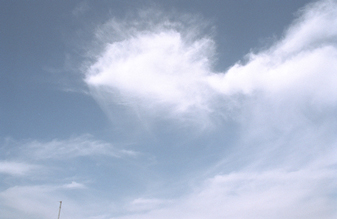
often appear over the SGP site from fall to spring.
Cirrus clouds exert significant controls on the Earth’s radiation budget, both reflecting solar radiation (the albedo effect) and reducing radiative heat loss through the atmosphere (the greenhouse effect). Quantifying cirrus albedo and greenhouse effects is an important factor in building accurate earth system models.
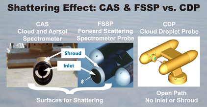
High-altitude cirrus clouds are made up primarily of ice crystals in various sizes, shapes, and densities. Discrepancies in how different instruments measure these properties contribute a large degree of uncertainty in scientific knowledge of these clouds. Some of these discrepancies may be due to the shattering of larger ice crystals on aircraft and probe surfaces during airborne sampling efforts.
The scientific objectives of the SPARTICUS field campaign included rectifying the archived discrepancies and improving the methodology for cirrus data acquisition. This provides scientists a better understanding of existing and future cirrus data sets, leading to an overall improvement in earth system model accuracy.
Between January and June 2010, the SPARTICUS field campaign collected 150 hours of concurrent data from cirrus clouds over the ARM Southern Great Plains site using a broad array of both ground-based and aircraft-mounted instruments. To obtain the airborne data, the ARM Aerial Facility coordinated flights by the SPEC Learjet 25, provided and flown by the Stratton Park Engineering Company, Inc. These corollary data sets will provide a solid foundation for the rigorous evaluation needed to rectify the existing discrepancies in cirrus data.
Follow Us:


Keep up with the Atmospheric Observer
Updates on ARM news, events, and opportunities delivered to your inbox
ARM User Profile
ARM welcomes users from all institutions and nations. A free ARM user account is needed to access ARM data.


