

Overview
The Carbonaceous Aerosols and Radiative Effects Study (CARES) took place in the central California region, to the northeast of Sacramento, from June 2-28, 2010. This field campaign was designed to increase scientific knowledge about evolution of black carbon and secondary organic aerosols from both urban/manmade and biogenic sources. New knowledge gained from subsequent detailed process-level analyses can then be integrated into regional and global aerosol models used for simulating the direct and indirect radiative effects on climate.
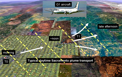
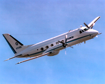
Comprehensive and complementary data sets of trace gases and aerosols were taken from the daily evolving Sacramento urban plume under relatively well-defined and regular meteorological conditions using multiple suites of ground-based and airborne instruments. To obtain the airborne data, the ARM Aerial Facility conducted regular flights through and around the Sacramento plume by a Gulfstream (G-1) research aircraft. The G-1’s flights coordinated with ground-based operations at two sites: one within the Sacramento urban source area and the other in the downwind area about 70 km to the northeast in a small town called Cool.
An important advantage in selecting the Sacramento area as the site for the CARES field campaign was the unique opportunity for collaboration with investigators from the California Air Resources Board, (CARB), the National Oceanic and Atmospheric Administration (NOAA), and the California Energy Commission (CEC), who planned a major field study, CALNEX 2010, in the Central Valley and Southern California regions in summer 2010.
Follow Us:


Keep up with the Atmospheric Observer
Updates on ARM news, events, and opportunities delivered to your inbox
ARM User Profile
ARM welcomes users from all institutions and nations. A free ARM user account is needed to access ARM data.


