

Jay Mace: Scientist of Clouds, Painter of Landscapes
Published: 25 April 2024
For one Utah researcher, a childhood admiration for nature, by way of the U.S. Navy, evolved into a career studying Earth’s atmosphere
During his boyhood in northeastern Ohio, Gerald “Jay” Mace had two dreams.
One was to have a career that brought him close to nature. In those days, long hikes in the woods always included stopping by his favorite tree. It was a totem of the peace and fascination he found in the outside world and the knowledge it offered.
Today, Mace is an atmospheric scientist and professor at the University of Utah. He’s an avid hiker and camper. He bikes to work. He and his wife own a cabin in Idaho. He even paints, in oils, the nature he still loves. Always landscapes, always in one take, and always while seated outdoors. It’s a style of painting called en plein air, a French expression meaning “in the open air.”
His other dream was to get far enough away from Southington, Ohio, that he would never work in an auto plant. His father did assembly line work. Many cousins and uncles too. For him? Nope, never, and no way.
Mace calls his parents “progressive thinkers,” imbued with the sense of optimism the working class had in those days. “I picked that up.”
Optimism, the woods, and an affinity for science “were a big part of forming the way I looked at the world,” he says.
But optimism is not the same as having enough money for college. Halfway through his senior year of high school, Mace decided to join the U.S. Navy.
“My plans had not changed,” he says. “I was going to escape one way or the other. My ticket out was through the military.”
After basic training, only one Navy specialty resonated with Mace’s inclination toward the natural sciences: meteorology.
“I’m an atmospheric scientist largely because I didn’t want to live in a submarine or in the bottom of some ship. I wanted to be able to see the sky.”
Jay Mace
“They needed weather people,” he says, though he turned down an offer to be a nuclear engineer instead. “I’m an atmospheric scientist largely because I didn’t want to live in a submarine or in the bottom of some ship. I wanted to be able to see the sky.”
A CAPE-k Mission
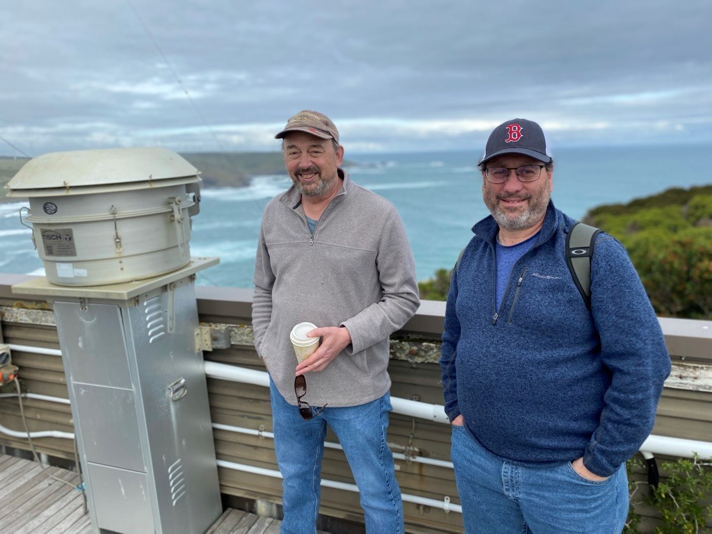
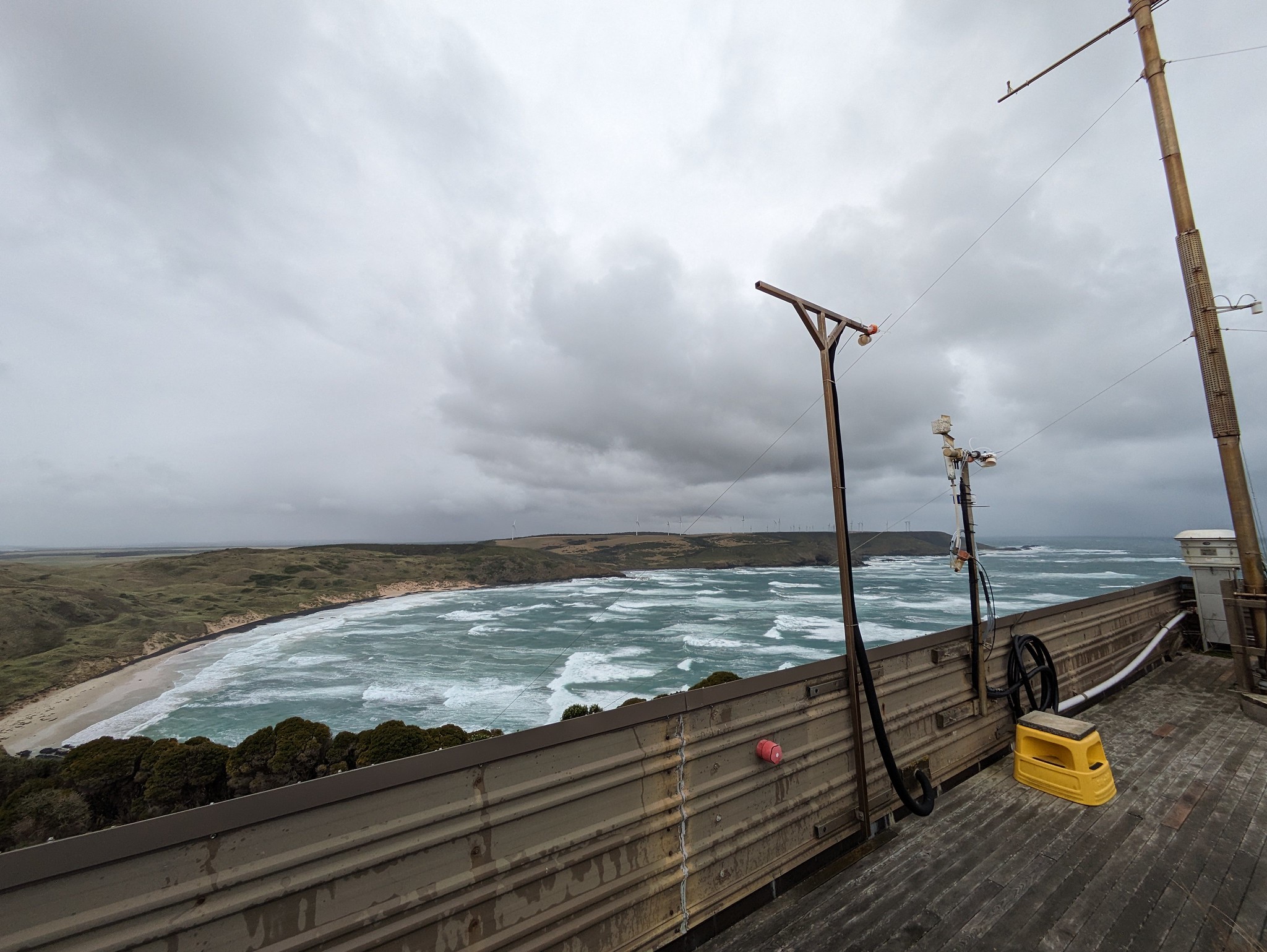
In late April 2024, Mace traveled to kennaook/Cape Grim, a wind-whipped coastal strip in northwestern Tasmania. The air blowing in from the Southern Ocean there is so pure that climate modelers use it as a proxy for Earth’s pre-industrial atmosphere.
Mace is co-leading the Cloud And Precipitation Experiment at kennaook (CAPE-k), a field campaign from April 2024 to September 2025.
He and co-principal investigator Roger Marchand, a research professor at the University of Washington, oversee teams collecting and analyzing measurements of some little-known atmospheric conditions and processes over the Southern Ocean.
Despite its critical importance to global climate, the Southern Ocean has historically been under-observed, largely because it is so remote and stormy.
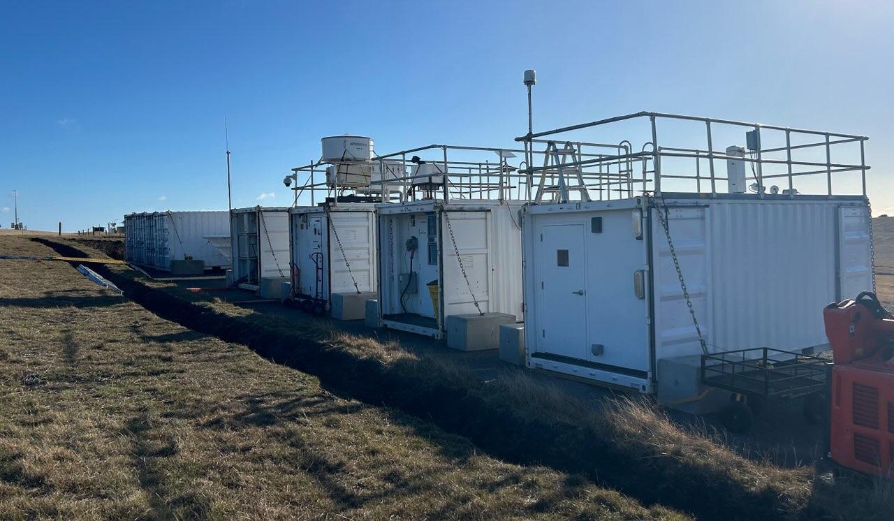
CAPE-k is supported by the U.S. Department of Energy (DOE) with help from the Australian Bureau of Meteorology (BOM) and the Commonwealth Scientific and Industrial Research Organisation (CSIRO), Australia’s government agency for scientific research. CSIRO and BOM jointly manage the Kennaook/Cape Grim Baseline Air Pollution Station, where CAPE-k is sited.
The word “kennaook”—the aboriginal name for Cape Grim—is “a very important thing to remember,” says Mace. “We stand on their ground.”
The main instruments for CAPE-k are part of a multi-container mobile observatory operated by DOE’s Atmospheric Radiation Measurement (ARM) user facility.
ARM, whose data go back more than 30 years, maintains three fixed and three mobile observatories in climate-critical regions of the world. Mace took part in some of ARM’s earliest campaigns as a graduate student in the early 1990s.
To round out his sense of CAPE-k’s potential for rich data, Mace has spent time aboard the Australian research vessel Investigator, operated by CSIRO to get complementary land-sea views of conditions in the Southern Ocean. The Investigator will be part of a complementary campaign during CAPE-k.
A Navy Start
“Once I realized I could get paid to go to graduate school (through the Navy), I thought, ‘This might be what I am going to do.’ ”
Mace
Mace’s tour in the Navy added up to seven years of active duty (none of them on a ship) and seven years in the reserves, most of them as a forecaster with the Pennsylvania Air National Guard in support of an infantry division, and later an armored division.
It was the early 1990s by then, and the Gulf War was revving up. Mace volunteered to go but was not needed.
In all, including two years at a naval air station on Adak Island in the Aleutians, Mace calls himself “a veteran of the Cold War.”
The military was his ticket out of Ohio. It was also Mace’s ticket into college. In 1987, fresh off active duty, he entered Ohio University (B.S., meteorology, 1989). Credits earned in the Navy shortened his summa cum laude undergraduate work by two years. He was married with a family (his son turns 40 in 2024), and he admits it was a financial struggle.
“Once I realized I could get paid to go to graduate school (through the Navy),” says Mace, “I thought, ‘This might be what I am going to do.’ ”
There was another reason to pursue graduate studies, he says. “I didn’t want to stop (schooling), and I didn’t want to be a forecaster. I wasn’t very good at it.”
Introduction to ARM
At Penn State (PhD, atmospheric physics, 1994), Mace joined the doctoral program after a year of graduate coursework. He studied with Bruce Albrecht, now a University of Miami professor emeritus, and with Thomas P. “Tom” Ackerman, now a University of Washington professor emeritus.
Under Ackerman’s direction, Mace wrote his dissertation on the vertical motions that produce cirrus clouds. These wispy, icy, high-altitude clouds significantly influence the Earth’s energy budget.
Albrecht and Ackerman were heavy players and planners in the early days of ARM. Ackerman took Mace along to install the first cloud radar at ARM’s Southern Great Plains (SGP) atmospheric observatory in Oklahoma.
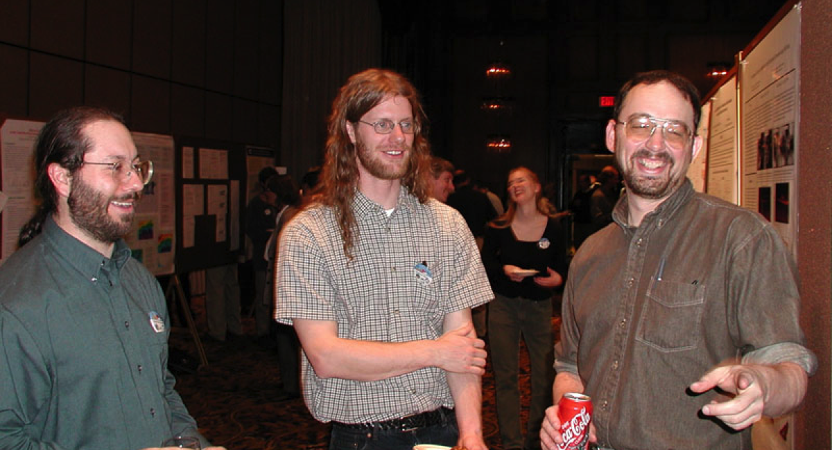
At the same time, Penn State swarmed with other future key figures in the then-nascent world of ARM. Jim Mather, ARM’s current director, was Mace’s officemate. When Mace left for Utah, Marchand—his CAPE-k partner—took his place as a postdoctoral researcher at Penn State.
Mace also shared an office with atmospheric modeler Andrew Vogelmann, who recently retired from Brookhaven National Laboratory in New York. Rutgers University cloud and climate researcher Mark Miller was Albrecht’s student then. Longtime ARM scientist Chuck Long (now deceased) was Ackerman’s student. Current Penn State professor Eugene Clothiaux and professor emeritus Johannes Verlinde were also there and, in the years that followed, played significant roles in ARM.
Mace’s first campaign was an early one with ARM—FIRE II Cirrus in 1991 in Coffeyville, Kansas. It was one of four intensive field campaigns collectively known as the First ISCCP Regional Experiment (FIRE), which began in 1984. The FIRE series was the NASA-run U.S. contribution to the International Satellite Cloud Climatology Project (ISCCP), intended to provide the first systematic picture of global cloud behavior.
ARM took part to gain operational experience for its own future field deployments. ARM did not officially begin collecting data until 1992 at the SGP.
“All the people who started the ARM program were involved in this,” says Mace of FIRE II. “We were there at the ground floor.”
Throughout the 1990s, Mace participated in many ARM campaigns, work that “taught us all how to do this kind of thing.”
Early Campaign Interludes
In December 1996, Mace took a tenure-track position at the University of Utah, where he has been now for close to 30 years.
Fieldwork was part of the job, and Mace kept close to ARM. In fall 1997, he led a 20-day intensive operational period at the SGP. It was a coordinated mix of six small research efforts on water vapor, clouds, aerosols, shortwave radiation, a single-column model, and what ARM now refers to as an uncrewed aerial system.
Spring cloud intensive operational periods followed in 1998 and 2000 at the SGP, with Mace leading both. The 2000 study deployed remote sensors with radars and lidars to record the first three-dimensional cloud field derived from observational data.
Over the next decade, Mace participated in campaigns in Florida, Texas, Australia, Georgia (the U.S. state), and Costa Rica, though ARM did not conduct all of them.
Mace returned to the SGP in the first half of 2010 to lead the Small Particles in Cirrus (SPARTICUS) campaign. He tapped remote sensing data going back to the early 1990s to improve how global climate models represented cirrus clouds.
A STORMVEX Adventure
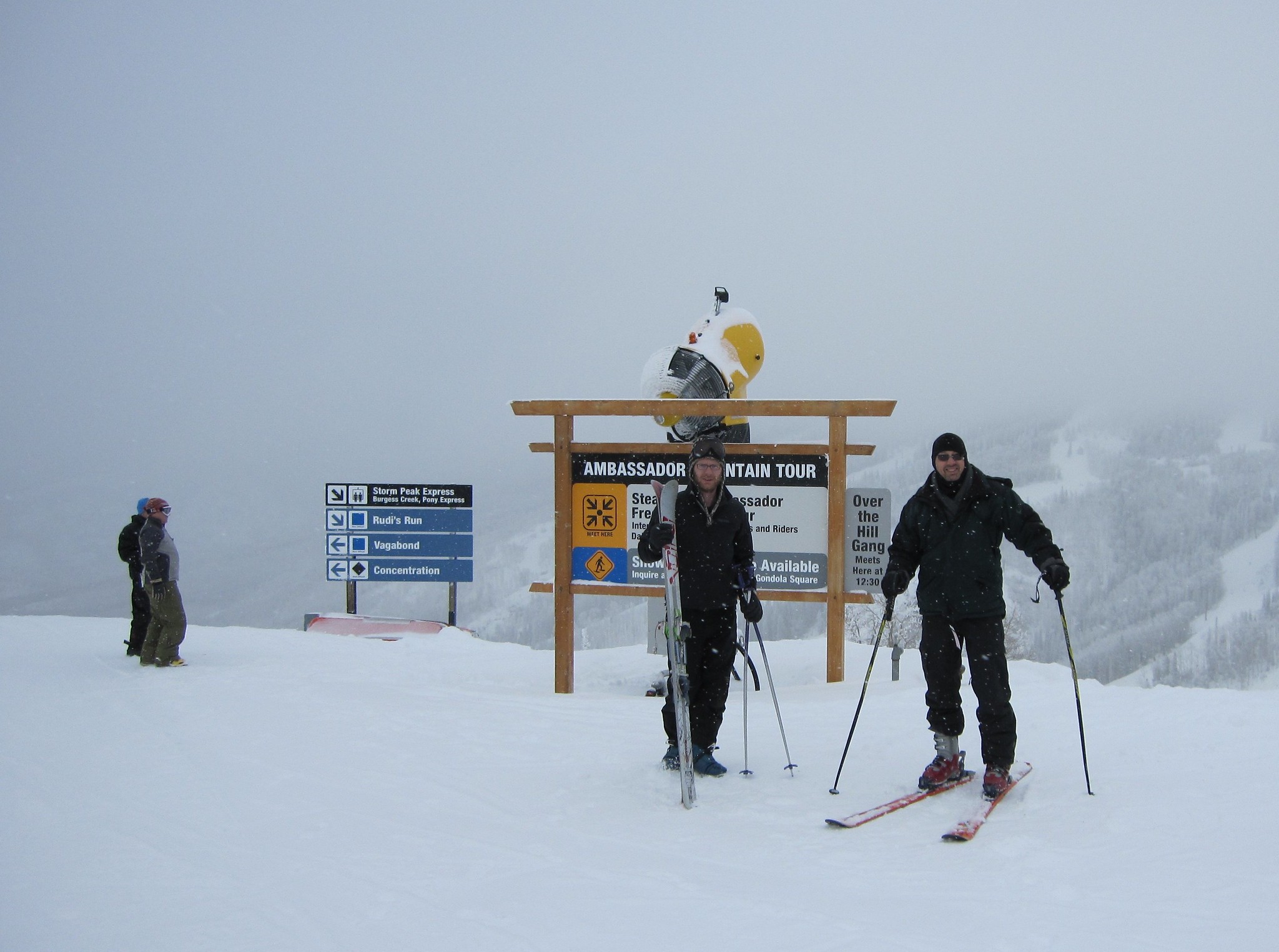
During the winter of 2010–2011, Mace led ARM’s Storm Peak Lab Cloud Property Validation Experiment (STORMVEX) in Steamboat Springs, Colorado.
The STORMVEX plan was to use four observation sites to capture a comprehensive picture of cloud and aerosol properties from below and within clouds that snowed.
“I was just looking at the data last night and thinking, ‘God, man, there’s just beautiful, beautiful data,’ ” he says.
However, STORMVEX deployed only one radar frequency, W-band, which is not the best one for studying snow.
“You need at least two frequencies,” he says, “and ideally three.”
In the winter of 2024–2025, Mace will be part of the Snow Sensitivity to Clouds in a Mountain Environment (S2nowClime) campaign, funded by the National Science Foundation. The campaign could pass as a remake of STORMVEX—this time with three radar frequencies. In April 2024, Mace and others scouted candidate instrument sites in Colorado.
One upside, Mace says, is that the new campaign “might teach us how to analyze the STORMVEX data.”
‘That Tree in the Woods’
For the last decade, Mace has focused his research on the lower troposphere, where low-level clouds reside and where “the big questions in climate science are,” he says.
Mace describes such clouds as “a machine that moves water along a conveyor belt that goes from aerosols and cloud condensation nuclei to precipitation.”
At the same time, those clouds reflect sunlight.
In all, this aerosol-cloud-precipitation-radiation conveyor belt “is the key to how sensitive Earth’s climate is to increased carbon dioxide,” he says, with the Southern Ocean as a dramatic example “because it’s such a huge ocean. The same thing is happening in the northern oceans, but less of it.”
Mace, Marchand, and others first conceived of CAPE-k in 2021 as a capstone Southern Ocean investigation.
“I had to go down there,” says Mace of this remote tip of Tasmanian coastline, marked by intervals of pristine air. “It’s the last remnant of pre-industrial Earth, the last great wilderness, the natural world before human beings.”
Over the next year and a half, CAPE-k is poised to collect data on the seasonal cycle of Southern Ocean clouds and precipitation. From these data, global climate models will gain precision.
The science prospects for CAPE-k are solid, says Mace, but it’s also an experience “that takes me all the way back to sitting in my tree in the woods. That’s as pure as you can get. There’s a direct line between the Southern Ocean and that tree in the woods.”
Art and Science
For most of his life, Mace has had a passion for hiking. He has struck out into the wilderness through Grand Teton, Yellowstone, and other national parks.
“That’s why I came West, ultimately,” he says, “and that’s why I stayed out here.”
The science Mace is doing in the Southern Ocean fits together with being a landscape painter, complete with representation by a gallery in Idaho. It’s an avocation that took the place of photography close to 20 years ago.
“As much as my science is part of me, doing art is part of me,” says Mace.
“You go out in nature and paint what’s in front of you. You stand and study it,” he says of the en plein air approach, the same way science demands observation. “People say there’s art and there’s science. I don’t see a boundary.”
The idea of art and science as complementary practices takes Mace back to his foundational experiences with nature in the woods of northeastern Ohio.
“As a teenager, I made a promise to myself to stay true to that kind of thing,” he says. “My 14-year-old self would recognize my 62-year-old self.”
Follow Us:


Keep up with the Atmospheric Observer
Updates on ARM news, events, and opportunities delivered to your inbox
ARM User Profile
ARM welcomes users from all institutions and nations. A free ARM user account is needed to access ARM data.


