

Looking Forward to EPCAPE
Published: 6 February 2023
A yearlong ARM field campaign launches in February 2023 to gather insights on the marine clouds that shade and cool the Earth
Starting on February 15, 2023, a new field campaign―slated to last a full year―will provide unprecedented four-season data on the properties of coastal marine clouds, including their radiative effects and the role man-made particles play.
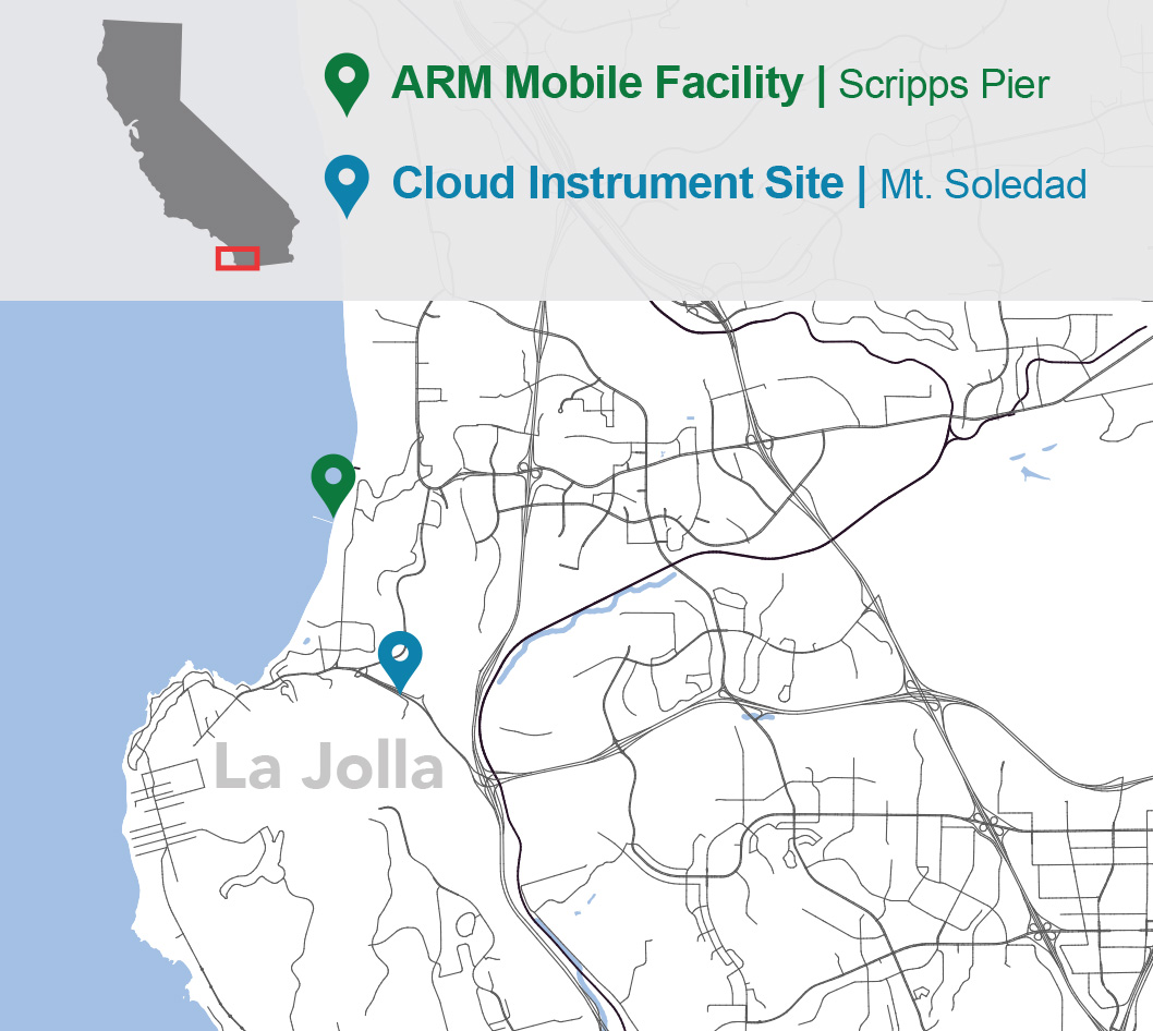
Scientists behind the Eastern Pacific Cloud Aerosol Precipitation Experiment (EPCAPE) have already deployed instruments at two sites in La Jolla, California, about 12 miles north of downtown San Diego.
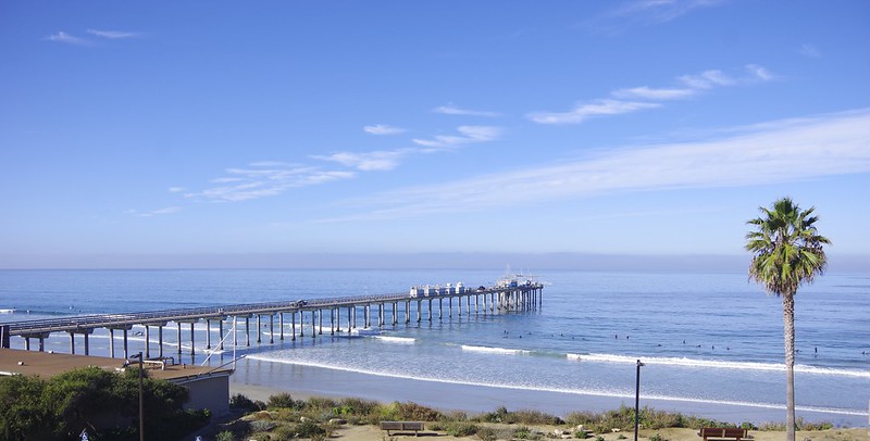
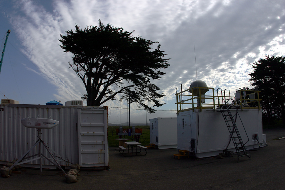
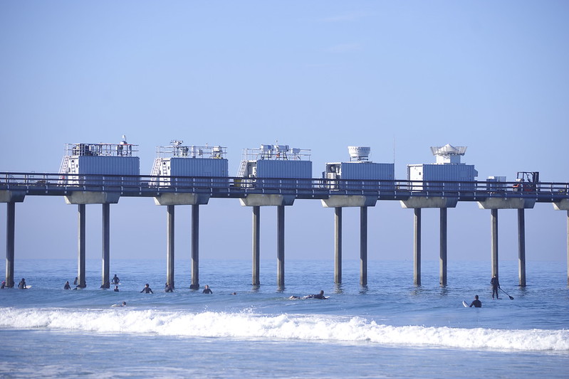
Instruments are installed along the Ellen Browning Scripps Memorial Pier, which juts straight out over the sea, and on Mount Soledad, about a mile from the coast.
At an elevation of 250 meters (820 feet), Mount Soledad is high enough to allow collection of data from within the clouds themselves.
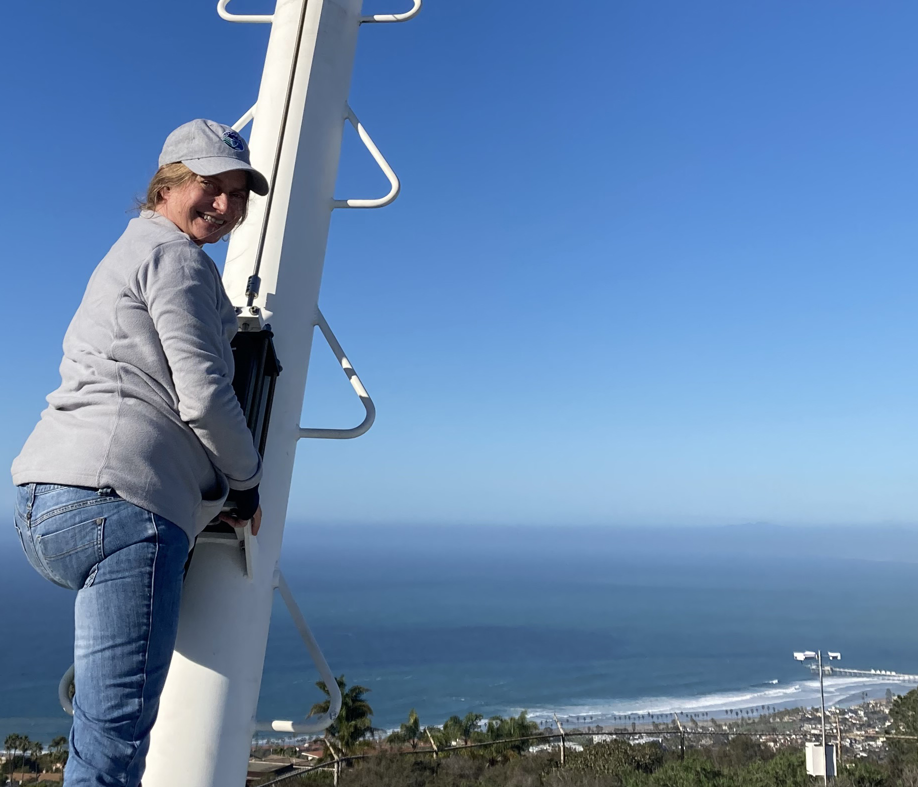
Cloud radars on Mount Soledad will have a clear view of the coast to the north and west. During cloud events there, instruments can also sample tiny cloud droplets, which are as much as a million times smaller than raindrops.
EPCAPE is a multi-institutional campaign, with 17 co-investigators from seven universities, three U.S. Department of Energy (DOE) national laboratories, NASA, and Environment and Climate Change Canada. The core instruments and support for EPCAPE are supplied by DOE’s Atmospheric Radiation Measurement (ARM) user facility.
ARM operates three fixed and three mobile atmospheric observatories in climate-critical regions of the world.
Scientists say it is crucial to understand marine stratocumulus clouds. At any given time, on average, thin decks of these bright, rounded, low-lying masses cover half of the world’s ocean surfaces. They are much brighter than the ocean surface they cover. That means marine stratocumulus clouds reflect more solar radiation than the ocean surface would, creating a net cooling effect. Their global ubiquity and cooling properties make such clouds an important influence on the Earth’s energy balance.
EPCAPE data will help inform and validate the numerical models used to represent ocean-cloud processes.
In the Lead
EPCAPE’s principal investigator is atmospheric chemist Lynn Russell, a professor of climate sciences at Scripps Institution of Oceanography, a department of the University of California San Diego.
The coast around La Jolla has plenty of offshore marine stratocumulus clouds to study. They interact with coastal land features such as Mount Soledad and persist overhead for more than six months a year.
Representative of other coastal cloud regimes in the world, stratocumulus formations around La Jolla are influenced by a large, dynamic range of aerosol concentrations and a variety of aerosol sources.
Atmospheric aerosols, Russell’s chief research interest, are tiny particles in the air that make cloud formation and precipitation possible. They can originate in nature, including as bits of soil or sea spray. Aerosols also originate as gases and soot from fossil-fuel burning or other man-made emissions.
Russell has a special interest in the gray, misty marine clouds that hug urbanized coastlines, where the mix of aerosols is complex.
More Data, Please
Despite the climate significance of marine stratocumulus, there are few long-term observational data on the properties of such clouds, which appear in regions with upwelling cold water from the deep ocean.
During EPCAPE, Russell and other aerosol researchers will team with cloud experts to build a yearlong portrait of coastal stratocumulus cloud properties. They will investigate how cloud layers form and how related processes are affected by man-made particles. Such particles come from ports in the Los Angeles/Long Beach area to the north.
The EPCAPE team also aims to answer science questions related to cloud-aerosol climatology, cloud radiative fluxes, and aerosol-cloud interactions.
“The kind of clouds we have near San Diego―offshore that then often come ashore―are some of the most important” to climate, says Russell, since they “represent a large fraction of daytime cloud cover.”
From April through June 2023, the first of two EPCAPE intensive operational periods will focus on cloud chemistry, including cloud droplet sampling and investigations of aerosol formation. Historically, during this time of year, Mount Soledad is shrouded in cloud cover.
The second intensive operational period, on radiation, will take place from July through September 2023. Among other things, researchers will look for photochemical effects that contribute to aerosols and affect the cloud cover observed on Mount Soledad.
EPCAPE co-investigators are excited about the potential for observations that could provide new scientific insights, including:
- a better understanding of biases within the models that simulate coastal marine clouds
- more details on aerosol sources
- new perspectives on cloud drizzle and turbulence, and on how aerosol interactions influence solar-power resources
- more information on atmospheric circulations near coasts
- deeper knowledge of cloud chemistry.
A Gathering of Collaborations
EPCAPE will also convene many collaborations intended to meet its scientific objectives. These include projects supported by DOE’s Atmospheric System Research (ASR) to collect airborne and surface data on aerosol sizes and other properties.
Other researchers from two University of California institutions (Los Angeles and San Diego) and North Carolina State University, funded by the National Science Foundation, will use instruments on Mount Soledad to investigate cloud chemistry.
Scientists from Dalhousie University and Environment and Climate Change Canada will pull in ground-instrument data on cloud droplets, volatile organic compounds, and aerosol absorption properties.
In June 2023, researchers will participate in airborne campaigns to study marine cloud chemistry and aerosol-cloud interactions upwind of EPCAPE.
Funders for these campaigns include the Office of Naval Research and ASR (for SCILLA, the Southern California Investigation of Low cloud and Land Aerosol) and NOAA (for AEROMMA, the Atmospheric Emissions and Reactions Observed from Megacities to Marine Areas campaign).
Surface Data, Mountain Data
To get the kind of cloud and aerosol data they need, Russell and her EPCAPE co-investigators will rely heavily on ARM instruments.
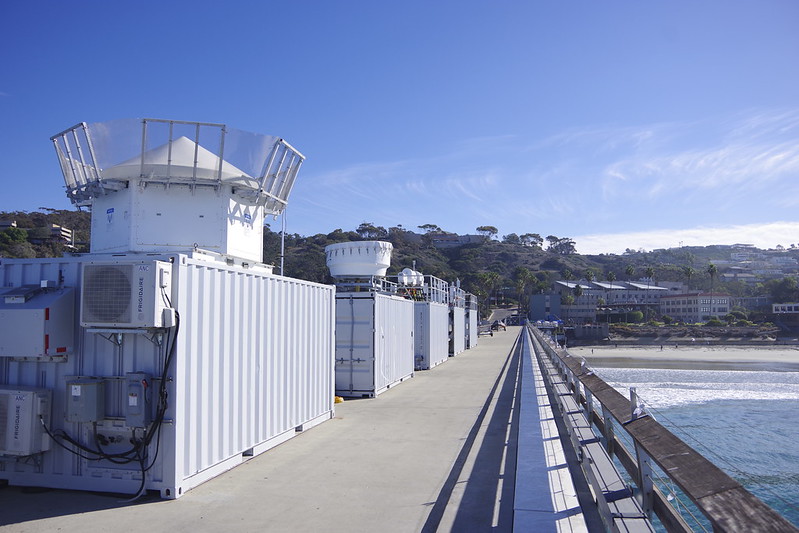
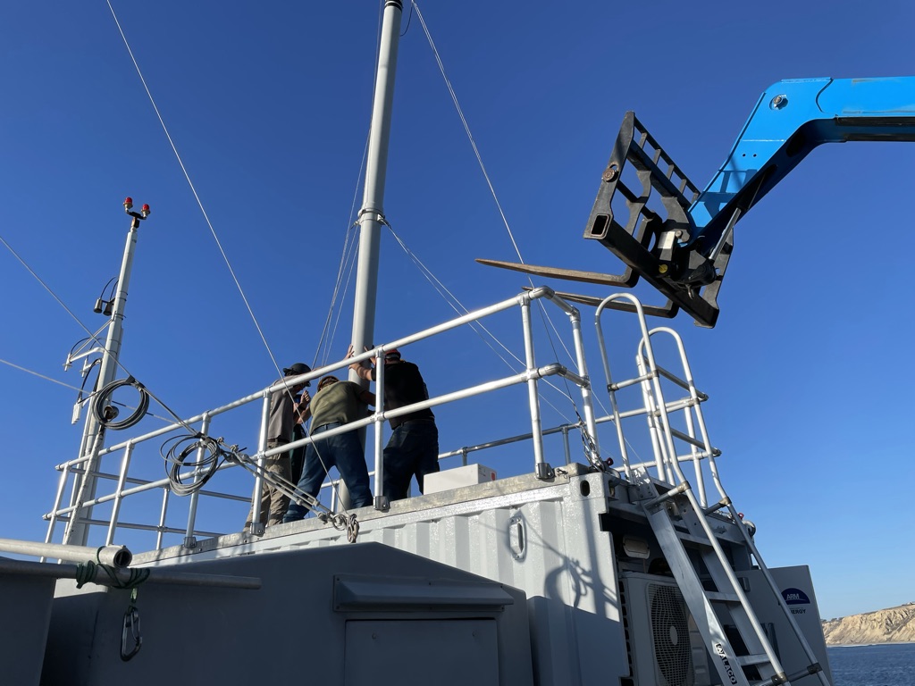
To get ready, ARM technicians set up an Aerosol Observing System in December 2022 at the ocean-side end of the Scripps Pier. The system will collect data on aerosol particle size, concentration, size distribution, backscattered radiation, and absorption.
During the same setup phase, ARM emplaced lidars and radars near the middle of the pier.
Included were Doppler lidars, which among other functions measure drizzle in a way that separates it from other motions in the air. Meanwhile, a large, bowl-like ARM radar will profile the full vertical structure of clouds, from the top of the troposphere to a few hundred meters above the ground.
The radars, lidars, and aerosol instruments are all part of the first ARM Mobile Facility. This portable observatory also includes shelters and communications and data systems.
On Mount Soledad, cloud and precipitation instrumentation will take measurements from within cloud cover; other instruments will scan the pier site. The Mount Soledad installation also includes instruments designed to sample the chemical composition of in-cloud droplets.
In all, EPCAPE researchers will have access to a two-site, multidimensional view of cloud and aerosol activity across all seasons.
From these two complementary observation points, “the radars will have a really good view of marine conditions out on the pier and a good scanning view with the Soledad site,” says Russell. “The combination will allow for better retrievals of cloud properties than have been possible before.”
MASRAD Sets the Stage
In 2005, ARM conducted a seven-month field campaign at Point Reyes, California, just north of San Francisco. Marine Stratus Radiation Aerosol and Drizzle (MASRAD) included the first deployment of an ARM Mobile Facility.
MASRAD’s lead scientist was Mark Miller of Rutgers University. Eighteen years later, Miller returns to similar science questions as an EPCAPE co-investigator.
“I’m thrilled to be part of a mission I believe in,” says Miller, “and people I really like working with.”
EPCAPE will leverage the technological advantages gained since MASRAD, he says, including “more mature” radars and improved models. In addition, EPCAPE has a better location. The 2005 campaign set up shop a half-mile from the shore, in a pasture, which could have skewed readings of the marine boundary layer.
In the last 15 years, says Miller, MASRAD has certainly added a lot to the data and literature on coastal marine stratocumulus clouds, but “EPCAPE is everything Point Reyes wanted to be. We just weren’t there technologically.”
Russell was not part of MASRAD but has studied its data, including observations EPCAPE will use to improve remote-sensing techniques.
With MASRAD being the first ARM Mobile Facility deployment, she says, “we can’t have expected it to have everything that we have today.”
After MASRAD, ARM conducted two other campaigns in northeastern Pacific cloud regions: the Marine ARM GPCI Investigation of Clouds (MAGIC, 2012–2013) and the ARM Cloud Aerosol Precipitation Experiment (ACAPEX, 2015).
In 2013, in pursuit of long-term data on similar oceanic cloud regimes, ARM also established the Eastern North Atlantic atmospheric observatory in the Azores, an island chain west of mainland Portugal.
Together, MASRAD, MAGIC, ACAPEX, and the Eastern North Atlantic observatory were among the formative influences behind Russell’s EPCAPE science plan.
Earlier Scripps Pier Studies
Russell has had a longtime interest in coastal stratocumulus, “one of the things we’re just starting to get a good grasp of,” she says.
Over the open ocean, Russell explains that there is a “fairly well-behaved boundary layer” because the ocean surface is homogenous over hundreds of kilometers.
“Then you hit the coast,” she says, where cloud and aerosol properties become more complex because of coastal land features and urban air influences.
To illustrate the radical change in conditions from the open ocean to the coast, Russell points out that historical levels of carbon dioxide around the Scripps Pier show “clean marine” conditions only about 5% of the time.
Going back more than a decade, Russell was part of other efforts to collect data on coastal cloud-aerosol properties in the eastern north Pacific. For instance, she designed and led three aerosol composition experiments on the same pier EPCAPE will use.
A May 2010 study looked at the wintertime prevalence of submicron organic particles linked to inland urban emissions. A paper in November 2010 used data on particles transported downwind from wildfires in Northern California. A third study, in August 2011, investigated ozone-related particles associated with fossil-fuel combustion.
All three Scripps Pier studies—based on three data sets from 2008 and 2009—were warmups for EPCAPE.
Russell’s vision for the campaign is that the study will combine two things: what she calls ARM’s “amazingly comprehensive view of coastal stratocumulus clouds” and a new, more precise chemical characterization of aerosol and cloud droplets affected by pollution from urban centers.
Follow Us:


Keep up with the Atmospheric Observer
Updates on ARM news, events, and opportunities delivered to your inbox
ARM User Profile
ARM welcomes users from all institutions and nations. A free ARM user account is needed to access ARM data.


