

A Study of Stormy Houston Switches Gears
Published: 17 November 2022
TRACER, an epic investigation of coastal convection, moves from observations to data analysis

In weather terms, convection is the process of conveying heat and moisture upward through a turbulent atmosphere. From there, convection forms clouds―mostly puffy, rain-free shallow cumuli. But others evolve into towering cumulonimbus, or anvil clouds, which form thunderstorms.
Thunderstorms bring needed rain―more than any other water source in the Earth’s middle latitudes. But they also bring heavy precipitation, lightning, and hail―a crush of conditions that can cause significant impacts on people and infrastructure.
Science has not fully answered some related questions. How do multiple interacting atmospheric processes control the details of how thunderstorms form, grow, and dissipate? How are these governing processes influenced by aerosols, the tiny particles in the air that make clouds and precipitation possible? And how does all this interact in urbanized coastal terrain?
Such questions require improved predictive models, which need the kind of data now on hand from a comprehensive yearlong field campaign funded by the U.S. Department of Energy (DOE): the TRacking Aerosol Convection interactions ExpeRiment (TRACER).
After two COVID-related delays, operations started October 1, 2021, in and around Houston, Texas. This coastal region―subtropical, humid, and stormy―was ideal for such inquiries.
“I don’t think there has ever been another urban coastal study like this,” says TRACER’s lead scientist, Michael Jensen, a meteorologist at DOE’s Brookhaven National Laboratory in New York. “Not one focused on clouds and aerosols, at least. And there’s never been one with the same scope.”
‘My Head Is Spinning’

TRACER researchers measured the impact of aerosols on convective vigor. They studied how the dynamics of sea breezes interacted with urban emissions and those of cleaner rural areas.
By September 30, 2022, after a year of measurement at three main sites, TRACER had racked up 38 terabytes of data.
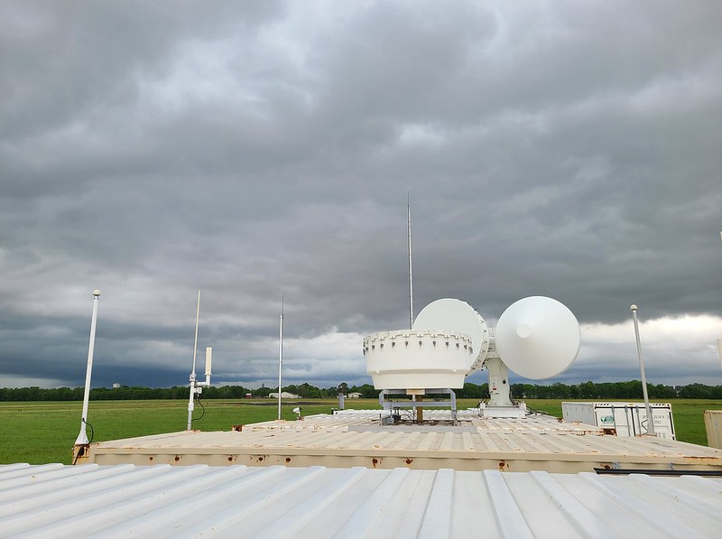
Core instrumentation came from DOE’s Atmospheric Radiation Measurement (ARM) user facility, which operates fixed-location and mobile observatories across the world.
“It’s going to be a rich data set,” says Jensen. “I am seeing so, so many cool, different science directions to go in. My head is spinning.”
Jensen outlines TRACER by the numbers. A few of the facts:
- five other agencies with observational assets
- 45 institutions―many of them with guest instruments
- 150 field participants in varied disciplines
- 188 datastreams (data are now freely available from the ARM Data Center)
- approximately 395 operational days, including the September 2021 data evaluation period
- 1,885 radiosonde launches.
TRACER included a four-month intensive operational period (IOP) from June through September 2022. IOPs are marked by an increased tempo of operations, more personnel in the field, and more instruments at work.
Coastal Data

The Houston region is exceptionally rich terrain for studying the evolution of convective storms.
To TRACER’s advantage, the Houston area is heterogeneous; that is, it has the environmental complexity scientists seek. It includes an urban core, a fringe of heavy industry, and suburban and rural environments.
Add to that another regional influence that researchers studying convection are eager to know more about: an ocean coastline. The Gulf of Mexico is connected to the Atlantic, and sea breezes are thought to help prompt convective activity.
TRACER’s unique data include measures of the radiative energy balance as frontal boundaries come through the region―a feature of convective storms that “I don’t think anyone has really quantified before,” says Jensen.
Eventually, TRACER data will help inform models of cloud-aerosol interactions that are useful worldwide.
“The processes we’re seeing in Houston happen in lots of different coastal regions,” says Jensen.
A Test of Endurance

The IOP, says Jensen, “was a test of endurance,” especially for the scientists and technicians who spent long weeks or months onsite. A few were there for TRACER’s full year.
TRACER co-investigator Chongai Kuang of Brookhaven Lab recalled his time in the field in Guy, Texas, watching a tethered balloon system (TBS) carry his and other instruments aloft through humid skies under a blazing sun.
“This was a pretty rad way to spend the summer, (essentially) in a farmer’s field,” he says, adding praise for those who stayed for the whole IOP.
Of course, hard work delivers rewards.
Gijs de Boer, a senior research scientist from the University of Colorado Boulder/NOAA, took part in TRACER. In early October, he summed up his post-campaign mood: “Yes. Happy.”
During the summer IOP, de Boer led a team of investigators studying physical processes in the boundary layer by using uncrewed aerial systems (UAS).
Sea breezes from the Gulf of Mexico help govern the formation and life cycle of the Houston region’s convective clouds. To date, numerical models do not represent the clouds in such coastal regimes very well.
With an eye to better models, de Boer’s team set up its UAS to capture data on the vertical and horizontal variability of atmospheric properties. These include humidity, wind speed, and temperature. The fixed-wing RAAVEN aircraft also swept up data on the horizontal gradients of aerosol size distributions.
RAAVEN, developed at the University of Colorado Boulder, stands for Robust Autonomous Aerial Vehicle-Endurant Nimble. During TRACER, these aircraft―91 inches wide and powered by batteries―were catapulted into the air for missions that averaged 90 minutes each.
Now, de Boer’s TRACER-UAS team will quality-check its measurements, deliver them to the ARM Data Center, and complete a data paper “describing what we did,” he says. “Then we’ll move on to science (that is) focused on regional aerosol properties and statistics of the Gulf breeze.”
DOE’s Urban Aspirations
TRACER-UAS was among 10 smaller campaigns within the TRACER framework funded by DOE’s Atmospheric System Research (ASR) program. Jensen praised ASR for its foresight in supporting projects whose funding was announced ahead of TRACER.
In addition, TRACER anticipated what is now a full-on DOE effort to support research on how climate change will affect urban areas. In fall 2022, the agency announced funding for four Urban Integrated Field Laboratories (UIFL)―in Baltimore, Maryland; Chicago, Illinois; Beaumont/Port Arthur, Texas, on the Gulf Coast; and the Arizona corridor including Tucson, Phoenix, and Flagstaff.
Related to that, ARM is requesting preliminary proposals from scientists to deploy one of three ARM Mobile Facilities to an urban region in the United States or one of its territories. (An ARM Mobile Facility supplied core instrumentation for TRACER.) The deployment could start as early as fall 2024.
Proposals can focus on aspects of urban-climate interactions, such as process gradients in a region with urban, suburban, and rural environments. The call for preproposals closes December 19, 2022.
A Variety of Platforms
To achieve their epic data, TRACER and its associated campaigns called on a wide variety of instrument platforms.
In play were satellites, UAS, crewed aircraft, truck- and trailer-mounted mobile sensors, tethered balloons, radiosondes, watercraft (including a repurposed shrimp boat), and dozens of surface instruments.
Such a variety of instruments “is not unprecedented,” says Jensen. “But it’s a trend we’re seeing in more field campaigns, which (matches) a trend towards more agencies working together.”
“Ten years or 20 years from now, we’ll still be publishing results using the data we collected during TRACER.”
TRACER Principal Investigator Michael Jensen
From all that time and all those instruments and collaborations, he anticipates, “10 years or 20 years from now, we’ll still be publishing results using the data we collected during TRACER.”
Data ‘As Useful As Possible’
“TRACER is not over yet,” says Jensen, who is planning a campaign data and science workshop in spring 2023. “We’re just moving from the observations to data analysis and modeling. This is the longest phase, where the meat of the research gets done. It could last a decade or more.”
Principal investigators of smaller campaigns within the TRACER framework are required to deliver data within six months of the campaign’s September 2022 close. So are ARM co-investigators.
“You want at least quality-controlled data submitted by then,” says Jensen, “but final geophysical products will take more time.”
Maggie Davis, who works at the ARM Data Center, says data submitted in six months should be “meaningful and useful,” though there is a process for extending the deadline.
ARM Director Jim Mather describes the goal: timely data with strong ties to “community engagement―to make data as useful as possible.”
Collaborations to Come

TRACER had a significant presence at the in-person/virtual 2022 Joint ARM User Facility/ASR Principal Investigators Meeting in late October.
The meeting included 32 TRACER-related posters―“pretty good for a campaign that ended three weeks earlier,” says Jensen.
He and Kuang hosted a science and operations overview at the joint meeting in Rockville, Maryland.
Jensen praised the campaign’s university partners, along with intrepid TRACER technicians who endured heat, rain, and dust. He also enumerated a few sources of observational pride: TBS, radiosondes, stereo cameras that helped unravel cloud evolution, polarimetric radars that measured sea-breeze dynamics, lightning data sets, large-scale meteorology data, and an ARM radar that tracked the evolution of cloud cells.
Kuang pointed to many other instruments and advances. These included a transparent aerosol chamber that captured ultrafine particles, TBS sampling of petrochemical fires, particle water-uptake data, mobile air-quality platforms, data-correction methods, and devices to collect ice-nucleating particles that he says look like “inverted salad bowls.”

Three other experts weighed in. Pavlos Kollias, who has a joint appointment at Brookhaven Lab and Stony Brook University, talked about the preliminary analysis of data from TRACER’s novel radar tracking of convective cells.
He called the automated, algorithm-aided technique “a revolutionary approach” to getting rapid views of cloud evolution, with 12,000-plus scans recorded in “a very nontraditional data set.”
Olga Mayol-Bracero, lead mentor for the ARM Aerosol Observing System, tasked fellow Brookhaven Lab researcher Maria Zawadowicz to outline TRACER’s variety of aerosol measurements, including size distributions and optical and chemical properties.
“We also found long-range (aerosol) transport from Mexico,” said Zawadowicz. “A surprise.”
Severe weather researcher Jiwen Fan of Pacific Northwest National Laboratory in Washington state looked ahead at plans for TRACER modeling activities, including model intercomparisons and identifying sea-breeze cases.
Fan also spoke of the need to nurture closer collaborations with observationalists.
“It’s very exciting to see so many observational analyses coming out of this campaign,” and so early, she said.
The meeting’s TRACER event was “a call for collaborations,” says Jensen. “There are some cool things going on. We want to start gathering people together.”
Follow Us:


Keep up with the Atmospheric Observer
Updates on ARM news, events, and opportunities delivered to your inbox
ARM User Profile
ARM welcomes users from all institutions and nations. A free ARM user account is needed to access ARM data.


