

From Bedrock to Atmosphere: Deep Investigations Into Disappearing Snowpack
Published: 24 January 2022
An ARM campaign in Colorado unites with two other research efforts to better understand critical mountain hydrology
Imagine turning on the water tap, only to get a dribble instead of a gush.
Globally, mountain regions, which take up about 23% of Earth’s land area, might be coming to something like that. In a warming world, winter stores of snowpack are shrinking, along with the volume of water they generate downstream.
About 40% of mountains worldwide maintain a seasonal snowpack. Meanwhile, 60% to 90% of fresh water on Earth is delivered by streams, rivers, and groundwater recharged by high-altitude hydrological systems. Some scientists call mountains the “water towers” of the world.
While each mountain system has unique features, they share some common themes: physically in terms of how they extract moisture and deliver water downstream; ecologically in terms of some of the flora and fauna they support; and societally in terms of how civilization uses the immense power of complex terrain to harness water.
The American West contains four large mountain ranges that provide many scientific opportunities for water research: the Rockies, Cascades, Sierra Nevada, and Wasatch/Uinta.
A recent paper in Nature Reviews Earth & Environment reports that by 2050 in the mountainous American West, there will be declines of about 25% in snow-water equivalent. The authors write that this emerging “low-to-no-snow” pattern is presently episodic. But the scientific consensus, as reviewed by the paper, found that snow drought will be the norm in as little as 35 to 60 years.
Lead author Erica R. Siirila-Woodburn, a watershed hydrodynamics expert at Lawrence Berkeley National Laboratory (LBNL) in California, delivered a presentation on the study in December 2021 at the annual fall meeting of the American Geophysical Union (AGU). The review paper closely analyzes 18 previous studies (out of hundreds) on climate projections linked to climate change, especially warming trends.
The bottom line: If emissions of greenhouse gases remain high, the world’s mountain systems will likely be mostly snow-free and will produce very different amounts of water at very different times of the year.
The U.S. Department of Energy (DOE) and other partners are funneling resources to the West to learn more about how warming trends affect the complex interdependent atmospheric, surface, and subsurface processes that affect the snowpack and water resources in this region.
‘Fell Off a Cliff’
Snowpack melts earlier than ever as temperatures rise. In the last century, water discharge from the Colorado River has decreased by about 10% per degree Celsius of warming, says study co-author Daniel Feldman, an LBNL atmospheric scientist.
In summer 2021, adds Feldman, levels of expected water discharge in the Colorado River Watershed “fell off a cliff.” Levels withered to 25% of historical averages in a region that supplies water to 40 million people across the West.
Even more dire, in 2015, springtime snowpack in the Sierras shrank to just 5% of the norm.
Long-term trends are also troubling. In the West, springtime snowpack accumulations have declined 21% since the 1950s. By 2200, that slump could reach 50% of historical averages, according to the study’s authors, who predict “an abrupt transition” by the mid-to-late 21st century.
Part of the problem is that rain is displacing snow as the predominant form of precipitation. (With warmer temperatures, storms tend to produce more rain but less snow.) This trend is like having a checking account for quick spending sprees of water―but no savings account to store water and gradually mete it out during the spring and summer.
In 2021, the importance of the low-to-no-snow scientific challenge became crystal clear: The Colorado River Watershed received 89% of its historical average in precipitation―but discharged from the river only 25% of its historical average.
Welcome to SAIL
Feldman is the principal investigator (PI) for the Surface Atmosphere Integrated Field Laboratory (SAIL) campaign, which began in September 2021 and is slated to end in June 2023. It’s conducted by the DOE Atmospheric Radiation Measurement (ARM) user facility, which operates fixed and portable atmospheric observatories in climate-critical regions of the world.
Feldman’s SAIL research funding comes from another DOE source, Atmospheric System Research (ASR).
SAIL is one of three recent interlinked and co-located scientific efforts working to improve the predictability of mountain water discharge patterns.
The Study of Precipitation, the Lower Atmosphere and Surface for Hydrometeorology (SPLASH), a NOAA field campaign underway from fall 2021 through at least summer 2022, aims to improve the predictability of weather and water over complex terrain.
DOE’s Watershed Function Science Focus Area (SFA), headquartered at LBNL, began in 2014 as a sustained effort to record how systems and subsystems within mountain ecology retain and release water, nutrients, and metals.
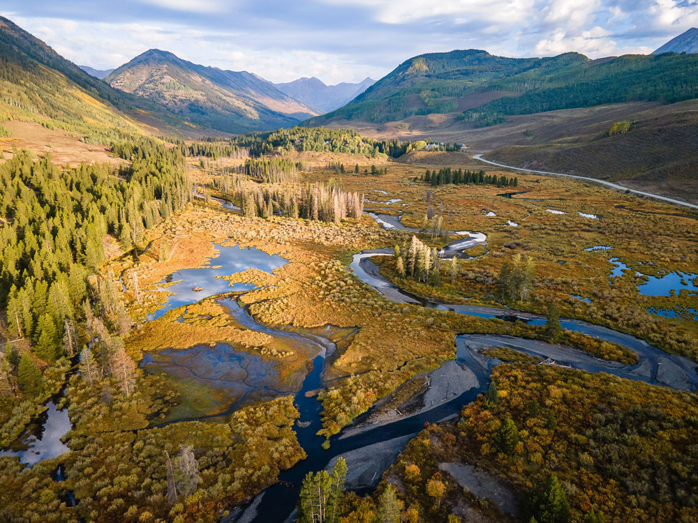
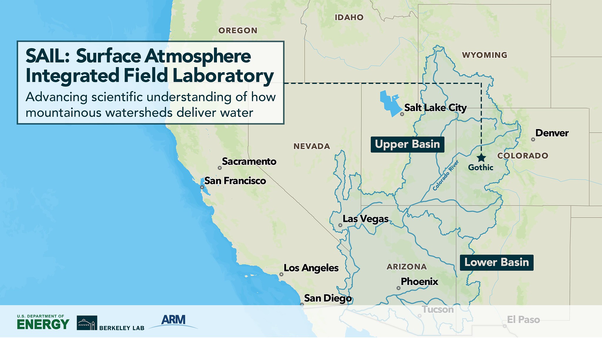
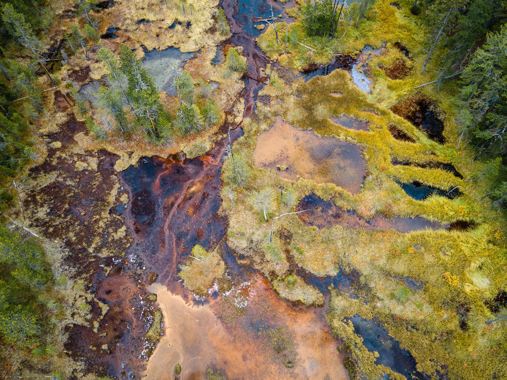
SAIL is investigating the East River Watershed, which covers 300 square kilometers (186 square miles) of the Upper Colorado River Basin. The area forms the headwaters of the Gunnison River, which downstream provides nearly half of the water going to the Colorado River.
Snowpack-dominated streamflow from this representative Colorado mountain watershed provides water for seven Western states. That includes water for hydropower and more than 5 million acres of agricultural irrigation. The Colorado River drives about $1 trillion in annual economic activity.
Multidisciplinary scientists involved in the three efforts are investigating the totality of processes that contribute to mountain hydrology.
Researchers are using sophisticated instrumentation at a variety of scales. In deep bedrock and seeping threads of groundwater, they are peering into geochemistry and microbial activity. On the rugged slopes of mountain terrain, they are investigating plant and soil surface conditions. Other experts are reaching more than a mile into the atmosphere, tracking aerosols, winds, storms, and other phenomena linked to water discharge.
The overarching aim is to collect data on the processes that make, hold, and release stores of water in mountain regions―which is not easy, says Feldman. “There is a lot of process complexity.”
The physical processes that inform SAIL and that are featured in the Siirila-Woodburn study make for quite a list:
- climate variability
- surface-layer characteristics, including vegetation
- snow physics
- turbulence in the boundary layer
- the microphysics of precipitation
- interactions between groundwater and surface water
- mountain-induced air circulation
- patterns of runoff generation.
Further complicating the picture is the need to get a sense of these hydrology patterns at a range of scales, from that of a watershed to the scale of a mountain region and continent. But the field activities take a practical approach. The aim is to understand the critical processes that dominate integrated mountainous hydrology enough to achieve improved predictability of future conditions.
In the end, the coordinated efforts will improve the data that contribute to predictive modeling of weather and water in the Colorado River Watershed. They also seek to provide benchmarks and guidelines for future field and modeling activities in similar systems across the world.
A Need for Advances
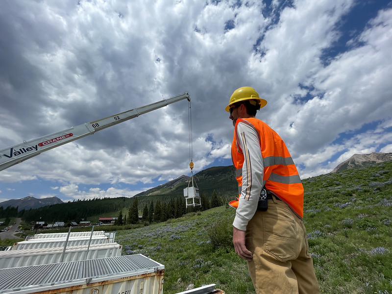
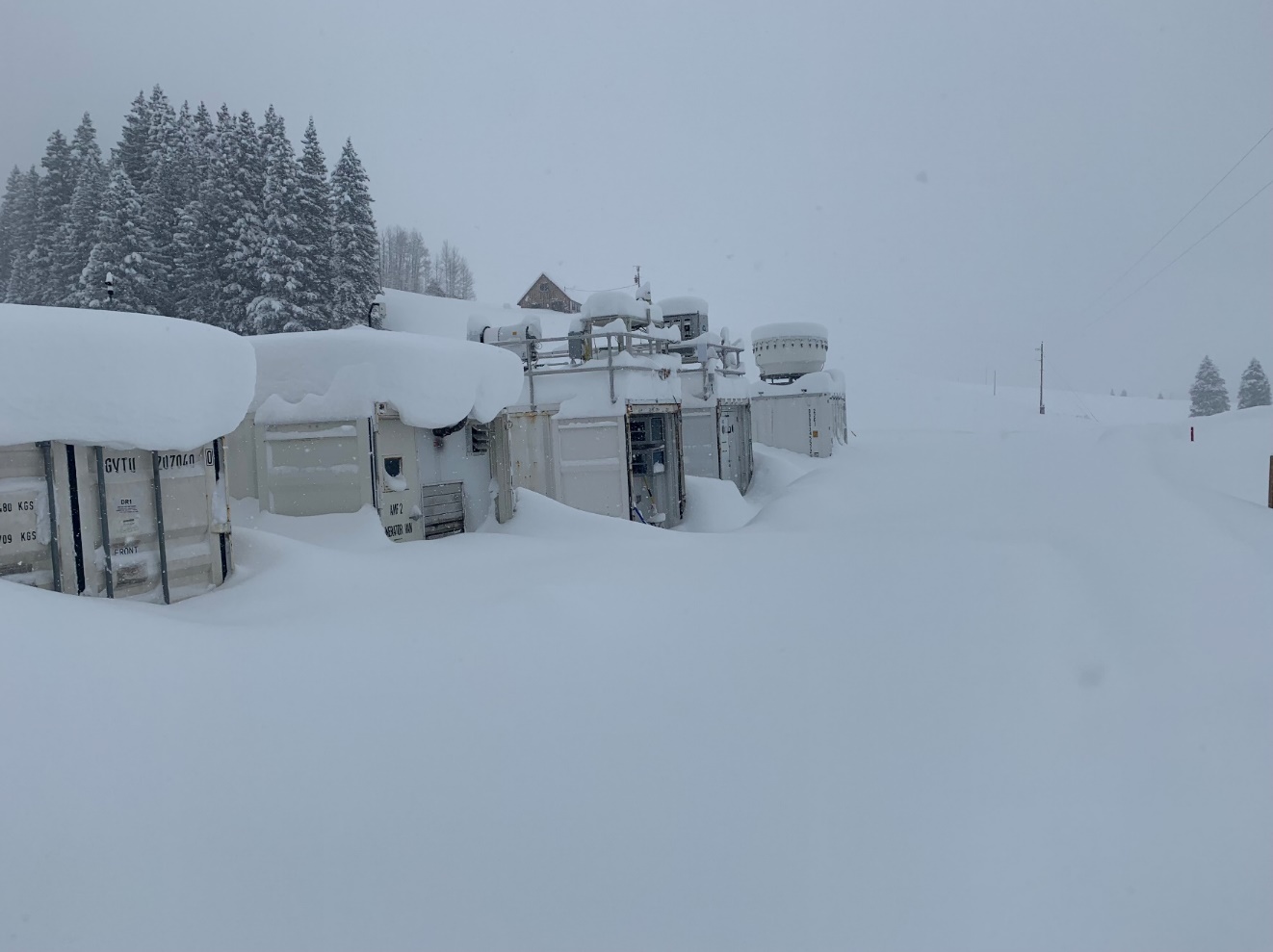
Containerized observatories called ARM Mobile Facilities in the last two decades “have gone to the ends of the Earth and many places in between,” says Feldman.
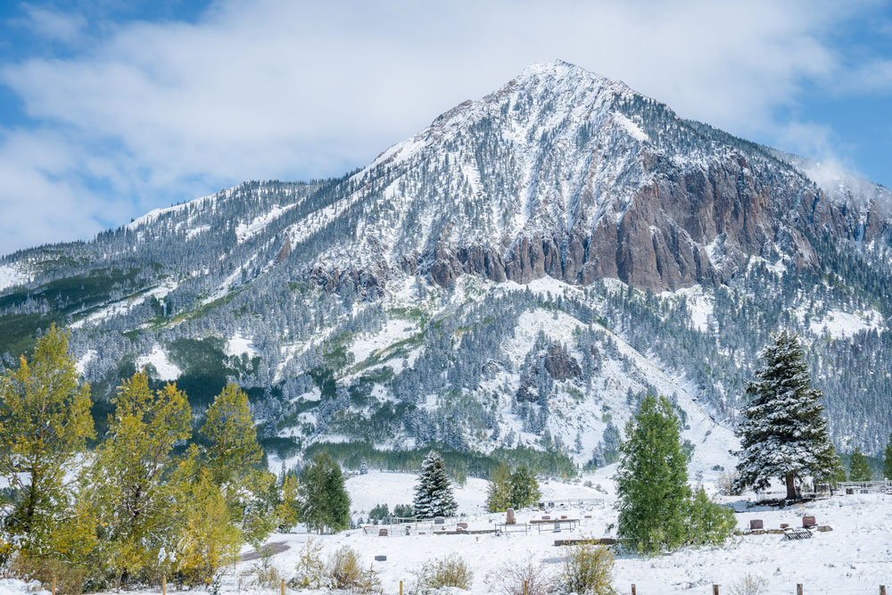
SAIL’s 50-plus main instruments are part of the second ARM Mobile Facility, which ARM personnel installed in summer 2021 in Gothic, Colorado.
The former ghost town in Colorado’s rugged Gunnison County is close to a ski-resort mecca called Crested Butte and is nestled in the shadow of a mountain of the same name. It is also home to the nearly century-old Rocky Mountain Biological Laboratory (RMBL) field station, one of many SAIL research partners from academia, industry, and federal agencies.
The Siirila-Woodburn paper “covers a number of themes that are highly relevant to SAIL,” says Feldman. Such themes include the societal impact of a low-to-no-snow future, the interlinking processes that lead to cascading hydrologic changes, and the need for advances in observations and modeling.
The links between paper and campaign are also evident because almost a third of the study’s co-authors are on the SAIL science team. Feldman (SAIL PI), William D. Collins (co-PI), and the study’s second lead author, Alan Rhoades, are all at LBNL. In addition, the paper acknowledges Feldman’s ASR funding.
With all the multidisciplinary scientific muscle brought to bear in SAIL, Feldman says that the next nearly two years of measurements will fill in “some critically important data gaps identified in the paper for advancing the predictability of water in and from mountains.”
Data From Deep and High
Those data gaps exist in a region of the United States that normally has too few measurement resources to build an all-season picture of mountain hydrology. Getting the right data in hazardous mountainous terrain is hampered by problems of instrument access, land-use restrictions, and safety considerations.
Assembling a comprehensive picture of high-altitude hydrology requires knowing more about how and why local and regional atmospheric conditions interact. With four months of SAIL data as of January 2022, there is already information for researchers to study.
Feldman presented an overview of SAIL during the 2021 AGU Fall Meeting. He noted that the campaign will eventually record an impressive 21 months of seasonal changes, including regional patterns of precipitation and wind and the evolution of storms around and across Gothic Mountain.
After an exceedingly dry start to the SAIL campaign, Gothic received over 300 centimeters (118 inches) of snow in December 2021.
Feldman says that a major snowstorm at the end of the month is “an opportunity to study how precipitation forms and how snow is deposited and redistributed.”
It’s also a challenge, he adds, since such a voluminous snowfall buried much of the SAIL instrument site in Gothic. That means a lot more work for the onsite technicians.
Meanwhile, preliminary data are available in ARM Data Discovery, notes Feldman. “There are many, many conditions to analyze.”
Adding a SPLASH
Some of the conditions needing analysis relate to the physical processes that take place just above the mountain surface (like precipitation) and at the interface of the surface and atmosphere (like soil moisture conditions).
SPLASH has deployed a surface-and-airborne observing network in the same Crested Butte-Gunnison region as SAIL.
And, like SAIL, the SPLASH campaign is motivated by declining water assets in this part of Colorado and the ability to predict weather and water over complex terrain.
Broadly, the campaign will focus on improving observations and modeling related to the processes that “control how much water makes its way into the watershed,” says SPLASH liaison Gijs de Boer. He is a research scientist with the Cooperative Institute for Research in Environmental Sciences (CIRES), a partnership of NOAA and the University of Colorado, Boulder.
Representing a multidisciplinary team of SPLASH scientists, de Boer delivered a presentation during the same AGU mountain hydrology town hall as Feldman.
SPLASH researchers are investigating complex terrain, turbulent energy fluxes at the atmosphere-surface interface, snow properties, the intricate microphysics of mountain storms, and other phenomena.
The idea is to improve predictions across a wide range of time scales: weather forecasts of one to 14 days; sub-seasonal forecasts two to 12 weeks out; and seasonal forecasts, which look ahead three months or more.
Along the way, says de Boer, a greater understanding of such weather patterns could someday be “leveraged for renewable energy.”
Sites and Flights and Models
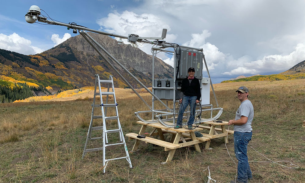
SPLASH has instruments arrayed at four field sites. Key instruments include:
- S- and X-band radar systems
- disdrometers to measure precipitation properties
- 2-meter (6.5-foot) snow stakes paired with cameras to track the evolution of snowpack
- surface energy budget and meteorological stations
- other remote-sensing instruments that will eventually help map the thermodynamic structure of the regional atmosphere.
SPLASH also has a NOAA snow survey aircraft. It deployed in October 2021 to record baseline soil moisture equivalents. Two more aircraft missions―in March 2022 and late April or May 2022―will, respectively, look at peak snow water and how much water is left after the snowmelt season.
In addition, SPLASH researchers will use data from uncrewed aerial systems to make detailed spatial maps of soil moisture content in the valley. The maps will also plot surface reflectivity and atmospheric conditions related to the development of cold-air drainage flows and convection.
On the modeling side, SPLASH will use its unprecedented measurements in the lower atmosphere and related surfaces to evaluate and improve current predictive tools. Areas of interest include the boundary-layer structure, the intensity of longwave radiative flows at the surface, and diurnal cycles of temperatures and wind.
The SPLASH website now includes a data portal.
Going Deep
A third sister research effort is gathering data on land-surface and below-ground conditions in the same mountainous Colorado region.
Until now, DOE’s Watershed Function SFA “has lacked the ability to look upward, into the atmosphere,” says SFA chief scientist Kenneth H. Williams, an LBNL biogeophysicist who lives near the Gothic site. “So (pairing with SAIL and SPLASH) is really a match made in heaven.”
The teamwork, he adds, emphasizes the “I” in SAIL—that is, “integrated: bold, italics, underlined.”
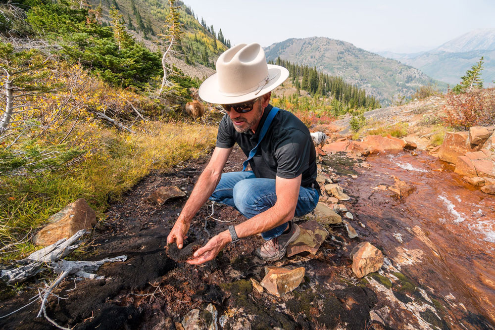
Williams co-authored a 2020 study in Geophysical Research Letters exploring one water-diminishing change in the Upper Colorado River―the increasing inability of late-summer monsoon rains to replenish streamflow and make up for any shortfalls in winter snowpack.
The SFA divides what Williams calls a “community watershed” into subsystems, including “ecogradients” that are tractable for measuring and modeling. One such ecogradient is the hill-slope system, which feeds water and nutrients into river corridors. The SFA study area includes a mile of such hill-slope gradients, which mark changes in elevation.
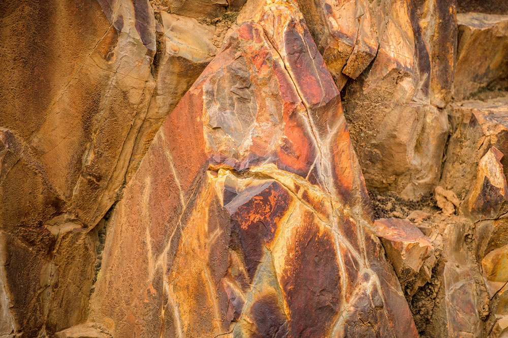
Another ecogradient comprises the East River Watershed’s diverse bedrock types, which are linked to groundwater recharge that Williams says feeds up to 50% of streamflow seasonally. “Without (groundwater recharge), you’re missing 50% of the hydrologic story.”
SFA researchers monitor groundwater at depths of 30 to 40 meters (98 to 131 feet).
Williams calls the overall SAIL-SPLASH-SFA collaboration “an incredible opportunity to directly link atmospheric processes to below-ground processes.”
More Research Questions Than Ever
“The goal here is to bring all of these collaborations and researchers to understand mountain watershed functionality in a way we couldn’t do ourselves. This is an unprecedented opportunity to do that.”
Kenneth H. Williams, chief scientist of the U.S. Department of Energy’s Watershed Function Science Focus Area
SFA researchers work in concert with 28 universities, seven DOE national laboratories, six federal agencies, and six small businesses.
“The goal here,” says Williams, “is to bring all of these collaborations and researchers to understand mountain watershed functionality in a way we couldn’t do ourselves. This is an unprecedented opportunity to do that.”
He is careful to credit RMBL, “a critical site host and partner” with a legacy of research in the region dating to 1928.
The rush of experts to Colorado, says Williams, means that in the next one or two years, scientists can address more research questions than ever.
For instance:
- How do snow and rain affect soil moisture and river discharge?
- How does complex topography influence snowpack accumulation and groundwater discharge?
- How does aerosol deposition affect snowpack? Soot and dust darken light patches of snow, altering the reflectivity of such surfaces. (The SFA maintains a distributed network of automated aerosol monitors, funded by DOE and co-located with two intensive study sites.)
- Where are the hot spots of microbial activity, an important vector for nutrient delivery to rivers?
Beneath questions like those lies the biggest question of all: What are the key datastreams that scientists and policymakers need? They need precise measurements, predictive long-term models, and short-term forecasts for―in this case―a location that supplies a large fraction of water to the southwestern United States.
As Williams puts it: “What is the minimum but sufficient information, spanning the atmosphere-to-bedrock continuum, that is needed to accurately predict fluxes of water and solutes? If you don’t make all the measurement streams at one location, you can never hope to answer this question.”
Ahead, Better Predictive Models
Feldman, de Boer, and Williams are hardly the only voices singing the importance of mountainous hydroclimates and the way they deliver critical amounts of water downstream.
A town hall in the first week of the 2021 AGU Fall Meeting laid out the need for a predictive understanding of water-making mountain systems.
Speakers represented the atmospheric, environmental, and modeling research themes of DOE’s Earth and Environmental Systems Sciences Division (EESSD), which includes ARM and ASR.
EESSD’s aim is to develop an improved capability for earth system prediction on seasonal to multidecadal time scales. Among the large-scale, multiyear collaborations it supports to further this vision are SAIL and LBNL’s subsurface SFA―both featured in what DOE calls its Integrated Mountainous Hydroclimate (IMHC) focus.
“Integrated” here means working across the different subsystems that are important in mountainous regions, as Williams does with the Watershed Function SFA. These process steppingstones reach into the deep subsurface, account for vegetation and soil, and measure conditions in the lowest region of the atmosphere, where weather happens.
Parallel efforts within EESSD to understand such terrain include:
- ExaSheds, a data-intensive machine learning project on watershed subsurface flows
- tools being developed for high-resolution simulations of mountain-region processes within DOE’s Earth and Environmental System Modeling (EESM) program
- Cloud, Aerosol, and Complex Terrain Interactions (CACTI), a 2018–2019 ARM campaign on convective initiation in mountainous Argentina. (The deepest convective storms take place in mountain regions.)
IMHC and its research priorities were the subjects of a November 2021 workshop, which was summarized during the town hall, and a companion workshop that focused on interagency IMHC collaborations that took place earlier this month (January 2022). A report, slated to be done by late spring 2022 and published soon after, will incorporate findings from both the November and January sessions.
The coming document will no doubt include stark facts on the disappearance of snowpack, the impacts of longer growing seasons on mountain ecosystems, and the increasing vulnerability of such ecosystems to perturbations and extreme events. (Wildfires were widely discussed in the November workshop.)
The plan for 2022 is to deepen alignment of current IMHC research across EESSD and through interagency collaborations, “which can take some time,” says DOE Environmental System Science Program Manager Jennifer Arrigo, who moderated the IMHC town hall. “We hope that this is the beginning of the conversation.”
Follow Us:


Keep up with the Atmospheric Observer
Updates on ARM news, events, and opportunities delivered to your inbox
ARM User Profile
ARM welcomes users from all institutions and nations. A free ARM user account is needed to access ARM data.


