

Eclipse, Rain Contribute to Memorable Field Campaign at Southern Great Plains
Published: 19 November 2017
Land-Atmosphere Feedback Experiment Already Providing Insights
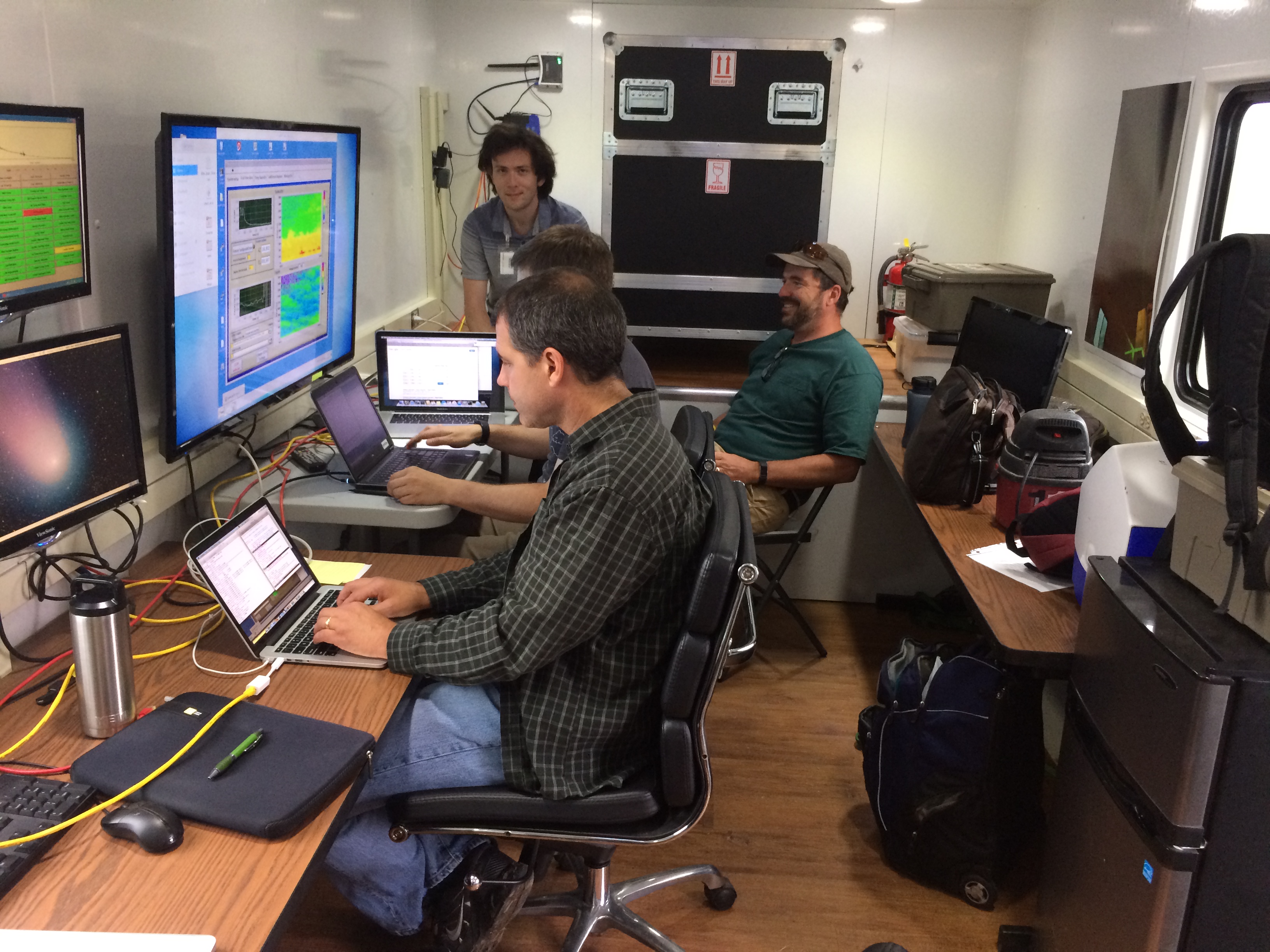
Researchers involved with the Land-Atmosphere Feedback Experiment (LAFE) are in the early stages of data processing, but they have already gained some distinctive insights into interactions between the land surface and the atmospheric boundary layer.
During the month-long LAFE field campaign, which ended August 31 at the ARM Climate Research Facility’s Southern Great Plains (SGP) atmospheric observatory, researchers got a bonus—seeing how land-atmosphere interactions unfolded during a solar eclipse. LAFE and ARM instruments captured the influence of the eclipse that swept across the United States on August 21.
“When we were planning this experiment, we weren’t planning around the eclipse,” says co-principal investigator Dave Turner of the National Oceanic and Atmospheric Administration (NOAA) Earth System Research Laboratory. “We were hoping to run this experiment last year so it could be coordinated with the HI-SCALE experiment. But for a variety of reasons, we couldn’t do it in that year. So we did it this year, and it became a very exciting event.”
An Impactful Celestial Event
The eclipse reaped some nice rewards for the LAFE research team, including Turner and co-principal investigator Volker Wulfmeyer, chair of physics and meteorology at the University of Hohenheim in Stuttgart, Germany.
“During the peak of the eclipse, we had about 90 percent coverage, but the solar radiation decreased over 800 watts per meter squared, so we could actually see how the land surface responded to this very rapid change in solar energy—both decrease and then increase—and then how did the boundary layer respond to that change in the land surface,” Turner says.
Those eclipse observations became part of a paper primarily authored by Turner and Wulfmeyer that was submitted to Geophysical Research Letters.
ARM instrument mentors David Cook, Argonne National Laboratory, and Rob Newsom, Pacific Northwest National Laboratory, provided analyses for the paper and are among the authors.
Newsom is the mentor for Doppler and Raman lidars. The Doppler lidars provide measurements of the profiles of horizontal wind and turbulent motions in the boundary layer, and the Raman lidar can deliver profiles of water vapor.
Cook oversees the energy balance Bowen ratio (EBBR) and eddy correlation (ECOR) flux measurement systems. The EBBR system produces 30-minute estimates of the vertical fluxes of sensible and latent heat at the surface. Meanwhile, the ECOR system provides half-hour measurements of the surface turbulent fluxes of momentum, sensible and latent heat, and carbon dioxide.
“Their instrument systems were absolutely critical for understanding these land-atmosphere processes,” Turner says.
Those instruments were combined with the University of Hohenheim’s unique three-dimensional scanning water vapor and temperature lidar systems, which Wulfmeyer noted performed extremely well during the entire period of LAFE.
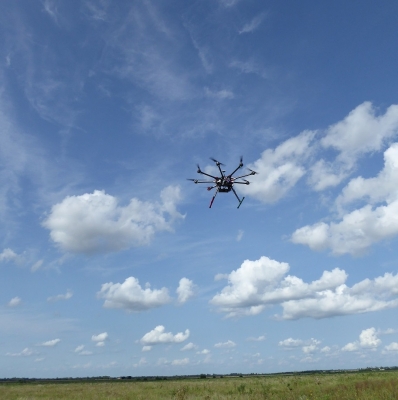
Portable facilities from the University of Wisconsin-Madison, University of Oklahoma, and NOAA National Severe Storms Laboratory supplemented SGP instruments with two vertically pointing atmospheric emitted radiance interferometers and two Doppler lidar systems. The campaign also incorporated an unmanned aerial system (UAS) operated by NOAA’s Air Resources Laboratory. The UAS helped measure temperature, humidity, wind, and sensible heat flux.
A Wet and Wild Challenge
The cloud-free sky during the eclipse stood in sharp contrast to conditions at the SGP just 10 days before.
“In August, typically, the sensible flux is much larger than the latent flux because August is generally not a month with a lot of precipitation, so therefore, the soil is usually dry,” Turner says. “On the 10th and 11th of August this year, we had close to 5 inches of rain, and several of our instruments—our trailer-based instruments—became like they were in the middle of a lake.”
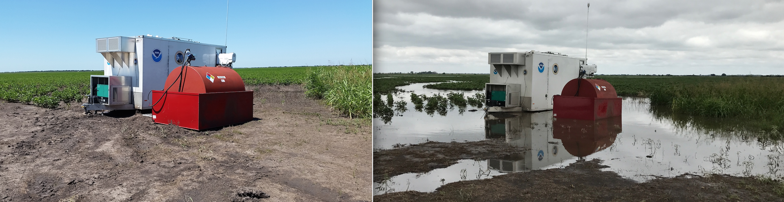
As a result of the storm, researchers got much more variable soil conditions than they expected during the measurement period.
“It was a very nice contrast in that, the first 10 days, it’s more of a typical August with high sensible heat flux relative to latent, and the last 10 days, it’s reversed—high latent heat fluxes and lower sensible,” Turner says.
Once the land dried out, the LAFE team again could see differences in fluxes across a variety of field covers, such as soybeans or pasture. Researchers wanted to find out more about how those different fluxes affect the boundary layer, which controls the exchange of momentum, energy, and water between the land and atmosphere.
“That was always a big part of this experiment,” Turner says.
What’s Next?
LAFE should provide a foundation to construct a more complete picture of land-atmosphere interactions for modeling purposes.
“Ultimately, we believe we have a very good data set,” Turner says. “We believe we’re going to learn a lot of things. The question will be, in the end, is it very representative of the central part of the U.S.? Do we need to perform a similar type of campaign in other regions, like, for example, over a forested region, which has a very different distribution of latent and sensible heat fluxes?”
Wulfmeyer already has plans for a LAFE-style campaign back home in Germany. He is creating the Land-Atmosphere Feedback Observatory, or LAFO, which uses the unique remote-sensing instrument setup implemented for LAFE. The systems, which measure moisture, temperature, and horizontal wind mean, gradient, and turbulence profiles, can scan from the surface throughout the atmospheric boundary layer up to 3,000 meters. Wulfmeyer will run the systems more routinely and for a longer time span than at the SGP.
The LAFE team hopes its research will help shape the future of boundary-layer representation in models so that one scheme can be used everywhere.
“We need to have a boundary layer scheme that’s able to handle different types of environments and different types of situations,” Turner says. “I can imagine having to do a couple versions of LAFE in different places to make sure that what we learn is transferrable to other locations.”
The ARM Climate Research Facility is a DOE Office of Science user facility. The ARM Facility is operated by nine DOE national laboratories, including Argonne National Laboratory.
Follow Us:


Keep up with the Atmospheric Observer
Updates on ARM news, events, and opportunities delivered to your inbox
ARM User Profile
ARM welcomes users from all institutions and nations. A free ARM user account is needed to access ARM data.


