Reconfiguring ARM: Arctic Eyes in the Sky
Published: 18 July 2016
Beginning routine collection of spatial information using unmanned aerial systems and tethered balloon systems

In 2014, the ARM Climate Research Facility began a major reconfiguration to more tightly link its measurements and atmospheric models. The reconfiguration strategy included high-resolution enhancements at its Southern Great Plains (SGP) site and upgrades at its North Slope of Alaska (NSA) site that will yield additional observations to support modeling and process studies. “Next-generation ARM,” then, is all about collecting, analyzing, and applying the finer-grained data required to refine the accuracy of earth systems models used to predict future climate scenarios.
Getting Airborne
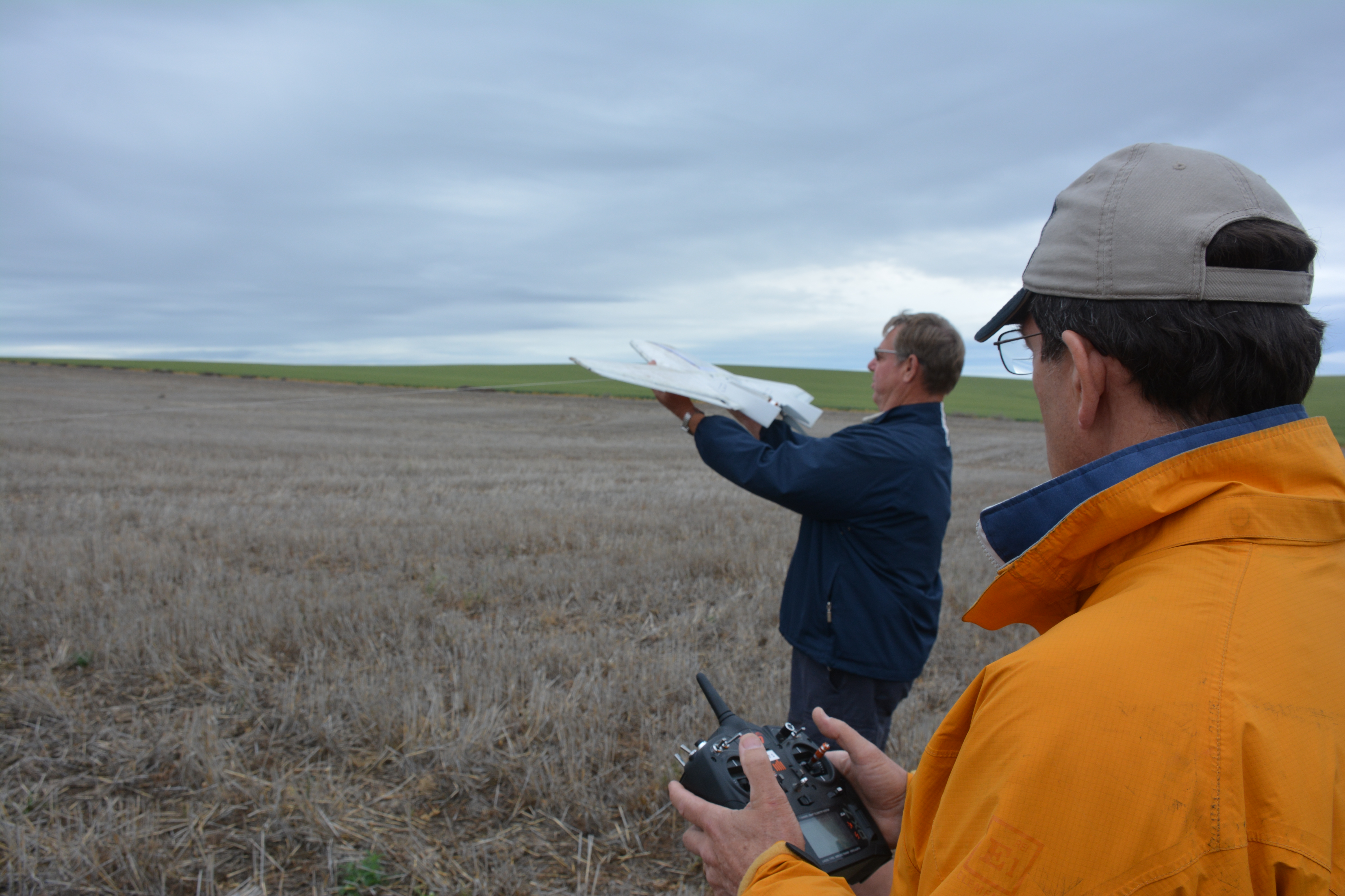
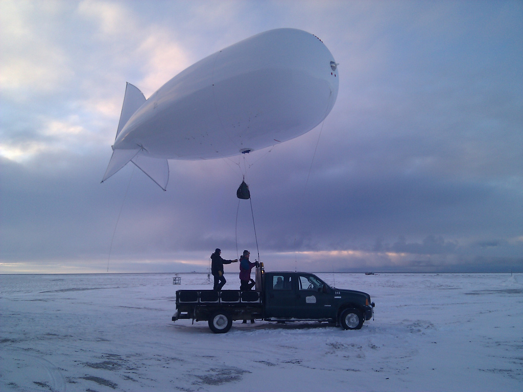
To that end, ARM has launched the Inaugural Campaigns for ARM Research using Unmanned Systems, or ICARUS, an internal initiative at the third ARM Mobile Facility at Oliktok Point, Alaska, that is collecting spatial information about the rapidly changing arctic environment using unmanned aerial systems (UAS) and tethered balloon systems (TBS) in conjunction with ground-based instruments. ICARUS is gathering data on surface radiation, heat fluxes, and vertical profiles of the basic atmospheric state (temperature, humidity, and horizontal wind), as well as turbulence, aerosol properties, and cloud properties.

The routine TBS and UAS flights at Oliktok were identified as high-priority, short-term actions in both the 2013 Polar Research with Unmanned Aircraft and Tethered Balloons Workshop and the 2014 North Slope of Alaska Priorities Workshop.
In some ways, ICARUS represents an internal effort similar to the Evaluation of Routine Atmospheric Sounding Measurements using Unmanned Systems (ERASMUS) campaign, during which external investigators, in two multi-week phases spread over 2015 and 2016, completed similar studies in the Arctic using ARM facilities. In contrast, however, ICARUS has no principal investigator (PI): It will be managed by ARM Aerial Facility (AAF) and NSA staff.
Learning Lessons “Way up North”
The ARM Facility experimented with deploying UAS at Oliktok Point last year during Arctic Shield 2015, a field campaign conducted in conjunction with the U.S. Coast Guard, the National Oceanic and Atmospheric Administration, Federal Aviation Administration, and Conoco Phillips. But ICARUS is ARM’s first foray into routine UAS and TBS operations, using ARM instruments and measurement platforms as well as ARM measurement processing conventions. ARM’s small DataHawk2 UAS are being flown by pilots from the Pacific Northwest National Laboratory and a contract pilot from the University of Alaska–Fairbanks, while the TBS are being operated by ARM staff based at Sandia National Laboratories.
ICARUS comprises a series of short measurement periods (few weeks) from April through October 2016. These repeat deployments are enabling sampling of a broad range of conditions at Oliktok. At least initially, this sampling are being restricted to sunlit months due to the difficulties of operating in the dark and extreme cold of the northern Alaskan winter.
“ICARUS will help us answer a major question: What ‘routine’ aerial measurements are possible at Oliktok Point with TBS and UAS?” says, Mark Ivey, NSA Facilities Manager from Sandia.
“Put it this way, Oliktok is a windy location on the North Slope of Alaska and weather conditions typically close our operating window between late October and late March. We’d like to get statistical representations of important atmospheric parameters with frequent flights, but we’re not sure what will be possible given the challenging conditions.”

The DataHawk2 platform is restricted in its carrying capacity, but the TBS can carry significantly heavier payloads. Initially, the TBS will focus on the basic atmospheric state, but later ARM plans to add a printed optical particle spectrometer (POPS) and, eventually, a turbulence package and a cloud particle imager for the final flights in October. A similar series of periodic measurements are planned for 2017 and beyond.
Small UAS and TBS provide the means to sample the environment immediately surrounding AMF3, but the ARM Facility also plans to deploy a mid-size UAS that will carry much larger payloads far from Oliktok. The Facility is purchasing a Navmar Applied Sciences Corporation TigerShark, to be known as the ArcticShark, that can carry up to 100 pounds to an altitude of up to 15,000 feet for up to 12 hours.
This mid-size UAS will provide the capability of sampling aerosol, and eventually cloud properties, along with radiation and a variety of atmospheric state parameters, well out over the Arctic Ocean, thus providing greater context for ARM measurements.
Lessons learned in operating these eyes in the sky “way up North” can then be applied in lower latitudes. Beat Schmid, AAF Facilities Manager, says those lessons are already coming in.
“We completed the first phase of flying the DataHawk for ICARUS at Oliktok Point in early June, clocking a dozen flights in nine days for a total of 7.5 hours airborne. We started the second phase on June 25 at Oliktok, and as of June 30, we’d logged another 12 flights with about 4.5 hours aloft. We started again on July 10.”
Summing up, Schmid notes, “Flying has been very challenging in difficult wind conditions. This is all new to our UAS operators.”
# # #
The ARM Climate Research Facility is a national scientific user facility funded through the U.S. Department of Energy’s Office of Science. The ARM Facility is operated by nine Department of Energy national laboratories including the Pacific Northwest National Laboratory, which leads management of the ARM Aerial Facility, and Sandia National Laboratories, which operates the North Slope megasite.
The ARM Climate Research Facility is a DOE Office of Science user facility. The ARM Facility is operated by nine DOE national laboratories, including .
Keep up with the Atmospheric Observer
Updates on ARM news, events, and opportunities delivered to your inbox
ARM User Profile
ARM welcomes users from all institutions and nations. A free ARM user account is needed to access ARM data.


