

25 Years of ARM Shows Benefits of Having Heads in the Clouds
Published: 23 May 2016
How ARM transformed the culture of atmospheric science
This is the first article in a series about the first 25 years of the ARM Climate Research Facility.
A monograph published online this spring by the American Meteorological Society tells the history—25 years of it so far—of what is now called the Atmospheric Radiation Measurement (ARM) Climate Research Facility. Today, it’s a multi-laboratory, multi-institution scientific user facility funded by the U.S. Department of Energy (DOE) Office of Science. It has three fixed and three mobile research sites—and aircraft—available to scientists worldwide. The ARM Facility now generates and archives trillions of bytes of continuous and reliable data on factors influencing Earth’s ever shape-shifting climate.

ARM’s core mission remains the same as when in 1989 it was just a detailed program plan submitted by three scientists in Washington, D.C., to the U.S. Global Change Research Program. The plan’s intent was to improve the predictive capability of general circulation models, and especially, how those models simulate cloud distribution and its impact on the Earth’s radiation balance.
The Monograph was released the week of the second joint meeting of ARM users and Atmospheric System Research (ASR) principal investigators in Virginia. Five years in the making, and with a print version available later this year, it is 30 chapters long: Four are introductory; eight are about ARM infrastructure, including sites, aircraft, and data systems; and 18 are technical, including overviews of water vapor, broadband radiometry, surface properties, aerosols in climate models, and other topics.
“There is a lot of science to be learned here, lessons about what to do and not to do,” said Jim Mather of Pacific Northwest National Laboratory (PNNL), who is ARM’s current technical director and Monograph contributing writer. “There is a story to tell, including how to organize collaborative science at this scale.”
To get a glimpse of ARM’s impact on current climate science, and its international influence on similar data-gathering projects, “just go down the list of chapters,” said Monograph co-lead editor David D. Turner, a physical scientist with the National Severe Storms Laboratory in Oklahoma, a branch of the National Oceanic and Atmospheric Administration (NOAA).
His co-editor is Robert Ellingson, a physical meteorologist now at Florida State University. Ellingson helped write the ARM Program plan in 1989, and once co-directed what is widely viewed as a prototype of ARM and its quantitative mission: the DOE-funded Spectral Radiance Experiment, or SPECTRE.
Turner, who started working with the ARM Program in 1994 at PNNL, sees the program in terms of three phases: the “very dynamic” period from 1990 to 1998, when previously lab-bound instrumentation became robust enough for turn-key field applications; 1999 to 2008, when ARM became operationally mature; and 2009 to the present, marked by organizational changes and a rapid expansion of instrumentation capacity.
What if ARM had not appeared? Climate science would now be “hugely delayed,” said Turner.
Prelude
ARM arrived on the climate science scene in early 1990, after DOE approved the program plan authored by Ellingson (then at the University of Maryland), Gerald Stokes (now a research professor at Stony Brook University), and David Sowle of the Mission Research Corporation (now retired and on the Board of Directors for Litel Instruments). It brought to bear an idea of continuous measurement and lab-spanning collaboration. Nine of DOE’s 17 national laboratories now take part; eight were on board during the 1990 launch.
“We said to the labs, ‘We want your best,’ and they gave us their best,” said Stokes, who led the ARM program-plan writing team and who in 1990 became the facility’s first chief scientist. The ARM philosophy was a first-ever break from a competitive culture in which labs competed for research funds.
“Only together,” wrote Argonne National Laboratory research meteorologist and ARM Instrument Coordinator Doug Sisterson in the Monograph, “did they have the required expertise.”
ARM’s arrival seemed, in a way, just in time. In the 1970s, concern over increasing carbon dioxide in the atmosphere at DOE and among scientists at large had mounted like darkening thunderheads. As early as the nineteenth century, carbon dioxide was prominent among gases thought to have a blanketing, heat-trapping “greenhouse effect” on the atmosphere. Around 1900, scientists speculated that carbon dioxide might have a grave warming effect on the Earth’s climate. Further postulations in the 1930s suggested, and measurements in the 1960s showed, that atmospheric levels of carbon dioxide were rising fast.
In the 1970s and 1980s, rising carbon dioxide levels prompted concern over uncertainties within that era’s global climate models. How much did carbon dioxide and other radiative forcing agents change the energy balance of the atmosphere? How well did the parameterizations of such climate models agree with ground-based measurements of water vapor and other factors? What about the role of clouds, which one Monograph author called the “thermostatic regulators” of the Earth’s climate? (Cloud radiative forcing was not understood well enough to inform reliable climate models.)
Public interest in climate change had accelerated too, prompted in part by a killer heat wave in 1988 that struck the United States that summer. Stokes wrote in his Monograph chapter, “Original ARM Concept and Launch,” that the heat wave killed up to 10,000 Americans and caused “more than $70 billion in weather-related economic losses.” That same year, in another sign of a building momentum of interest, the Intergovernmental Panel on Climate Change was founded.
In the 1980s, DOE commissioned a set of reports to assess the uncertainties of climate models, demonstrating that such models offered too wide a range of predictions regarding climate changes caused by greenhouse gases. Starting in 1982, DOE sponsored a series of intercomparison studies of radiation models in clouds. They determined, according to Ellingson’s co-authored “Prelude” chapter in the Monograph, that “cloud radiative feedback is the single most important effect determining the magnitude of possible climatic responses to human activity.” That conclusion, he added, led to the establishment of the ARM Program.
Deployment
“We were starting somewhat from scratch,” wrote Sisterson in his Monograph chapter, “Deploying the ARM sites and Supporting Infrastructure.” A systematic, data-driven, instrument-centered study of Earth’s climate had never been done. Science needed a framework for improving climate-model simulations with instruments that observed the atmosphere from the ground as intelligently as the space-based measurement programs of NOAA and the National Aeronautics and Space Administration.
The key was to establish well-instrumented ground research sites in the world’s key climate regions, including its equatorial and polar extremes. “The largest net energy input is at the equator,” said Mather, who has been associated with ARM for most of the last 22 years. “And the greatest net energy loss is at the poles.”
With an eye on key locations for research, ARM’s first 8 years focused on site selection and development, choosing and developing instruments, and other logistical necessities. Having an operative philosophy helped. From the beginning, ARM was conceived as a multi-laboratory effort and its execution would be speeded by this unified approach, where each lab would have a predetermined role. The first ARM Program plan, in 1990, arose from the 1989 document as well as from a series of intense workshops facilitated by Wise Integrated Systems Development Methodology (WISDM). That third-party workshop strategy dampened potentially divisive lab loyalties and competing scientific egos. The logistics of getting ARM deployed, after all, required the labs acting in concert. It required bringing together the full weight of operational and science expertise in managing large infrastructure projects and in managing the instrumentation and data required.
Deploying ARM also benefited from a convening personality like Stokes. Former ARM Technical Director Ted Cress called him “the philosopher” for his farsightedness in establishing these early principles of collaboration. One-time ARM communications specialist Nancy Burleigh, remarking on Stokes’s passionate work ethic, recalled a nickname for him back then, “the Energizer Bunny.”
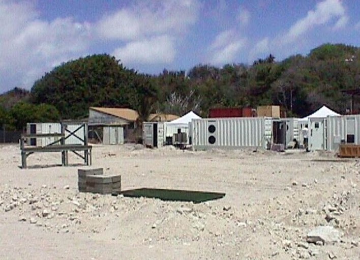
ARM’s initial focus was tripartite, said Stokes: Making cloud and radiation measurements, doing ongoing experiments at appropriately short physical and temporal scales, and amassing relevant data any climate researcher could use. By 1992, about 18 months after the ARM Program was approved, the first fixed research site was deployed. Today, the Southern Great Plains (SGP) is the largest climate research field site in the world (55,000 acres and 50-plus instrument clusters). In 1993, the first ARM field research campaign took place at SGP.
“We proved the value of these base stations” said Stokes, which supplemented campaign-based atmospheric science research with long-term observations.
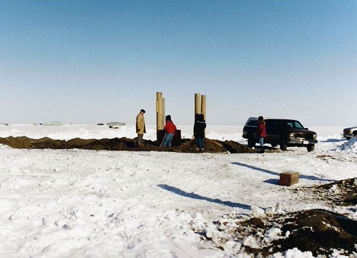
An ambitious string of ARM sites followed: The first Tropical Western Pacific (TWP) in 1996, on Manus Island in Papua New Guinea; the Barrow, Alaska, North Slope of Alaska (NSA) site in 1997; a TWP facility on Nauru Island in 1998; a second Alaska site, south of Barrow in remote Atqasuk, in 1999; and in 2002 a new TWP facility in Darwin, Australia. In 2005, to expand research sites into more of the world’s climate-sensitive regions, ARM deployed its first mobile facility (AMF).
Stokes remembers flying into Nauru aboard a plane stacked with palm fronds and landing on the tiny island nation’s sole airstrip. Travel aside, he reflected on ARM’s widening and deepening international impact on climate research. “It was an exciting time,” said Stokes. “We changed the way people used data for weather science.”
Part 2 in the series will be, “How It Grew: ARM’s scientific and operational maturation.”
# # #
The ARM Climate Research Facility is a national scientific user facility funded through the U.S. Department of Energy’s Office of Science. The ARM Facility is operated by nine Department of Energy national laboratories.
The ARM Climate Research Facility is a DOE Office of Science user facility. The ARM Facility is operated by nine DOE national laboratories, including .
Follow Us:


Keep up with the Atmospheric Observer
Updates on ARM news, events, and opportunities delivered to your inbox
ARM User Profile
ARM welcomes users from all institutions and nations. A free ARM user account is needed to access ARM data.


