

Observationalists and Modelers Work Toward Common Goals at GEWEX Workshop
Published: 24 July 2023
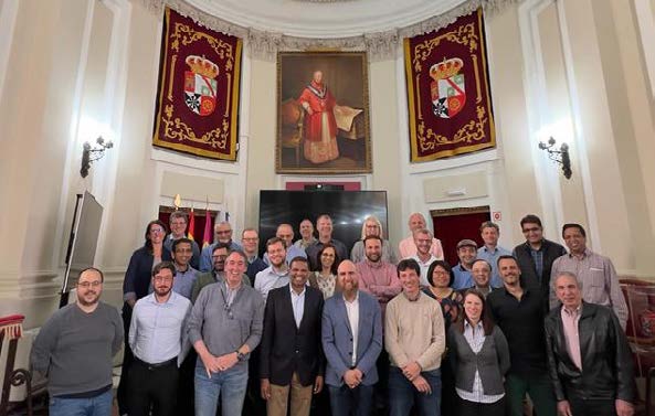
ARM/ASR community members attend to help make progress on issues related to the study of land-atmosphere processes
An important international climate workshop in spring 2023 brought together observationalists and modelers to look at how ground-based data, satellite observations, and modeling could be better integrated to inform the study of land-atmosphere processes.
The Global Energy and Water Exchanges (GEWEX) Integrated Product Workshop took place from April 11–13 in Toledo, Spain, at a unique historical venue, the Cardenal Lorenzana Palace and library of the University of Castile-La Mancha. Details on the workshop, including the agenda and list of presenters, are available on the event website.
Christian Kummerow of Colorado State University led the meeting, which included involvement from representatives of the U.S. Department of Energy’s Atmospheric Radiation Measurement (ARM) user facility and Atmospheric System Research (ASR) community.
One of the workshop’s co-organizers was ARM Director Jim Mather, who also attended and co-wrote a meeting report that appears on pages 13–15 of the Quarter 2 2023 GEWEX newsletter. ASR principal investigator Yunyan Zhang and recent ASR co-investigator Tristan L’Ecuyer were among the report’s co-authors.
Other participants from the ARM/ASR community included Larry Berg, William Gustafson, Petra Klein, Shawn Serbin, and Dave Turner.
GEWEX is a core project of the World Climate Research Programme (WCRP). WCRP was established in 1980 under the joint sponsorship of the International Science Council and World Meteorological Organization to coordinate multidisciplinary, international research on key climate questions. This research underpins the U.N. Framework Convention on Climate Change.
The objective of this workshop was to make progress on quantifying state-dependent errors in evaluating climate data records. These errors, caused by inaccurate assumptions in satellite algorithms, relate to water and energy fluxes.
The specific target in Toledo was the consistency, closure, and underlying processes of the terrestrial water cycle, from both observational and modeling perspectives. While the objectives were global, there was also considerable discussion on the role of well-instrumented ground sites, including ARM’s flagship Southern Great Plains atmospheric observatory centered in Oklahoma. These sites guided the assessment and provided the high-resolution physical information needed to fully understand the processes under scrutiny.
Workshop Goals and Findings
Workshop attendees explored how to determine what processes, meteorological background, and land conditions and dynamics affect our ability to upscale local observations and models to a global framework. A second goal was to identify primary sources of errors and uncertainties in making these translations to a global scale.
Key findings were:
- Regional water and energy budget closure studies should be used to stress-test measurements as part of science and model validation plans.
- Extensively instrumented ground sites, such as ARM’s upcoming long-term mobile observatory in Alabama, could be leveraged for process studies and to gain insights into the connections between soil and atmosphere parameters.
- More effort should be invested in describing the diurnal temperature of soil temperature measurements from satellites.
- Improving soil moisture measurements from satellites may benefit from diverse training data, including high-quality precipitation measurements and uncrewed aerial system (UAS) measurements of soil moisture and temperature over long time periods at landscape scales.
- Co-variance of water and energy parameters should be more fully exploited in model development and validation.
- Studies should be supported that focus on using satellite data to verify model simulations of water cycle processes at subseasonal to seasonal scales (three weeks up to two years). This could lead to rapid advances in forecasting at this scale.
- Activities should be supported that make use of collaborations to work toward these goals. Of particular interest are measurements that provide data continuity related to the water cycle and ground-based and aerial measurements (including UAS) that provide fine-scale observations.
“This interdisciplinary and international GEWEX workshop brought together scientific communities that don’t normally engage with one another, finding important issues at that intersection,” says Mather. “Making progress on those issues will require strong continued collaboration.”
Follow Us:


Keep up with the Atmospheric Observer
Updates on ARM news, events, and opportunities delivered to your inbox
ARM User Profile
ARM welcomes users from all institutions and nations. A free ARM user account is needed to access ARM data.


