Instruments on Mt. Pico to Supplement Measurements from Graciosa Island
Published: 31 May 2010

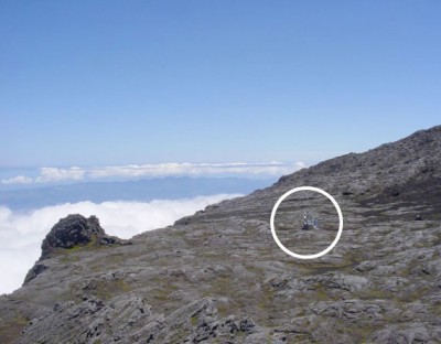
Located high on Mount Pico in the Azores, the University of the Azores, the University of Colorado, and Michigan Technological University operate an instrumented observation station, the Pico Observatory. In May, a small team of local volunteers from Pico Island helped install a set of ARM radiometers near the observatory for the Above-Cloud Radiation Budget Near Graciosa Island field campaign. This radiometer deployment will greatly enhance the utility of the data set collected by the ARM Mobile Facility site on Graciosa Island, which is visible to the north of the Pico Observatory, by enabling measurements of the amount of radiation that enters the top of the cloud layer above Graciosa.
The difference between the measurements at Pico and those on the surface of Graciosa Island, where the AMF is obtaining detailed measurements of the cloud structure and radiation at the surface, reflect the impact of the marine clouds upon the transmission of radiation through the lower atmosphere. Radiation that permeates these clouds is ultimately used to heat the ocean below.

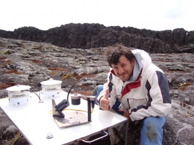
Mike Alsop, the AMF lead technician, designed, built, and tested the radiometer collection at the AMF site on Graciosa prior to its trip over to Pico. Leaving from the Pico Mountain Natural Preserve trailhead at an elevation of about 900 meters, a team of local volunteers, led by new AMF technician Carlos Sousa, hiked the rest of the way up the mountain with instruments and tools totaling 90 kilograms secured in their backpacks. Their route up the mountain totaled approximately 4000 meters, changing from lush vegetation near the bottom to nearly barren rock at their final destination.
Outside the observatory, Sousa secured a small instrument platform to the mountain surface, then attached the radiometers to the platform and made sure everything was level. He then connected the data system to the observatory, about 15 meters away, with data collection beginning on May 11. The AMF ancillary instruments on Pico are scheduled to operate until September, while the full instrument system on Graciosa will operate through December 2010.
The ARM Climate Research Facility is a DOE Office of Science user facility. The ARM Facility is operated by nine DOE national laboratories, including .
Keep up with the Atmospheric Observer
Updates on ARM news, events, and opportunities delivered to your inbox
ARM User Profile
ARM welcomes users from all institutions and nations. A free ARM user account is needed to access ARM data.


