

Explosive Origins of ‘Secondary’ Ice—and Snow
Published: 23 March 2021
Definitive, real-world evidence for “freezing fragmentation” of drizzle as a major source of ice in slightly supercooled clouds has important implications for forecasting weather and climate
Where does snow come from? This may seem like a simple question to ponder as half the planet emerges from a season of watching whimsical flakes fall from the sky—and shoveling them from driveways. But a new study on how water becomes ice in slightly supercooled arctic clouds may make you rethink the simplicity of the fluffy stuff.
This study, published in March 2021 by the Proceedings of the National Academy of Sciences, includes new direct evidence that shattering drizzle droplets drive explosive “ice multiplication” events.
“Our results shed new light on prior lab-experiment-based understanding about how supercooled water droplets—water that’s still liquid below its freezing point—turn into ice and eventually snow.”
Lead author Edward Luke, Brookhaven National Laboratory
Researchers made this discovery analyzing years of cloud radar and weather balloon data from the Atmospheric Radiation Measurement (ARM) user facility’s North Slope of Alaska atmospheric observatory. The U.S. Department of Energy’s Atmospheric System Research (ASR) and NOAA funded the data analysis.
The findings have implications for weather forecasts, earth system modeling, water supplies—and even energy and transportation infrastructure.
“Our results shed new light on prior lab-experiment-based understanding about how supercooled water droplets—water that’s still liquid below its freezing point—turn into ice and eventually snow,” said the paper’s lead author, Edward Luke, an atmospheric scientist at Brookhaven National Laboratory in New York.
The new results, from measurements in mixed-phase clouds (composed of liquid water and ice) at temperatures between zero and minus 10 degrees Celsius (32 and 14 degrees Fahrenheit), provide evidence that freezing fragmentation of drizzle drops is important to how much ice will form and potentially fall from these clouds as snow.
“Now climate models and the weather forecast models used to determine how much snow you’ll have to shovel can make a leap forward by using much more realistic physics to simulate ‘secondary’ ice formation,” Luke said.
What Is Secondary Ice?
Precipitating snow from supercooled clouds usually originates from “primary” ice particles, which form when water crystallizes on select tiny specks of dust or aerosols in the atmosphere, known as ice-nucleating particles. However, at slightly supercooled temperatures (i.e., zero to minus 10 degrees C), aircraft observations have shown that clouds can contain far more ice crystals than can be explained by the relatively few ice-nucleating particles present.
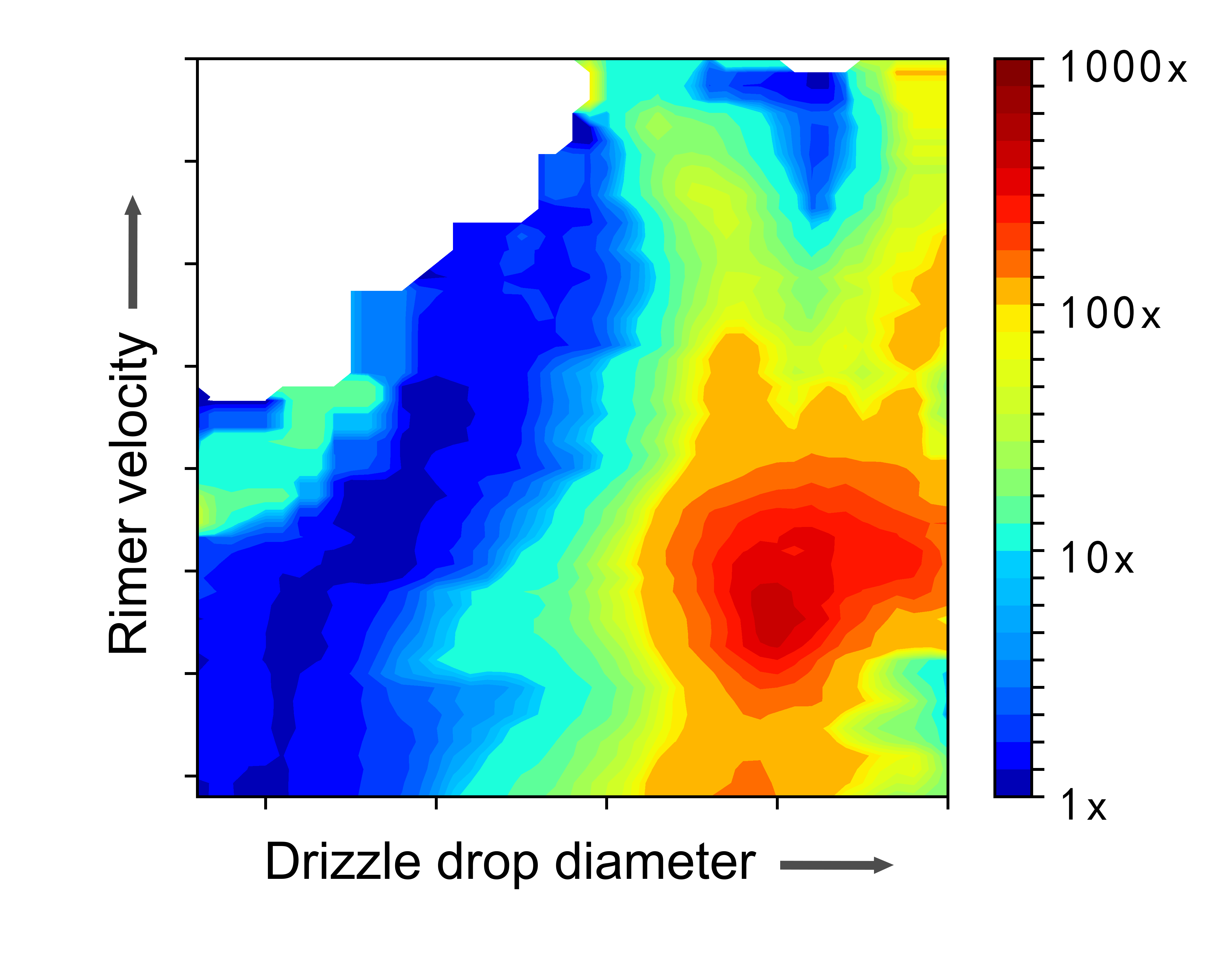
Scientists have thought that the explanation is “secondary” ice production, in which the additional ice particles are generated from other ice particles. The new results from the Arctic show that larger supercooled water droplets, classified as drizzle, play a much more important role in producing secondary ice particles than commonly thought.
“When an ice particle hits one of those drizzle drops, it triggers freezing, which first forms a solid ice shell around the drop,” explained Fan Yang, a co-author on the paper. “Then, as the freezing moves inward, the pressure starts to build because water expands as it freezes. That pressure causes the drizzle drop to shatter, generating more ice particles.”
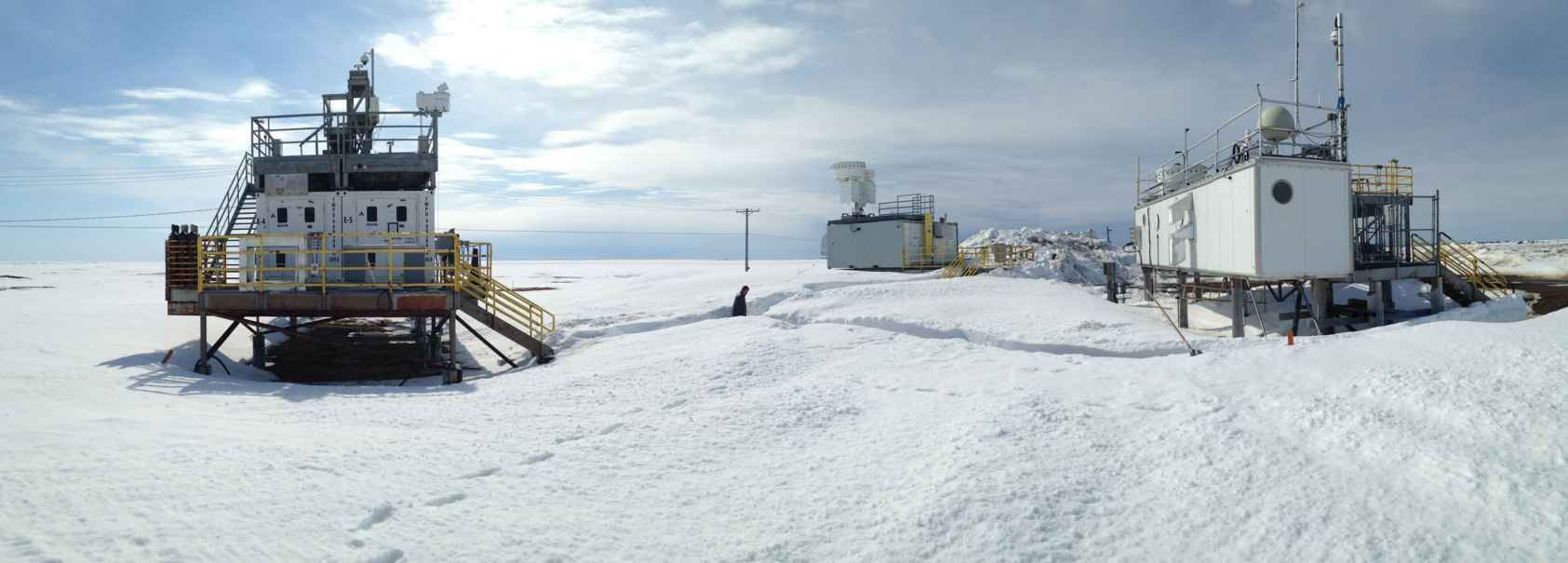
The new results hinge upon six years of ARM data gathered by an upward-pointing millimeter-wavelength Doppler radar in Utqiaġvik (formerly Barrow), Alaska. The radar data are complemented by measurements of temperature, humidity, and other atmospheric conditions collected by weather balloons launched from Utqiaġvik throughout the study period.
Brookhaven Lab atmospheric scientist and study co-author Pavlos Kollias, who is also a professor at Stony Brook University, was crucial to the collection of the radar data in a way that made it possible for the scientists to deduce how secondary ice was formed.
“ARM has pioneered the use of short-wavelength cloud radars since the 1990s to better understand clouds’ microphysical processes and how those affect weather on Earth today,” Kollias said. “Our team led the optimization of their data sampling strategy so information on cloud and precipitation processes like the one presented in this study can be obtained.”
For more information, read the full news release from Brookhaven Lab.
Follow Us:


Keep up with the Atmospheric Observer
Updates on ARM news, events, and opportunities delivered to your inbox
ARM User Profile
ARM welcomes users from all institutions and nations. A free ARM user account is needed to access ARM data.


