Arctic Research Soars to New Heights
Published: 5 May 2020
This story was originally published on the Cooperative Institute for Research in Environmental Sciences (CIRES) website.

Radiance Calmer holds the wide wings of an unmanned aerial system (UAS) in place on its launcher, scanning the blue Boulder, Colorado, sky for potential obstacles. Behind her, Jonathan Hamilton stands with a controller in hand. Calmer counts down, “Three … two … one … zero!” and releases. The UAS flies off the launcher, hovers just a few feet above the ground for a precarious moment, and then zooms into the clouds at 35 mph.
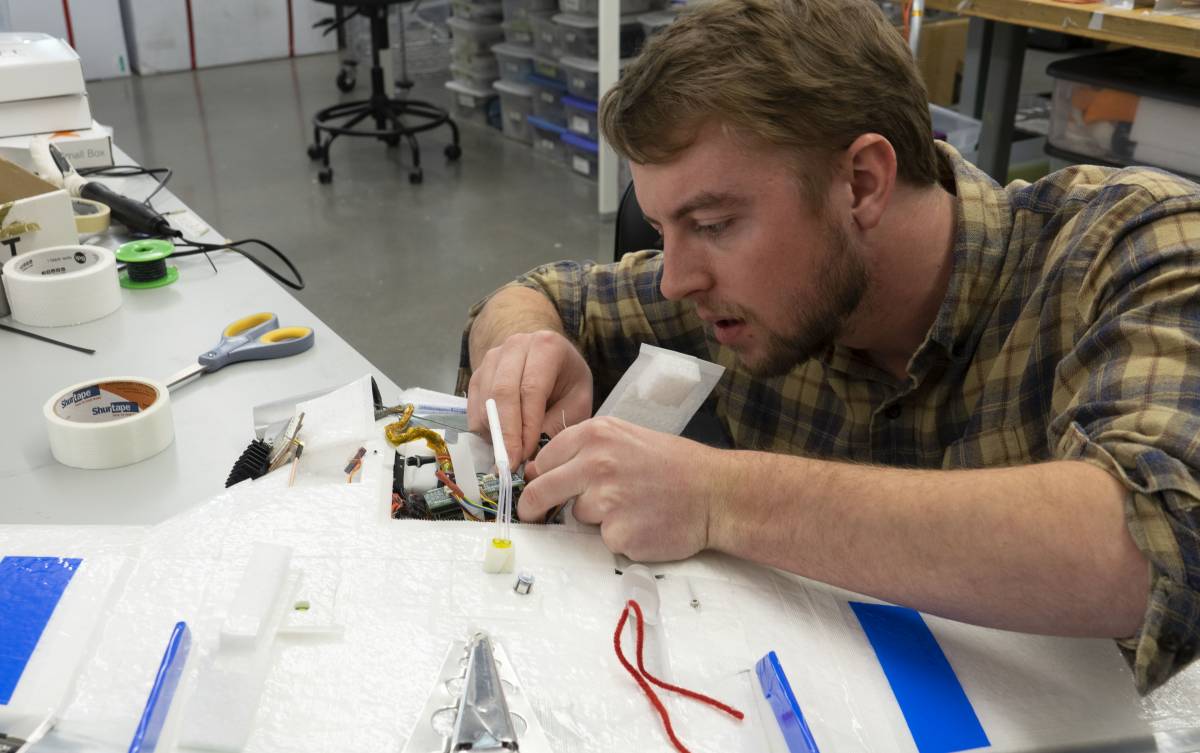
That February 2020 practice run was just one of two years’ worth of flight tests preparing for an arctic mission that is pushing the limits in atmospheric research.
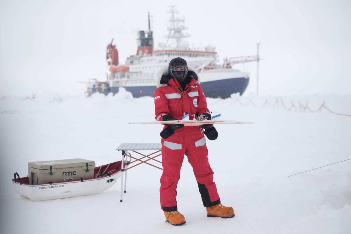
Calmer, a postdoctoral researcher with the Cooperative Institute for Research in Environmental Sciences (CIRES), and Hamilton, an aerospace engineering graduate student at the University of Colorado, Boulder (CU), leave in May for the Multidisciplinary Drifting Observatory for the Study of Arctic Climate (MOSAiC) expedition. There, they will pilot UAS to collect atmospheric data over the frozen Arctic Ocean. The project, spanning several months, involves 20 UAS outfitted for atmospheric science and marks the first time UAS have been used to gather near-surface atmospheric readings so far north.

Gina Jozef, a PhD candidate in CIRES and CU Boulder’s Atmospheric and Oceanic Sciences department, has been blogging about her experience aboard the German icebreaker R/V Polarstern, which is frozen into drifting arctic ice. “Throughout the week, we did seven successful flights (and two unsuccessful flights), which is a record!” Jozef wrote in early April.
The UAS project is largely the brainchild of Gijs de Boer, a CIRES scientist affiliated with NOAA’s Physical Sciences Laboratory. Although the work for MOSAiC is funded by the National Science Foundation (NSF), many of de Boer’s research campaigns have been supported by the U.S. Department of Energy’s (DOE) Atmospheric Radiation Measurement (ARM) user facility, where he serves as the DOE Atmospheric System Research (ASR)-funded science lead for ARM’s efforts at Oliktok Point, Alaska. He also co-chairs ASR’s High Latitude Processes Working Group.
De Boer’s journey to MOSAiC began in 2012 when he wrote a review paper on the importance of arctic clouds in atmospheric processes. “I realized that we (didn’t) necessarily have the right observational tools to fully measure all the things that come together to support the life cycle of these clouds,” de Boer says.
He began experimenting with unmanned aircraft as a way to collect missing pieces of atmospheric data not only in the Arctic but across the globe. He has also conducted UAS research in slightly warmer places, like Barbados.
UAS could help close some knowledge gaps: for example, the lower atmosphere in remote arctic regions where low-altitude flights on manned research aircraft are dangerous. UAS also allow for flexibility; a pilot can quickly direct a UAS to interesting features in the landscape like cracks in the ice.

The UAS on the German icebreaker R/V Polarstern carry instruments to measure things like temperature, wind, humidity, and solar intensity. Together, these measurements provide a profile de Boer hopes will help scientists and funders, including the National Science Foundation, better understand how much energy is transported between ocean and atmosphere in the Arctic.
Calmer and Hamilton will be on MOSAiC’s “new leg 4,” with an adjusted timeline caused by the COVID-19 pandemic. From May to late August, the team will watch part of the arctic atmosphere transition from spring to summer, as sea ice melts. Shifts in the arctic melt season are a major climate change indicator, with temperatures rapidly rising over the north polar region and implications for warming around the rest of the planet.
Hamilton estimates that he’s spent at least 41 hours flying UAS, in Boulder and in Svalbard, Norway, where he and de Boer traveled in spring 2019 to put their systems through the paces in an environment that’s more similar to what they will face on MOSAiC.
Despite meticulous planning and testing, uncertainties remain. A lack of satellite imagery makes planning launching points difficult, and ice ridges can complicate equipment placement. Jozef already found that batteries drain faster than expected, leading to some premature landings in risky locations on the ice.
Those uncertainties are part of pressing the boundaries on atmospheric research. “If we come back with all 20 drones, I’m going to be a bit disappointed,” de Boer says. “It likely means we weren’t pushing our limits far enough or that outside factors prevented us from (more flights).”
This story was written by Julia Medeiros, University of Colorado, Boulder. The original story appears on the CIRES website.
Keep up with the Atmospheric Observer
Updates on ARM news, events, and opportunities delivered to your inbox
ARM User Profile
ARM welcomes users from all institutions and nations. A free ARM user account is needed to access ARM data.


