

New Radar Plan Delivers for Users
Published: 15 June 2017
A year ago, as shared in a previous news feature, the ARM Climate Research Facility implemented a plan to focus its radar maintenance efforts in a new way. The aim was to maximize the production of reliably high-quality data from the most important units at ARM’s three fixed and three mobile atmospheric observatories. Work was to be done intensively on a set of five key radars at a time to optimize their operational performance, and then move on to the next five.
Since then, while ARM’s radar engineers have been tuning up the hardware, they have also been busy creating a program to convert raw radar output data into a user friendly common format that provides consistency between units.
This interfacing effort, started from scratch, is already 60 percent complete. For users, this means cleaner data, ready to analyze, available as usual from the ARM Data Archive. Calibrated data helps in quantitative analysis, speeding the production of scientific results, thereby increasing ARM’s impact and value.
ARM’s Radar Team: Boots on the Ground

The improved data quality represents a big change from ARM’s pioneering phase when the radars were operated so much—and moved so often and so far, typically from one climate extreme to another—that there was little time for routine calibration and characterization.
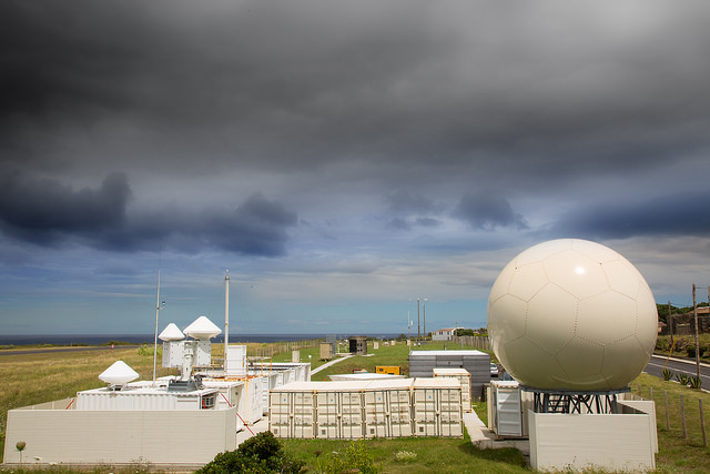
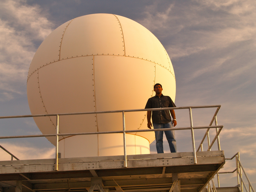
This careful maintenance is paying dividends. For example, the radars at ARM’s Eastern North Atlantic (ENA) site in the Azores and those in the third ARM Mobile Facility (AMF3) have been calibrated so that they are all consistent with each other.
At ENA, Brad Isom of the radar team performed the testing and calibration with a test set-up designed and built by the team itself.
“This is unprecedented,” says Nitin Bharadwaj, ARM’s radar engineering group lead at Pacific Northwest National Laboratory (PNNL). “It’s largely due to the implementation of the radar plan by, first, Brad at ENA, and then by Joe Hardin in AMF3, which is still ongoing.”
Overall, the radar plan is going well and the process is on schedule, says Bharadwaj, though it’s been a challenge to coordinate between ARM sites and staff spread across the national lab system. “We’re making it work: progress has been good, but there’s lots more to do.”
The radar team comprises people from several labs, including Brookhaven (BNL), Los Alamos (LANL), Sandia (SNL), Argonne (ANL), and PNNL. The team currently includes Bharadwaj, Andrei Lindenmaier, Joe Hardin, Brad Isom, and Alyssa Matthews at PNNL, Karen Johnson at BNL, Todd Houchens at SNL, Peter Argay at LANL, and onsite radar staff at the Southern Great Plains (SGP) observatory in Oklahoma, managed by ANL. They are supported by site operations contractors and people from other groups within ARM infrastructure such as the Data Quality Office, the Data Management Facility, translators, and data product developers at multiple laboratories. These individuals are helping to evaluate data and build new data products that are consistent across multiple radar systems.
A lot of their radar work is done onsite, but they bring components back to PNNL, the main location, if extensive rebuilding is required. The work is exacting and extremely technical—most radar engineers have an electrical or electronics engineering background. The radar team is rightly proud of their work: they just wish they would received more feedback from scientists who use the data their equipment produces to ensure it is meeting the broader community’s needs.
Tuning Up, Zeroing In
Work completed to date includes:
- Ka-Band ARM Zenith Radar (KAZR) and Scanning Cloud Radars: The KAZR and scanning ARM cloud radars at ENA and AMF3 were configured, calibrated, and set up for baseline operations. Final calibration for these units at the Oliktok Point, North Slope of Alaska (NSA) site is to be verified with the latest measurements done this May.
- X-Band Scanning ARM Precipitation Radar (X-SAPR): All the Southern Great Plains (SGP) site units have been upgraded with a newer radar control processor. One of the three is operational while the other two are being tested. A second-generation X-SAPR was also installed and accepted at ENA.
- Marine W-Band (95 GHz) ARM Cloud Radar (MWACR)/W-Band (95 GHz) ARM Cloud Radar (WACR): All three transmitters have been repaired, tuned, and configured for operations. The MWACR is ready for the Measurements of Aerosols, Radiation, and Clouds over the Southern Ocean (MARCUS) campaign upcoming in September, while the WACR was sent back for operations on Ascension Island in the Layered Atlantic Smoke Interactions with Clouds (LASIC) campaign, which runs through October.
Get ‘er Done
The reusable process, or “pipeline,” that the engineers have developed to optimize each radar includes data flow. This is an end-to-end set-up from the radar in the field to the data in the archive. Data analysis that combines calibration and quality control (QC) must be done by the team to get the data in a science-ready state. Problems discovered are logged in data quality reports, and these issues are then resolved, if possible, by staff at ARM’s radar engineering and operations at PNNL.
The first phase of the radar plan will conclude by the end of 2017—a significant milestone that the team is confident of achieving, and from which data-hungry scientists will benefit via the steady delivery of reliably accurate data from a wide variety of global settings. Meanwhile, in the next six months the radar plan will be updated to guide the team in their next phase of maintenance and optimization.
ARM maintains a network of almost 30 radars, the most comprehensive research radar network in the world. ARM’s radar capabilities continue to be at the forefront of new multi-frequency and dual-polarization radars, both for zenith profiling and scanning radars.
The ARM Climate Research Facility is a DOE Office of Science user facility. The ARM Facility is operated by nine DOE national laboratories.
Follow Us:


Keep up with the Atmospheric Observer
Updates on ARM news, events, and opportunities delivered to your inbox
ARM User Profile
ARM welcomes users from all institutions and nations. A free ARM user account is needed to access ARM data.


