

Updated: Quality-Assured SAIL X-Band Radar Data Available for Evaluation
Published: 3 July 2025
Editor’s note (July 3, 2025): The final evaluation release of the Corrected Moments in Antenna Coordinates (CMAC) value-added product for the Surface Atmosphere Integrated Field Laboratory (SAIL) campaign’s X-band precipitation radar is now available. Scientists can use data from this product, known as XPRECIPCMAC, from November 2, 2021, to April 1, 2022, and December 31, 2022, to June 16, 2023. In addition, the Surface Quantitative Precipitation Estimation (SQUIRE) evaluation product for SAIL has been expanded to cover the full 2021–2022 and 2022–2023 winter seasons (December 1, 2021, to April 1, 2022, and December 1, 2022, to March 31, 2023). The XPRECIPCMAC and SQUIRE data for SAIL are available from the ARM Data Center. Below is a 2023 data announcement describing the initial evaluation releases for XPRECIPCMAC and SQUIRE.
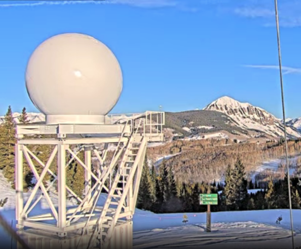
During the 2021–2023 Surface Atmosphere Integrated Field Laboratory (SAIL) campaign near Crested Butte, Colorado, the Atmospheric Radiation Measurement (ARM) user facility supported the deployment of an X-band scanning radar from Colorado State University, which provided observations for the calculation of precipitation estimates.
There could be some challenges in working with data directly from the radar. At times, the radar’s beam was blocked because of large variations in terrain height around the instrument, which was located on Crested Butte Mountain. Also, relating radar measurements to snowfall is difficult because the shapes of the ice crystals that make up snowfall are complex.
To help overcome these challenges and provide a quality-assured data set, ARM performed additional processing of the radar data using a new workflow called Surface Quantitative Precipitation Estimation (SQUIRE). The SQUIRE workflow projects the data from native antenna coordinates to Cartesian coordinates and extracts the lowest gate, or 3-dimensional (3D) grid point, available for each grid cell in the domain. This provides data fields on a grid that modelers or other scientists can add to their analysis, including surface estimates of liquid precipitation.
SQUIRE builds off the Corrected Moments in Antenna Coordinates (CMAC) value-added product for the X-band radar. CMAC corrects raw data for atmospheric phenomena and instrument characteristics, and it also retrieves precipitation quantities from the radar measurements. The CMAC product for the X-band radar, known as XPRECIPCMAC, includes corrections related to beam blockage, dealiased Doppler velocities, corrected reflectivity for liquid water path attenuation, differential phase corrected for non-uniform beam filling, and the integration of individual sweeps into volumes.
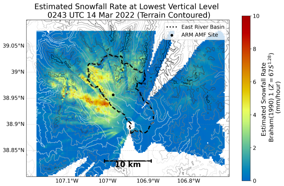
Within SQUIRE, CMAC precipitation estimates (derived from an ensemble of existing radar reflectivity and snowfall rate relationships) are then gridded to a Cartesian grid, with 250-meter horizontal and vertical grid spacing and a spatial domain of 20 kilometers (x) x 20 kilometers (y) x 5 kilometers (z), all in units of distance from the radar. For more details, please see the SQUIRE documentation. The lowest vertical level not blocked by terrain is calculated, and the data set is subset for this vertical level, with the fields valid at the lowest vertical level for each grid point.
SQUIRE evaluation data from January 7 to April 1, 2022, and from December 1, 2022, to March 31, 2023, are available in the netCDF format. Access the data in the ARM Data Center. (To download the data, create an ARM account.)
The XPRECIPCMAC evaluation product is also freely available in the ARM Data Center.
More information about these products can be found on the SQUIRE and XPRECIPCMAC web pages.
To get additional details about the X-band radar, see the instrument web page. Methodology and examples of using the radar data for scientific analysis are on GitHub.
For questions or to provide feedback on the SQUIRE and XPRECIPCMAC data, please contact Scott Collis, Maxwell Grover, Robert Jackson, Zachary Sherman, or Joseph O’Brien. Because the data are in evaluation mode, users are asked to communicate closely with the points of contact, especially if they find issues.
Data can be referenced as doi:10.5439/1884979 for SQUIRE and doi:10.5439/1883164 for XPRECIPCMAC.
Follow Us:


Keep up with the Atmospheric Observer
Updates on ARM news, events, and opportunities delivered to your inbox
ARM User Profile
ARM welcomes users from all institutions and nations. A free ARM user account is needed to access ARM data.


