

New Precipitation Radar Data Products Released for 2 ARM Observatories
Published: 17 November 2022
New precipitation radar data products processed with version 2 of the Corrected Moments in Antenna Coordinates (CMAC) value-added product are now available from the Atmospheric Radiation Measurement (ARM) user facility.
The new X-Band Scanning ARM Precipitation Radar (XSAPR) products are for the North Slope of Alaska (NSA) and Southern Great Plains (SGP) atmospheric observatories.
Raw data from ARM precipitation radars must be corrected for atmospheric phenomena and instrument characteristics (e.g., attenuation, clutter) to retrieve precipitation properties. CMAC contains a set of algorithms and code that makes such corrections, and it also retrieves precipitation quantities from the radar measurements.
Scientists can use the SGP and NSA evaluation products to analyze XSAPR data from both observatories.
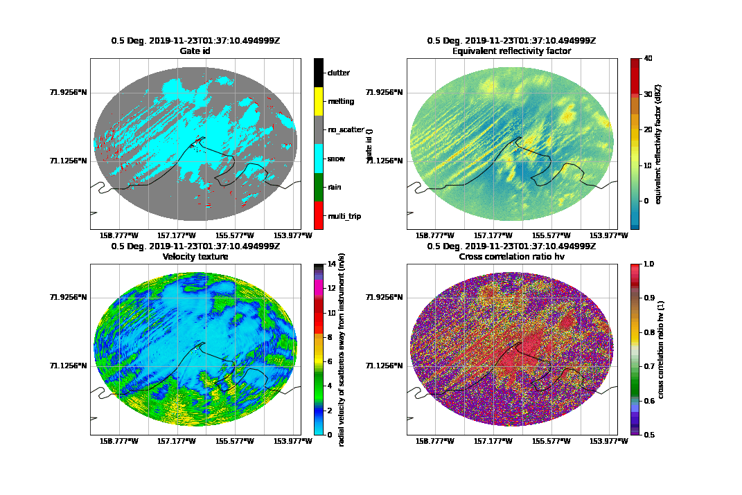
Using the NSA product, researchers can learn more about microphysical and dynamical processes in the Arctic. For this release, CMAC code was adjusted to filter and process data collected in extreme weather.
The NSA data are from November 21, 2019, to September 24, 2020, and can supplement observations from the 2019–2020 Multidisciplinary Drifting Observatory for the Study of Arctic Climate (MOSAiC) expedition in the central Arctic.
The SGP data are from a summer scanning experiment held from May to September 2018. Researchers can use these data to evaluate the microphysical and dynamical retrieval strategies tested during the SGP summer experiment.
The SGP and NSA XSAPR data and fields have been processed with CMAC to:
- correct for velocity aliasing
- unfold and generate a cross-polarimetric phase difference that is monotonically increasing, removing impulses caused by non-uniform beam filling and phase shift on backscatter
- recalculate the specific differential phase using a 20-point Sobel filter on the aforementioned phase
- correct for liquid path attenuation using the polarimetric signals
- correct for clutter due to oil and gas pipelines at the NSA and wind farms at the SGP.
CMAC provides data in a netCDF file using CF-Radial conventions.
Scientists can begin using the new XSAPR evaluation data products now. Scans at a constant elevation (plan position indicator mode) are available from the NSA XSAPR. Sector scans are available from the SGP XSAPRs at Billings, Garber, and Deer Creek, Oklahoma. Scans at varied elevations (range-height indicator mode) are available from the SGP XSAPR at Garber.
More information on these data can be found on the XSAPR-CMAC web page.
For questions, feedback, or to report data problems with the NSA XSAPR product, please contact developer Zachary Sherman or ARM translator Scott Collis.
Users can send comments or questions about the SGP data to developer Bobby Jackson or ARM translator Scott Collis.
Access the SGP and NSA data in the ARM Data Center. (Go here to create an account to download the data.)
To cite the NSA data, please use doi:10.5439/1781398. The SGP data can be referenced as doi:10.5439/1573362 for the sector scans and doi:10.5439/1855234 for the range-height indicator scans.
The CMAC team is working on X-band radar data processed with CMAC for the ongoing Surface Atmosphere Integrated Field Laboratory (SAIL) campaign in Colorado, and those data will be announced soon.
Follow Us:


Keep up with the Atmospheric Observer
Updates on ARM news, events, and opportunities delivered to your inbox
ARM User Profile
ARM welcomes users from all institutions and nations. A free ARM user account is needed to access ARM data.


