

Updated ARM Best Estimate Data Available for Eastern North Atlantic
Published: 22 January 2022
The Atmospheric Radiation Measurement (ARM) user facility provides tailored datastreams known as ARM Best Estimate (ARMBE) data products for use in the evaluation of global earth system models.
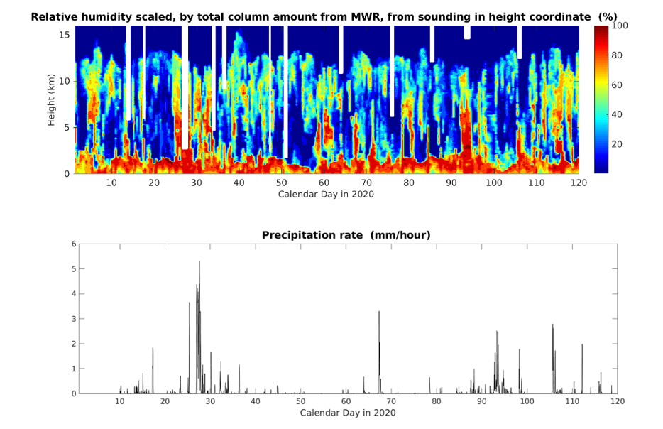
Two ARMBE data sets for ARM’s Eastern North Atlantic (ENA) atmospheric observatory have been extended to cover the years 2019 and 2020. The ARM Best Estimate Atmospheric Measurements (ARMBEATM) product contains basic atmospheric quantities, and ARM Best Estimate Cloud Radiation (ARMBECLDRAD) provides cloud and radiation quantities.
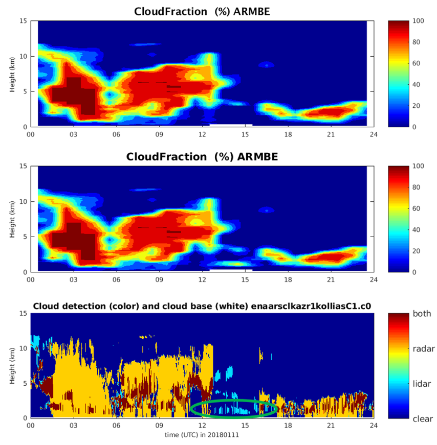
In addition, ARMBECLDRAD data from 2014 through 2018 have been reprocessed to fix an issue with the interpretation of micropulse lidar mask flags.
The fix has improved cloud detection below 3 kilometers from the micropulse lidar. The description of the lidar mask flag has been clarified to help identify valid data for the best estimate of clouds below 3 kilometers during periods when radar data are missing (see Figure 2).
It is recommended that people who downloaded the old ARMBECLDRAD data download the new data.
An ARMBE product assembles quantities that are both well observed by ARM over many years and are often used in model evaluation into one data set. These products consist of hourly averages and thus have temporal resolution comparable to a typical resolution used in climate model output.
Scientists can use the ENA ARMBEATM and ARMBECLDRAD data sets now. Find more information about ARMBE data products on the ARMBE web page.
Feedback and use of the data are always welcomed. If you have questions/suggestions, please contact Yuying Zhang or Shaocheng Xie.
Users can access the ENA data sets for ARMBEATM and ARMBECLDRAD in the ARM Data Center. (Go here to create an account to download the data.)
To cite these data, use doi:10.5439/1333748 for ARMBEATM and doi:10.5439/1333228 for ARMBECLDRAD.
Follow Us:


Keep up with the Atmospheric Observer
Updates on ARM news, events, and opportunities delivered to your inbox
ARM User Profile
ARM welcomes users from all institutions and nations. A free ARM user account is needed to access ARM data.


