Evaluation Data Available From MARCUS Navigation and Ship Correction VAPs
Published: 18 November 2019

Navigation and ship correction value-added products (VAPs) are now available for the ARM Mobile Facility deployed during the 2017–2018 Measurements of Aerosols, Radiation, and Clouds over the Southern Ocean (MARCUS) field campaign. These VAPs provide accurate ship location and orientation during ocean deployments and correct for ship motion.
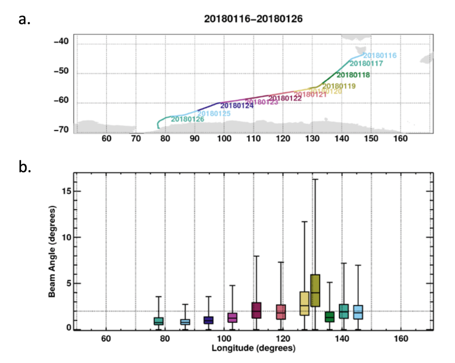
The second ARM Mobile Facility (AMF2) is designed to support shipboard deployments. During MARCUS, AMF2 collected atmospheric data on the Aurora Australis supply vessel while traveling between Australia and Antarctica.
During ship deployments, some AMF2 instruments collect Global Positioning System and inertial navigation system measurements. The Navigation Best Estimate (NAVBE) VAP consolidates multiple sources of these data into a single, continuous datastream to be used when information is required about ship location and orientation, and to provide an estimate that would not necessarily be available from any one instrument.
Complementing and making use of NAVBE, several ship correction VAPs post-process AMF2 data to correct the effect of ship motion on measurements that are intended to be vertically pointing. For MARCUS, the Marine W-band (95 GHz) ARM Cloud Radar (MWACR) Ship Correction (MWACRSHIPCOR) VAP produces motion-corrected fields of reflectivity, mean Doppler velocity, spectral width, and signal-to-noise ratio. Additional corrections are made to mean Doppler velocity to reduce the effect of ship heave (upward/downward motion). The Micropulse Lidar (MPL) Ship Correction (MPLPOLFSSHIPCOR) VAP produces corrected signal return values.
The ship-corrected MWACR data are inputs to the ship-corrected MWACR-Active Remote Sensing of Clouds (MWACR-ARSCL) product (see this separate MWACR-ARSCL release notice for more information).
Note—For the following time periods, the MWACR roll and pitch observations were incorrect, resulting in unreliable ship corrections applied to radar moments:
- December 20, 2017 (113000 Coordinated Universal Time), to December 21, 2017 (041500)
- February 16, 2018 (063000 to 163000).
It is recommended that non-ship-corrected MWACR data, specifically the datastream marmwacrM1.a1, be used instead for these periods.
Mean Doppler velocity corrections for the entire campaign should be used with caution because: 1) stable table performance was suboptimal during the campaign, and 2) corrections for the horizontal wind component are not included.
NAVBE and the ship correction VAPs are currently in evaluation mode, and MARCUS data are available now. Feedback and use of the data are welcomed and encouraged. For questions or to report data problems, please contact Tami Toto.
To access the data sets, please browse the data from each individual VAP web page above. (Go here to create an account to download the data.)
Keep up with the Atmospheric Observer
Updates on ARM news, events, and opportunities delivered to your inbox
ARM User Profile
ARM welcomes users from all institutions and nations. A free ARM user account is needed to access ARM data.


