New ARM Cloud ARSCL Evaluation VAPs Available
Published: 2 November 2015

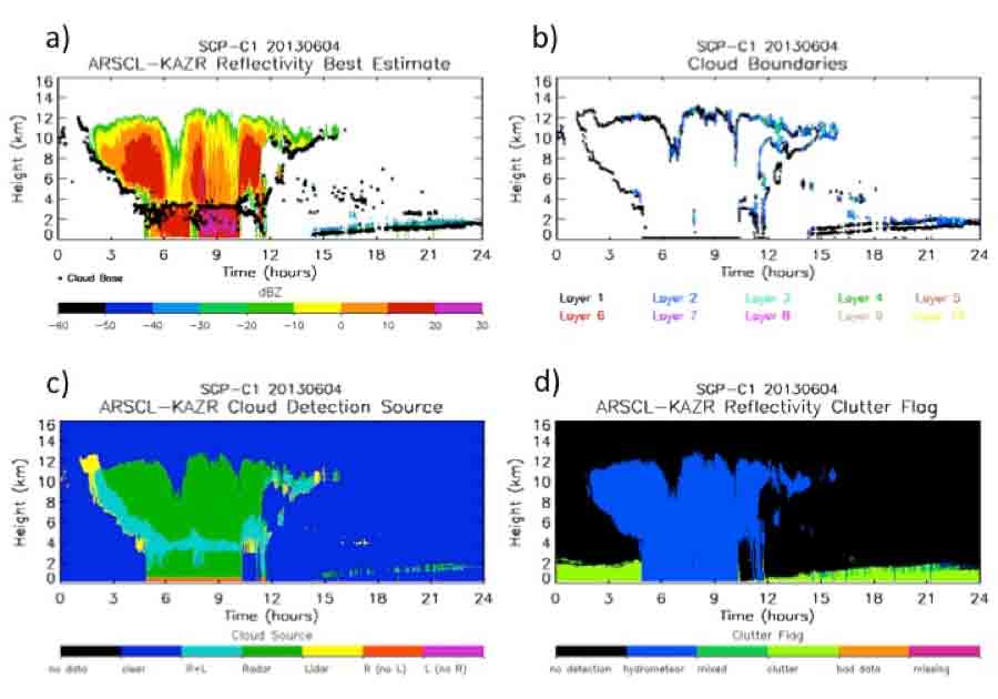
New value-added products (VAPs) have been developed to provide best-estimate radar moments and cloud locations for the Ka-band ARM Zenith Radars (KAZRs). The KAZR Active Remote Sensing of Clouds (KAZRARSCL) VAP and KAZR Correction (KAZRCOR) VAP together are succeeding the retired ARSCL VAP. Evaluation data from the two new VAPs are being provided for review by the user community before the VAPs are released to production.
The KAZRCOR VAP provides corrections to KAZR moments for each radar mode. The VAP corrects calibrated reflectivity for gaseous attenuation and dealiases mean Doppler velocities. In addition, a significant detection mask is created for each radar mode. Two corrected KAZR datastreams are produced at each site:
- KAZRCORGE, and
- either KAZRCORMD or KAZRCORHI, depending on which radar mode was in use.
The new KAZRARSCL VAP uses the KAZRCOR datastreams as input, along with micropulse lidar-derived cloud mask and cloud base, ceilometer-derived lowest cloud base, microwave radiometer liquid water path, and rain gauge observations to produce cloud boundaries and corrected, best-operating-mode radar moments on a time-height grid.
An automated algorithm is used to flag radar clutter and remove it from the reported best-estimate reflectivity field. Two KAZRARSCL datastreams are produced: ARSCLKAZR1KOLLIAS and ARSCLKAZRBND1KOLLIAS. The latter data set is a subset of the first, providing cloud boundaries only.
Feedback and use of these data are welcomed and encouraged. For questions or to report data problems, please contact Karen Johnson, Tami Toto, or Michael Jensen.
Browse the data set here or log in to the ARM Data Archive. (Go here to request an account).
# # #
The ARM Climate Research Facility is a national scientific user facility funded through the U.S. Department of Energy’s Office of Science. The ARM Facility is operated by nine Department of Energy national laboratories.
The ARM Climate Research Facility is a DOE Office of Science user facility. The ARM Facility is operated by nine DOE national laboratories, including .
Keep up with the Atmospheric Observer
Updates on ARM news, events, and opportunities delivered to your inbox
ARM User Profile
ARM welcomes users from all institutions and nations. A free ARM user account is needed to access ARM data.


