New 2- and 3-Channel Microwave Radiometer Retrieval Data Produced
Published: 14 November 2024

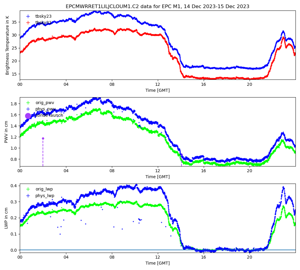
Both versions of the Atmospheric Radiation Measurement (ARM) user facility’s value-added product (VAP) for microwave radiometer retrievals are now available for the 2023–2024 Eastern Pacific Cloud Aerosol Precipitation Experiment (EPCAPE) in La Jolla, California. These products retrieve column precipitable water vapor and liquid water path—both important variables to understand radiative transfer in the atmosphere and clouds.
The Microwave Radiometer Retrievals (MWRRET) VAP and MWRRET version 2 (MWRRETv2) both apply the Turner et al. (2007) optimal estimation retrieval of column precipitable water vapor and liquid water path to microwave radiometer brightness temperature measurements. The primary difference between the VAPs is that MWRRET applies the retrieval to measurements from 2-channel microwave radiometers (23.8 and 31.4 GHz), whereas MWRRETv2 applies it to measurements from 3-channel microwave radiometers (23.8, 30, and 89 GHz).
MWRRET produces operational .c1-level files as well as .c2-level files, in which improved offsets are applied to the 23.8 GHz channel, improving the precipitable water vapor retrievals. In addition, the c2 processing stage uses cloud vertical extent information from the Active Remote Sensing of CLouds (ARSCL) VAP rather than ceilometer data to get the correct temperature of the liquid water layers in the atmosphere.
MWRRETv2 only produces .c1-level files. ARM recently replaced its 3-channel microwave radiometer systems and is evaluating if additional bias corrections are needed.
During EPCAPE, which took place from February 15, 2023, through February 14, 2024, a 2-channel microwave radiometer operated at the main site on the Ellen Browning Scripps Memorial Pier, and 3-channel microwave radiometers ran on Scripps Pier and at the supplemental site on Mount Soledad. MWRRET .c2-level data are available for the full duration of EPCAPE on Scripps Pier. MWRRETv2 .c1-level data are available for the entire EPCAPE campaign on Scripps Pier and Mount Soledad.
In addition to the EPCAPE releases, new MWRRET and MWRRETv2 data have been produced for other ARM sites.
MWRRET .c2-level data are now available for 2023 at ARM’s North Slope of Alaska atmospheric observatory.
Additional MWRRETv2 .c1-level data are now available for the following ARM sites and date ranges:
- the Eastern North Atlantic observatory (Graciosa Island, Azores, Portugal) from August 1, 2022, through January 31, 2024
- the Southern Great Plains (SGP) Central Facility (Lamont, Oklahoma) from November 1, 2019, through March 31, 2024
- SGP extended facility E32 (Medford, Oklahoma) from November 1, 2019, through September 25, 2022
- SGP extended facility E37 (Waukomis, Oklahoma) from November 1, 2019, through July 8, 2022.
More information about the data can be found on the MWRRET and MWRRETv2 web pages. Overviews of the retrieval technique, input parameters, output products, and data quality checks for each VAP are available in the MWRRET and MWRRETv2 technical reports.
Scientists can now access the MWRRET and MWRRETv2 data in the ARM Data Center. (To download the data, first create an ARM account.)
Feedback on the data can be sent to ARM translator Damao Zhang.
To cite the MWRRET data, please use doi:10.5439/1027369. For the MWRRETv2 data, please use doi:10.5439/1566156.
Reference: Turner DD, SA Clough, JC Liljegren, EE Clothiaux, KE Cady-Pereira, and KL Gaustad. 2007. “Retrieving Liquid Water Path and Precipitable Water Vapor From the Atmospheric Radiation Measurement (ARM) Microwave Radiometers.” IEEE Transactions on Geoscience and Remote Sensing, 45(11), doi:10.1109/tgrs.2007.903703.
Keep up with the Atmospheric Observer
Updates on ARM news, events, and opportunities delivered to your inbox
ARM User Profile
ARM welcomes users from all institutions and nations. A free ARM user account is needed to access ARM data.


