

Summertime, and the Living Is Soggy at SAIL
Published: 27 September 2022
Editor’s note: Daniel Feldman, the principal investigator for the Surface Atmosphere Integrated Field Laboratory (SAIL) campaign in Colorado, provided the following blog post.
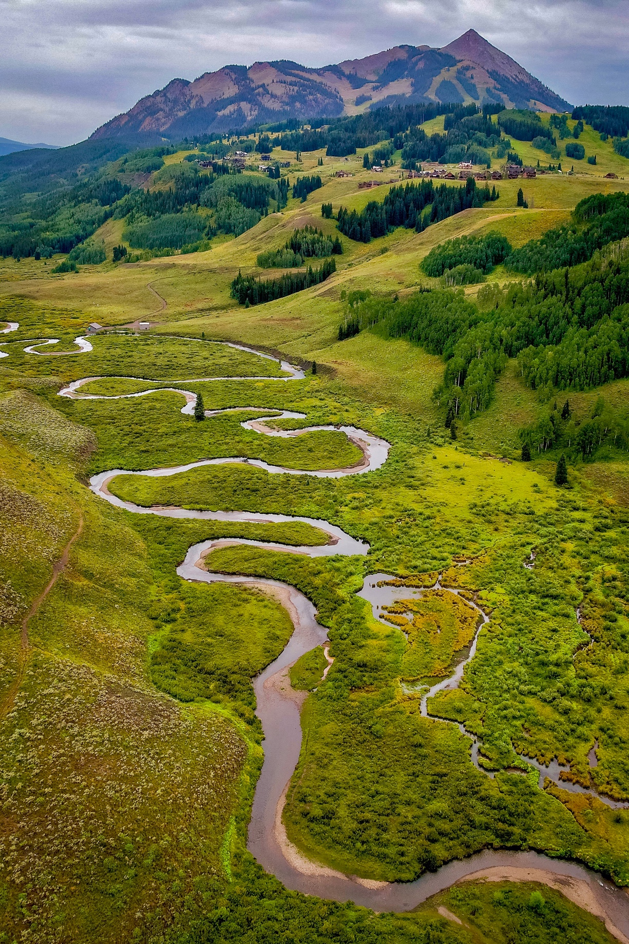
While winter snow is a major driver of the water that feeds the Colorado River, rain in the summer buoys the water budget. High up in the Upper Colorado River Basin (UCRB), where SAIL is collecting data, that rain typically accounts for about one-third of total annual precipitation.
Summer rain in the UCRB happens only some of the time, however. The primary source of that rainwater comes from surges of moisture taking place over 1,000 miles away in the Gulf of California. Those surges can soak southeastern California, Arizona, and southern Nevada, and they occasionally make their way to Utah, New Mexico, and Colorado.
Whether or not the summer monsoon arrives in the UCRB is not an idle concern. The monsoon not only replenishes water lost from epic droughts but also saturates soils. SAIL co-investigators Rosemary Carroll, David Gochis, and Ken Williams previously documented how this effect propagates into the spring. Saturated soils mean snowmelt makes its way directly into streams and rivers, whereas dry soils absorb snowmelt like a sponge.
So, what determines whether the monsoon makes it to SAIL? It’s a complex interplay of the heating of the land surface and surges of moisture in the Gulf of California, as SAIL co-investigator Bill Boos showed.
That interplay lined up perfectly in the UCRB in the summer of 2022. A veritable parade of thunderstorms occurred at SAIL, including regular thunderstorms in the afternoon.
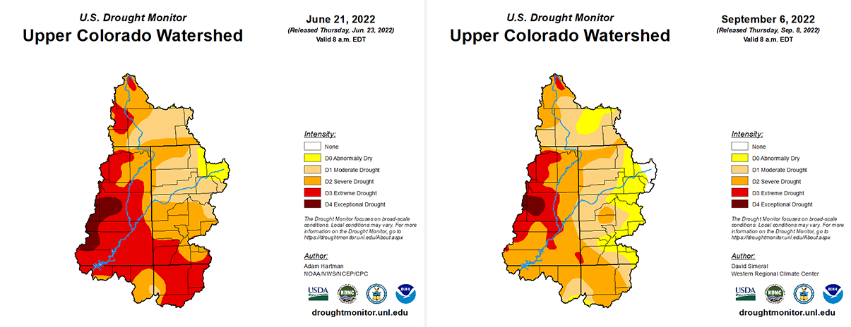
SAIL instruments recorded precipitation on at least 38 summer days. With detailed measurements of precipitation, aerosols, radiation, and how the boundary layer evolved during these events, and especially detailed measurements from a tethered balloon system deployment in July, SAIL has collected an information-rich data set. These data can provide insights into the controls of precipitation on the far edge of the North American Monsoon, especially when that precipitation helps partially alleviate drought conditions in the area, as shown in the maps below.
The nearly four dozen datastreams are now freely available in ARM Data Discovery for the scientific community to unpack for years to come.
Community Connections
The summer of SAIL saw a large amount of outreach. Scientifically, SAIL and the NOAA-led Study of Precipitation, the Lower Atmosphere and Surface for Hydrometeorology (SPLASH) collaborated to stand up a 5G networking capability with the help of DOE’s Energy Sciences Network (ESnet).
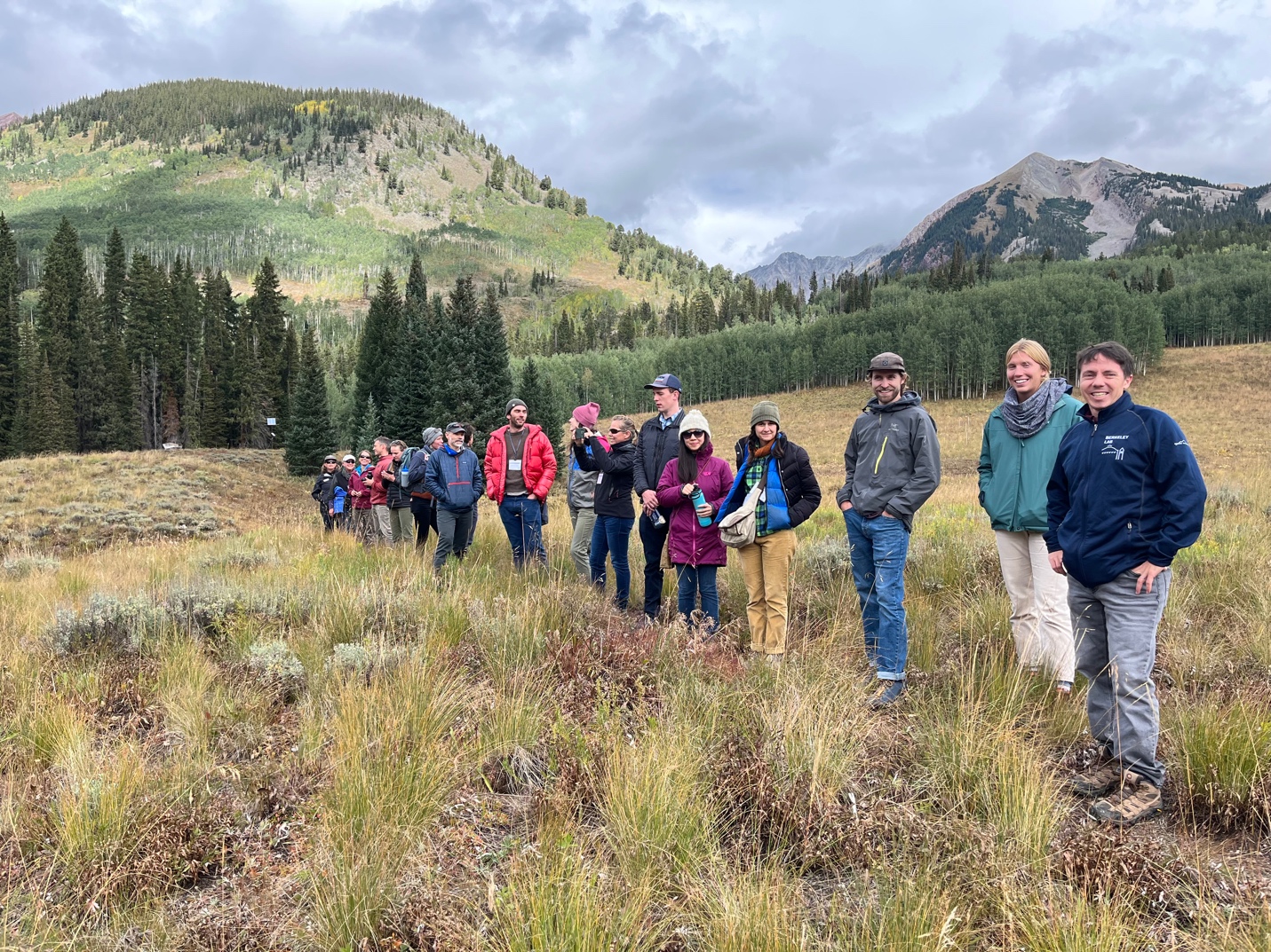
SAIL has also benefited from a close partnership with the Rocky Mountain Biological Laboratory (RMBL) to advance outreach and education. Through that partnership, more than 250 people across 17 public and educational group tours have seen the SAIL facilities. In addition, a RMBL youth education program, led by Katie Lawn and Erik Hulm, reached hundreds of students during the summer.
RMBL and SAIL team members coordinated with ARM communications to develop informational posters for the more than 20,000 people who visited RMBL this summer and the more than 100,000 people who passed by the SAIL facilities at Crested Butte Mountain Resort.
Stay tuned for more SAIL news as the campaign transitions to the fall, when the aspens change color, and many exciting guest instruments arrive (hopefully) before the first significant snow starts to fall.
Further afield, researchers from SAIL and its companion campaigns SPLASH and Sublimation of Snow (SOS) are preparing for the Joint ARM User Facility/Atmospheric System Research (ASR) Principal Investigators Meeting and the American Geophysical Union (AGU) Fall Meeting. Both meetings will see joint SAIL/SPLASH/SOS sessions.
Follow Us:


Keep up with the Atmospheric Observer
Updates on ARM news, events, and opportunities delivered to your inbox
ARM User Profile
ARM welcomes users from all institutions and nations. A free ARM user account is needed to access ARM data.


