

My Experience Doing Arctic Fieldwork at the Top of the World
Published: 31 August 2022
Editor’s note: Serina Wesen, the education and outreach designer for the Snow, Ice, and Permafrost Group at the University of Alaska Fairbanks Geophysical Institute, recently participated in an ARM field campaign in Utqiaġvik (formerly Barrow), Alaska. Wesen wrote the following blog post about her experience.
My colleagues and I spent the first part of our summer watching snow melt. When I tell this to others, they think that it sounds like waiting for water to boil or watching paint dry. However, our experience this spring in Utqiaġvik was a unique one—especially with it being a late melt year.
Before this spring, I had lived in Alaska my entire life and never been to the Arctic. If you drive, the closest portion of the Arctic Circle is almost five hours away from Fairbanks, the closest major city, and close to 11 hours driving from Anchorage, where I am from.
Since 2017, I have worked with Alaska Native and rural students who shared stories of life up north. They described their Arctic homes as a rich landscape covered with snow, ice, and tundra, which sounded spectacular but also difficult and expensive to access.

This spring and summer, as a part of the Snow, Ice, and Permafrost Group at the Geophysical Institute, I had the opportunity to spend a month assisting with fieldwork in Utqiaġvik, known as “the top of the world.”
I helped with the Snow ALbedo eVOlution (SALVO) field campaign, which tracks seasonal changes on tundra and sea ice from an entirely snowy landscape to complete melt.
The snowmelt is an annual phenomenon that occurs because of warming temperatures and increased sunlight, thawing the snow cover. Albedo is the ratio of how much sunlight a surface reflects compared to the incoming solar radiation.
During SALVO, which will track three melt seasons through 2023, albedo measurements are taken throughout the melt process to understand the changes from a very white, snow-covered surface to much darker tundra or water in conjunction with other snow properties at each site.
SALVO is supported by the U.S. Department of Energy’s ARM user facility and Atmospheric System Research (ASR) program.
Patience Pays Off
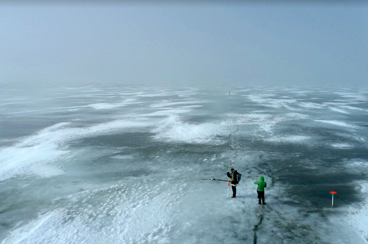
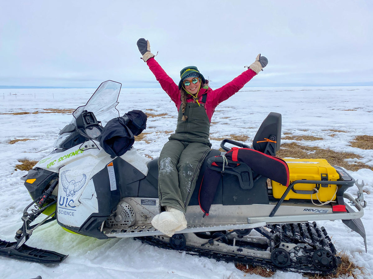
We spent a week in Utqiaġvik in mid-April to establish initial measurements and set up instruments at each of four sites—two on sea ice and two on tundra—before returning for the spring melt in late May. We spent our time at our sites taking line measurements of albedo, radiation, and snow depth; collecting snow samples; digging snow pits; working with terrestrial lidar scanners; and participating in additional science activities.
While I have had my fair share of Alaskan winters, and had conducted fieldwork before and thought I was used to the cold, the arctic wind made things difficult. During high gusts, we found that we were fighting with some of our instruments that relied on balance and precision, so in some cases, the wind was worse than the cold. Because of the high winds at below-freezing temperatures, I quickly learned that there is no such thing as too many layers, and hand warmers are your best friend.
After we returned in May, we went well into early June with no visible evidence of snowmelt. It turns out that this summer proved to be a remarkably late melt year, with some snow patches still around even after we left Utqiaġvik in late June.
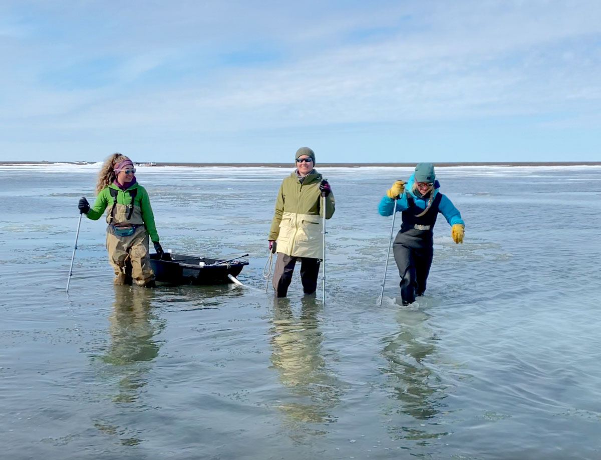
Once the snow began melting, it was rapid, with noticeable changes occurring even overnight. These warmer temperatures channeled a new kind of energy into everyone on the project as when the melt was finally happening was very exciting.
Other than spending time watching the snow melt, we spent time in Utqiaġvik during whaling season, riding snow machines, sampling muktuk (whale blubber), watching polar bears (we saw six!), working outside in the midnight sun, and mentoring undergraduates during an arctic science field school. These students shadowed us and helped out at our sites.
We would like to recognize that this ongoing research occurs on Iñupiat land and cannot be completed without the wisdom and generosity of the Utqiaġvik community. I was grateful to have had this opportunity, and I am excited to hopefully return for SALVO’s last field season in 2023.
The SALVO team includes Jennifer Delamere, Matthew Sturm, Melinda Webster, Anika Pinzner, Phillip Wilson, Ema Mayo, Serina Wesen, Hannah Chapman-Dutton, and Owen Larson, affiliated with UAF; David Clemens-Sewall from Dartmouth College; and David Shean with the University of Washington.
Follow Us:


Keep up with the Atmospheric Observer
Updates on ARM news, events, and opportunities delivered to your inbox
ARM User Profile
ARM welcomes users from all institutions and nations. A free ARM user account is needed to access ARM data.


