

S13
BNF - Bankhead National Forest, AL, Supplemental facility for STAMP2 near Tower Site
Established
1 October 2024
Latitude
34.344015°
N
Longitude
87.35062209°
W
Altitude
286 meters
Surface Type
Awaiting Information
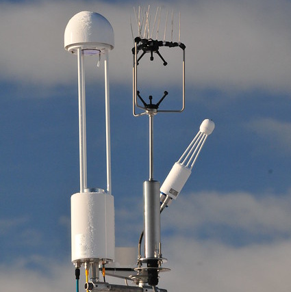
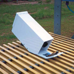
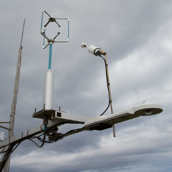
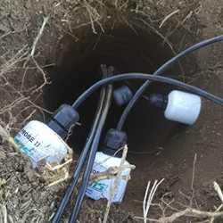
Instruments
6 (6
active)
Primary Measurement Types
21 (21 active)
Instruments deployed at BNF - Bankhead National Forest, AL, Supplemental facility for STAMP2 near Tower Site


Primary Measurements collected at BNF - Bankhead National Forest, AL, Supplemental facility for STAMP2 near Tower Site
Atmospheric moisture
Browse DataAtmospheric pressure
Browse DataAtmospheric temperature
Browse DataAtmospheric turbulence
Browse DataCarbon dioxide (CO2) concentration
Browse DataCarbon dioxide (CO2) flux
Browse DataHorizontal wind
Browse DataLatent heat flux
Browse DataLongwave broadband downwelling irradiance
Browse DataLongwave broadband upwelling irradiance
Browse DataMethane flux
Browse DataNet broadband total irradiance
Browse DataPrecipitation
Browse DataSensible heat flux
Browse DataShortwave broadband total downwelling irradiance
Browse DataShortwave broadband total upwelling irradiance
Browse DataSoil heat flux
Browse DataSoil moisture
Browse DataSoil temperature
Browse DataSurface energy balance
Browse DataSurface skin temperature
Browse DataFollow Us:


Keep up with the Atmospheric Observer
Updates on ARM news, events, and opportunities delivered to your inbox
ARM User Profile
ARM welcomes users from all institutions and nations. A free ARM user account is needed to access ARM data.


Atmospheric Radiation Measurement (ARM) | Reviewed
March 2025