
XDS: NOAASURF
NOAASURF: NOAA Surface Meteorology Data, Collected by NWS and NCDC
General Data Description
These datastreams provide hourly averaged surface meteorological measurements for both the SGP and NSA. The measurements are provided by NOAA’s National Centers for Environmental Information (NCEI).
Measurement Description
sgp60nwssurf.a1
Each station is one of the following systems:
- Manual (hourly or special)
- AWOS (hourly or 20 minute)
- AMOS (hourly or 20 minute)
- ASOS (hourly or 20 minute)
- MMMM (hourly or 20 minute)
- AUTOB (hourly or 20 minute)
Observations that are reported once per hour are assigned to the nearest hour. Observations reported more than once per hour are assigned to the nearest hour of the last observation.
- Latitude and longitude of station (degrees)
- Station id (3 characters ascii)
- Station elevation (meters) and type of elevation indicator
- Ceiling (code)
- Layer height (feet/code)
- Cloud amount (code)
- Horizontal visibility (m/code)
- Pressure (pascals)
- Temperature (K)
- Dew point temperature (K)
- Wind direction (degrees)
- Wind speed (m/s)
- Maximum wind speed (m/s)
- altimeter (pascals)
Numeric data reported more than once per hour undergo a straight numeric average. Exceptions are wind direction and wind speed. Wind direction is a vector-averaged direction weighted by wind speed and wind speed is vector-averaged wind speed. Other exceptions are horizontal visibility and layer height, which are described below.
Data that are reported as codes are not averaged but are concatenated in a character string, the length of which corresponds to a multiple of the number of observations per hour. Horizontal visibility and layer height, while numeric data, are concatenated.
Missing Data Values: -99 or -99999 means no data are available (either station not reporting or value is missing)
nac60ncdcsurfX1.00
A listing of the station names, latitudes, and longitudes can be found by clicking here.
These data files are ascii and in the following format:
 NUMERICAL CODES LISTING FOR HOURLY OBSERVATIONS
 --------------------------------------------------------------------------------------
 | NUMERICAL |                                                                        |
 |  COLUMN   |                         TERMINOLOGY                                    |
 |------------------------------------------------------------------------------------|
 |    0      | WBAN  NUMBER                                                          |
 |------------------------------------------------------------------------------------|
 |    1      | DATE                                                                   |
 |------------------------------------------------------------------------------------|
 |    2      | TIME IN LST (LOCAL STANDARD TIME)                                      |
 |------------------------------------------------------------------------------------|
 |           | STATION TYPE:                                                          |
 |    3      | A02  = UNATTENDED                                                      |
 |           | A02A = ATTENDED (OBSERVER PRESENT)                                     |
 |------------------------------------------------------------------------------------|
 |    4      | ASOS MAINTENANCE INDICATOR                                             |
 |           |                                                                        |
 |           | (INDICATES ASOS EQUIPMENT IS EXPERIENCING MAINTENANCE AS A RESULT OF   |
 |           |  INTERNAL QUALITY ASSURANCE CHECKS.  ONE OR MORE ELEMENTS MAY BE       |
 |           |  MISSING OR REPLACED BY MANUAL INTERVENTION.)                          |
 |------------------------------------------------------------------------------------|
 |    5      | SKY CONDITIONS:                                                        |
 |           |                                                                        |
 |           | SKY CONDITIONS BELOW 12,000 FEET AGL (ABOVE GROUND LEVEL)              |
 |           | SKY CONDITIONS CONTRACTIONS ARE FOR EACH LAYER IN ASCENDING ORDER.     |
 |           | NUMBERS FOLLOWING CONTRACTIONS ARE BASE HEIGHT IN HUNDREDS OF FEET     |
 |           | ABOVE GROUND LEVEL (AGL).                                              |
 |           | CLR: CLEAR BELOW 12,000 FT                                             |
 |           | FEW: > 0/8 - 2/8 SKY COVER                                             |
 |           | SCT SCATTERED:  3/8 - 4/8 SKY COVER                                    |
 |           | BKN BROKEN: 5/8 - 7/8 SKY COVER                                        |
 |           | OVC OVERCAST: 8/8 SKY COVER                                            |
 |           |                                                                        |
 |           | VVXXX INDICATES INDEFINITE CEILING WITH THE VERTICAL VISIBILITY (XXX)  |
 |           | LISTED IN HUNDREDS OF FEET.                                            |
 |           |                                                                        |
 |           | WHEN CLOUDS ARE COMPOSED OF TOWERING CUMULUS OR CUMULONIMBUS,          |
 |           | TCU OR CB (RESPECTIVELY) FOLLOW CLOUD HEIGHT.                          |
 |------------------------------------------------------------------------------------|
 |    6      | VISIBILITY:                                                            |
 |           |                                                                        |
 |           | REPORTED IN STATUTE MILES AND FRACTIONS FROM < 1/4 THROUGH 10+
 |           | FOLLOWED BY LETTERS SM                                         |       |
 |------------------------------------------------------------------------------------|
 |    7      | (SEE EXPLANATION OF WEATHER TYPES IN TABLE BELOW)                 |
 |-----------|------------------------------------------------------------------------|
 |    8      | DRY BULB TEMPERATURE (DEGREES F)                                       |
 |-----------|------------------------------------------------------------------------|
 |    9      | DEW POINT TEMPERATURE (DEGREES F)                                      |
 |------------------------------------------------------------------------------------|
 |    10     | WET BULB TEMPERATURE (DEGREES F)                                       |
 |------------------------------------------------------------------------------------|
 |    11     | RELATIVE HUMIDITY (PERCENT)                                            |
 |-----------|------------------------------------------------------------------------|
 |    12     | WIND SPEED (KNOTS)                                                     |
 |-----------|------------------------------------------------------------------------|
 |    13     | WIND DIRECTION (TENS OF DEGREES FROM TRUE NORTH)                       |
 |           |                                                                        |
 |           | VRB = VARIABLE WITH SPEED EQUAL TO OR LESS THAN 6 KNOTS                |
 |-----------|------------------------------------------------------------------------|
 |    14     | WIND CHARACTERISTIC GUSTS (G IF GUSTS EXIST)                           |
 |-----------|------------------------------------------------------------------------|
 |    15     | VALUE FOR WIND CHARACTER (KNOTS)                                 |
 |-----------|------------------------------------------------------------------------|
 |    16     | STATION PRESSURE (INCHES IN HUNDREDTHS)                                |
 |-----------|------------------------------------------------------------------------|
 |    17     | PRESSURE TENDENCY                                                      |
 |-----------|------------------------------------------------------------------------|
 |    18     | SEA LEVEL PRESSURE                                                     |
 |           |                                                                        |
 |           | TENTHS OF HECTOPASCALS (MILLIBARS).                                    |
 |           | SHOWN AS LAST 3 DIGITS ONLY WITHOUT DECIMAL POINT (eg.,013 = 1001.3 MB)|
 |-----------|------------------------------------------------------------------------|
 |    19     | REPORT TYPE:                                                           |
 |           |                                                                        |
 |           | AA - METAR (AVIATION ROUTINE WEATHER REPORT) - HOURLY                  |
 |           | SP - METAR SPECIAL REPORT                                              |
 |-----------|------------------------------------------------------------------------|
 |    20     | PRECIPITATION TOTALS (INCHES AND HUNDREDTHS)                           |
 |           |                                                                        |
 |           |1)  HOURLY TOTALS IF COLUMN 19 IS "AA" (HOURLY METAR REPORT).           |
 |           |                                                                        |
 |           |2)  CUMULATIVE AMOUNT SINCE THE LAST HOURLY METAR REPORT IF             |
 |           |    COLUMN 19 IS "SP" (METAR SPECIAL REPORT).                           |
 |------------------------------------------------------------------------------------|
      WEATHER PHENOMENA  TYPES                              |
 --------------------------------------------------
  +FC TORNADO/WATERSPOUT
  FC  FUNNEL CLOUD
  TS  THUNDERSTORM
  GR  HAIL
  RA  RAIN
  DZ  DRIZZLE
  SN  SNOW
  SG  SNOW GRAINS
  GS  SMALL HAIL &/OR SNOW PELLETS
  PE  ICE PELLETS
  IC  CRYSTALS
  FG+ HEAVY FOG (FG & LE.25 MILES)
  FG  FOG
  BR  MIST
  UP  UNKNOWN PRECIPITATION
  HZ  HAZE
  FU  SMOKE
  VA  VOLCANIC ASH
  DU  WIDESPREAD DUST
  DS  DUSTSTORM
  PO  SAND/DUST WHIRLS
  SA  SAND
  SS  SANDSTORM
  PY  SPRAY
  SQ  SQUALL
-----------------------------------------------
 DESCRIPTORS AND QUALIFIERS
-----------------------------------------------
  DR  LOW DRIFTING
  SH  SHOWER
  FZ  FREEZING
  MI  SHALLOW
  PR  PARTIAL
  BC  PATCHES
  BL  BLOWING
  VC  VICINITY
  -   LIGHT
  +   HEAVY
  "NO SIGN" MODERATE
                              HOURLY PRECIPITATION TABLE
   WATER EQUIVALENT IN INCHES
   T = TRACE PRECIPITATION AMOUNT
** THE SUM OF THE HOURLY TOTALS IS GIVEN WHEN IT DIFFERS FROM THE DAILY
   TOTAL.  NWS DOES NOT EDIT ASOS HOURLY VALUES BUT MAY EDIT DAILY AND
   MONTHLY TOTALS.  HOURLY, DAILY, AND MONTHLY TOTALS ARE PRINTED AS
  REPORTED BY THE ASOS SITE.
Report Type Codes:
AA – METAR (aviation routine weather report) – hourly
SP – METAR special report
Temporal Coverage
sgp60nwssurfX1.a1 data are available as daily files from January 1993 through June 1996.
nac60ncdcsurfX1.00 data are available as daily files beginnng in July 1996.
Data are available at the ARM Data Center approximately one month after they are generated.
Area Covered
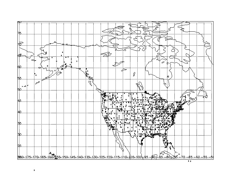
sgp60nwssurfX1.a1
The stations included (approximately 70) are those within 1000km by 1000km centered on the ARM facility (lat 31.941 : 41.00 lon -103.561 : -91.585).
nac60ncdcsurfX1.a1
Datastream Inputs
sgp60nwssurfX1.00 (EBUFR format) is input to sgp60nwssurfX1.a1
Related Link
Data Source
Institution
National Centers for Environmental Information
Processing History
October 2002 – From this month forward the file that lists information on the stations in the ASCII file nac60ncdcsurfX1.00 is included in a tar file with the data.
Data User Notes
Prior to October 2002, the file containing information on the stations included in the ASCII data file nac60ncdcsurfX1.00 is not included with the data file. Users wishing information on the stations can find a typical “station information” file at http://www.xdc.arm.gov/docs/data_info/sgp/ncdcsurf_sta.txt
Acronyms
AMOS    Automated Meteorological Observing System
ASOS    Automated Surface Observing System
AUTOB   Automated Reporting Station
AWOS    Automated Weather Observing System
EBUFR   Enhanced Binary Universal Form
MMMM    Missing Station
NCEI    National Centers for Environmental Information
NOAA    National Oceanic and Atmospheric Administration
NAC     North American Continent
NSA     North Slope of Alaska
SGP     Southern Great Plains
WBAN    Weather Bureau/Army/Navy Station Identifier
Follow Us:


Keep up with the Atmospheric Observer
Updates on ARM news, events, and opportunities delivered to your inbox
ARM User Profile
ARM welcomes users from all institutions and nations. A free ARM user account is needed to access ARM data.


