
Editor’s note: This is an update from ARM Engineering and Process Manager Jennifer Comstock, who also oversees ARM science products.

ARM provides comprehensive atmospheric measurements and data products that support model evaluation and improvement. Linking ARM data, which are distributed at locations around the world, to earth system models (ESMs) is challenging primarily because of the difference in spatial scales.
Over the years, ARM has developed data products specifically designed for linking global models to ARM measurements and process modeling studies. These products are continuously improved and expanded each year under the leadership of ARM’s modeling translator, Shaocheng Xie.
Best-Estimate and Forcing Data
Two of ARM’s long-standing products for modelers are ARM Best Estimate (ARMBE) and large-scale model forcing data sets based on the constrained variational analysis approach (VARANAL). ARM previously focused on producing ARMBE and VARANAL data from its fixed observatories before turning its attention to ARM Mobile Facility (AMF) field campaigns.
ARMBE merges quality-controlled cloud, radiation, and atmospheric quantities that are often used in climate model evaluations into yearly data sets tailored for climate modelers with hourly temporal resolution, similar to the frequency of climate model output. ARMBE data can be used for both process studies and statistical evaluation of models at ARM sites.
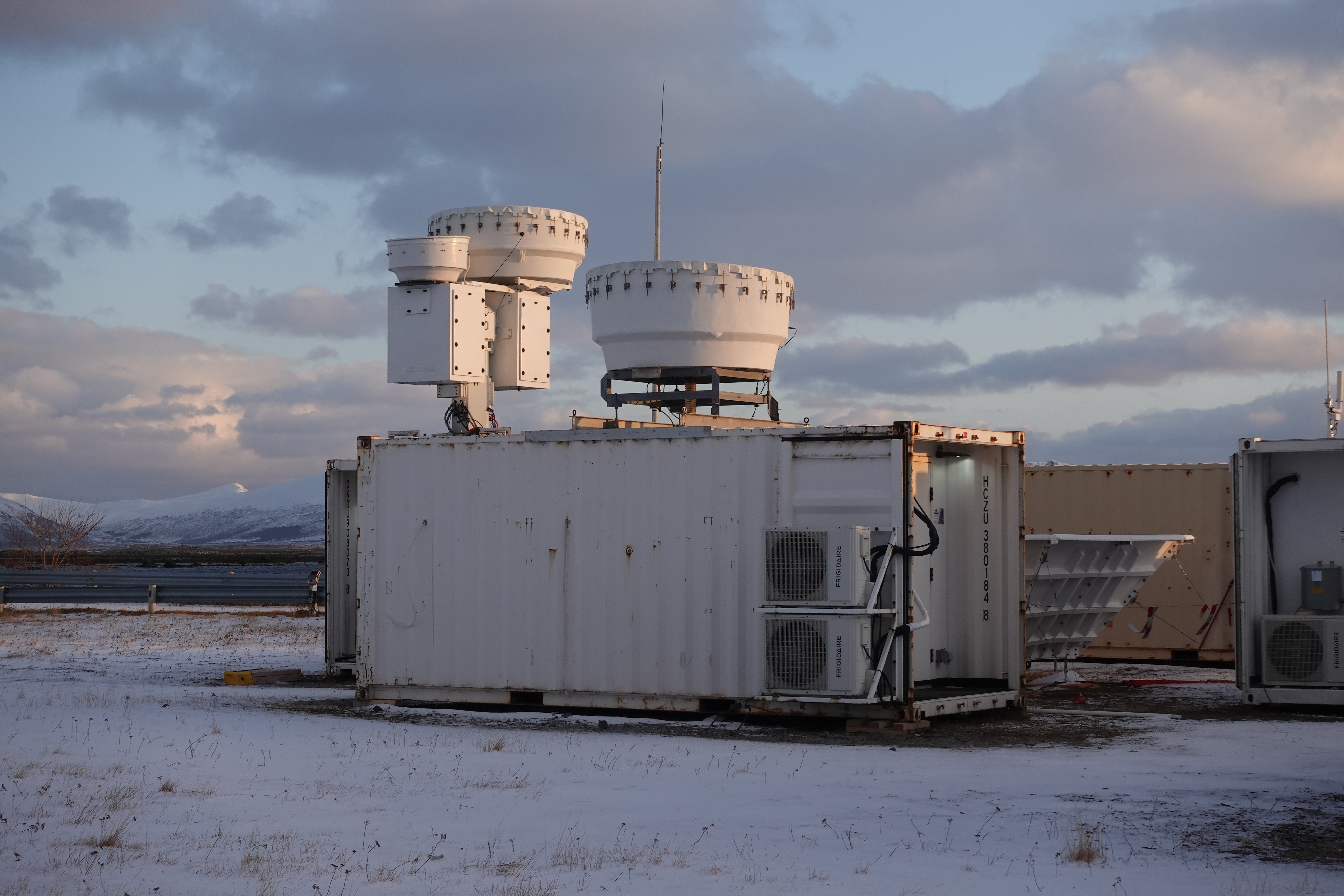
ARMBE is now available for five AMF deployments. The most recent AMF releases are from field campaigns near Córdoba, Argentina, and Andenes, Norway.
In 2022, ARMBE will be expanded to a ship-based expedition in the central Arctic; measurements of convective systems around Houston, Texas; and the now-inactive AMF deployment at Oliktok Point, Alaska.
The VARANAL large-scale forcing data provide the critical initial and boundary conditions to drive single-column and cloud-resolving models and large-eddy simulations, and they are constrained by surface and top-of-atmosphere observations. VARANAL is created over ARM sites by combining measurements and weather forecast model reanalysis data.
Recently, VARANAL was expanded to two high-latitude AMF campaigns in Norway and West Antarctica.
Xie and his team are working to provide forcing data sets in 2022 for two Southern Hemisphere deployments in Argentina and on Macquarie Island in the Southern Ocean.
Modeling Diagnostics and Instrument Simulator Packages
Over the last several years, ARM has developed diagnostic tools and data sets to further facilitate use of ARM data in climate model evaluation and improve model-observation comparison.
The ARM Diagnostics for Climate Model Evaluation (ADCME) package combines ARM data sets with an open-source Python-based toolkit, which creates diagnostic plots and tables to compare model simulations with ARM data. ADCME uses data products such as ARMBE, VARANAL, and ARM Cloud Retrieval Ensemble Data (ACRED). The package also provides process-oriented metrics for evaluating convection onset in ESMs.
Previously, ADCME covered the Southern Great Plains (SGP), North Slope of Alaska (NSA), and Tropical Western Pacific (TWP) sites. In 2021, ADCME was integrated into DOE’s Energy Exascale Earth System Model (E3SM), and data from ARM’s Eastern North Atlantic atmospheric observatory and an AMF deployment near Manaus, Brazil, were added to the basic metrics package. In 2022, data and metrics for evaluating aerosol-cloud interactions and warm bias attribution are under development.
ARM users are also interested in working with instrument simulators, which enable more direct comparisons of observations and model simulations. Previously, ARM configured the radar simulator developed for the space-based CloudSat radar for application to ARM’s ground-based cloud radars.
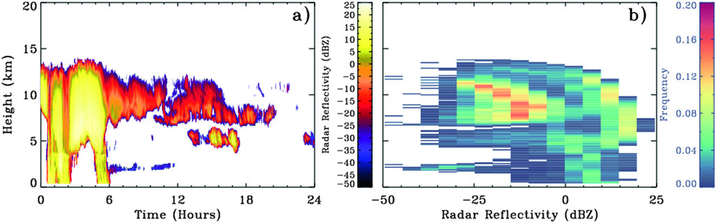
To help researchers compare ARM cloud observations with clouds simulated in climate models, the ARM simulator tabulates joint histograms of radar reflectivity measurements and altitude known as Radar Contoured Frequency by Altitude Diagrams (RADARCFADs). These are compiled for the SGP, NSA, and two TWP sites.
Building on these radar data products and responding to the 2020 ARM Triennial Review recommendation to place more emphasis on the development of instrument simulators, ARM is working to add lidar simulator capabilities for E3SM. ARM also plans to compile relevant lidar data sets for use with the new lidar simulator package.
Learn about ARM’s plans to amplify its impact on modeling as part of its Decadal Vision. All ARM data are freely available to download and order from Data Discovery.